FAA INFORMATION EFFECTIVE 11 JUNE 2026
Location
| FAA Identifier: | IND |
| Lat/Long: | 39-43-02.3000N 086-17-40.7000W
39-43.038333N 086-17.678333W
39.7173056,-86.2946389
(estimated) |
| Elevation: | 796.2 ft. / 242.7 m (surveyed) |
| Variation: | 05W (2015) |
| From city: | 7 miles SW of INDIANAPOLIS, IN |
| Time zone: | UTC -4 (UTC -5 during Standard Time) |
| Zip code: | 46241 |
Airport Operations
| Airport use: | Open to the public |
| Activation date: | 04/1940 |
| Control tower: | yes |
| ARTCC: | INDIANAPOLIS CENTER |
| FSS: | TERRE HAUTE FLIGHT SERVICE STATION |
| NOTAMs facility: | IND (NOTAM-D service available) |
| Attendance: | CONTINUOUS |
| Wind indicator: | lighted |
| Segmented circle: | no |
| Beacon: | white-green (lighted land airport)
Operates sunset to sunrise. |
| Fire and rescue: | ARFF index D |
| International operations: | customs landing rights airport |
Airport Communications
| UNICOM: | 122.95 |
| WX ASOS: | PHONE 317-220-6243 |
| INDY GROUND: | 121.9 121.8 |
| INDY TOWER: | 120.9 251.1 |
| INDIANAPOLIS APPROACH: | 119.05 ;WEST OF ACTIVE RWY 127.15 ;EAST OF ACTIVE RWY 128.175 317.8 |
| INDIANAPOLIS DEPARTURE: | 119.05 ;WEST 124.95 ;EAST 317.8 |
| CLEARANCE DELIVERY: | 128.75 251.1 |
| PRE-TAXI CLEARANCE: | 128.75 |
| CLASS C: | 119.05 ;WEST OF ACTIVE RWY 127.15 ;EAST OF ACTIVE RWY 317.8 |
| D-ATIS: | 134.25 |
| EMERG: | 121.5 243.0 |
| IC: | 128.175 |
| RACYR STAR: | 128.175 317.8 |
| WX ASOS at EYE (7 nm N): | 121.575 (317-329-1754) |
| WX AWOS-3 at 8A4 (7 nm NE): | 135.525 (317-955-3160) |
| WX AWOS-3PT at 2R2 (9 nm W): | 118.025 (317-718-4872) |
| WX AWOS-3P at HFY (11 nm SE): | 118.525 (317-882-5862) |
| WX AWOS-3PT at UMP (17 nm NE): | 119.375 (317-842-3911) |
| WX AWOS-3PT at TYQ (19 nm N): | 120.725 (317-769-3154) |
| WX AWOS-3PT at MQJ (20 nm E): | 124.175 (317-335-3037) |
- SAID IN USE. OPERATE TRANSPONDERS WITH ALTITUDE REPORTING MODE AND ADS-B (IF EQUIPPED) ENABLED ON ALL AIRPORT SURFACES.
Nearby radio navigation aids
| VOR radial/distance | | VOR name | | Freq | | Var |
|---|
| VHPr149/6.7 | | BRICKYARD VORTAC | | 116.30 | | 01E |
| SHBr282/22.3 | | SHELBYVILLE VOR/DME | | 116.15 | | 01E |
| OOMr025/37.4 | | HOOSIER VORTAC | | 110.20 | | 02W |
| NDB name | | Hdg/Dist | | Freq | | Var | | ID |
|---|
| CRAWFORDSVILLE | | 123/32.7 | | 388 | | 04W | | CFJ | -.-. ..-. .--- |
Airport Services
| Fuel available: | 100LL JET-A JET-A1+ |
| Parking: | tiedowns |
| Airframe service: | MAJOR |
| Powerplant service: | MAJOR |
| Bottled oxygen: | HIGH |
| Bulk oxygen: | HIGH |
Runway Information
Runway 5L/23R
| Dimensions: | 11200 x 150 ft. / 3414 x 46 m |
| Surface: | concrete/grooved, in good condition |
| Weight bearing capacity: | | Single wheel: | 145.0 | | Double wheel: | 300.0 | | Double tandem: | 550.0 |
|
| Runway edge lights: | high intensity |
| RUNWAY 5L | | RUNWAY 23R |
| Latitude: | 39-42.383895N | | 39-43.698502N |
| Longitude: | 086-19.248375W | | 086-17.572652W |
| Elevation: | 738.0 ft. | | 782.9 ft. |
| Traffic pattern: | left | | left |
| Runway heading: | 050 magnetic, 045 true | | 230 magnetic, 225 true |
| Declared distances: | TORA:11200 TODA:11200 ASDA:11200 LDA:11200 | | TORA:11200 TODA:11200 ASDA:11200 LDA:11200 |
| Markings: | precision, in good condition | | precision, in good condition |
| Visual slope indicator: | 4-light PAPI on left (3.00 degrees glide path) | | 4-light PAPI on left (3.00 degrees glide path) |
| RVR equipment: | touchdown, midfield, rollout | | touchdown, midfield, rollout |
| Approach lights: | ALSF2: standard 2,400 foot high intensity approach lighting system with centerline sequenced flashers (category II or III) | | MALSR: 1,400 foot medium intensity approach lighting system with runway alignment indicator lights |
| Runway end identifier lights: | no | | no |
| Centerline lights: | yes | | yes |
| Touchdown point: | yes, lighted | | yes, no lights |
| Instrument approach: | ILS/DME | | ILS/DME |
Runway 5R/23L
| Dimensions: | 10000 x 150 ft. / 3048 x 46 m |
| Surface: | concrete/grooved, in good condition |
| Weight bearing capacity: | | Single wheel: | 145.0 | | Double wheel: | 300.0 | | Double tandem: | 550.0 |
|
| Runway edge lights: | high intensity |
| RUNWAY 5R | | RUNWAY 23L |
| Latitude: | 39-42.014550N | | 39-43.188125N |
| Longitude: | 086-18.265100W | | 086-16.768747W |
| Elevation: | 788.8 ft. | | 787.6 ft. |
| Traffic pattern: | left | | left |
| Runway heading: | 050 magnetic, 045 true | | 230 magnetic, 225 true |
| Declared distances: | TORA:10000 TODA:10000 ASDA:10000 LDA:10000 | | TORA:10000 TODA:10000 ASDA:10000 LDA:10000 |
| Markings: | precision, in good condition | | precision, in good condition |
| Visual slope indicator: | 4-light PAPI on left (3.00 degrees glide path) | | 4-light PAPI on left (3.00 degrees glide path)
PAPI UNUSBL BYD 7 DEGS LEFT OF CNTRLN. |
| RVR equipment: | touchdown, midfield, rollout | | touchdown, midfield, rollout |
| Approach lights: | ALSF2: standard 2,400 foot high intensity approach lighting system with centerline sequenced flashers (category II or III) | | MALSR: 1,400 foot medium intensity approach lighting system with runway alignment indicator lights |
| Runway end identifier lights: | no | | no |
| Centerline lights: | yes | | yes |
| Touchdown point: | yes, lighted | | yes, no lights |
| Instrument approach: | ILS/DME | | ILS/DME |
Runway 14/32
| Dimensions: | 7278 x 150 ft. / 2218 x 46 m |
| Surface: | asphalt/grooved, in good condition |
| Weight bearing capacity: | | Single wheel: | 145.0 | | Double wheel: | 300.0 | | Double tandem: | 550.0 |
|
| Runway edge lights: | high intensity |
| RUNWAY 14 | | RUNWAY 32 |
| Latitude: | 39-44.053432N | | 39-43.212430N |
| Longitude: | 086-17.329397W | | 086-16.223158W |
| Elevation: | 787.5 ft. | | 782.6 ft. |
| Traffic pattern: | left | | left |
| Runway heading: | 140 magnetic, 135 true | | 320 magnetic, 315 true |
| Declared distances: | TORA:7278 TODA:7278 ASDA:7278 LDA:7278 | | TORA:7278 TODA:7278 ASDA:7278 LDA:7278 |
| Markings: | precision, in good condition | | precision, in good condition |
| Visual slope indicator: | 4-light PAPI on left (3.00 degrees glide path)
PAPI UNUSBL BYD 8 DEGS RIGHT OF CNTRLN. | | 4-light PAPI on right (3.00 degrees glide path) |
| RVR equipment: | touchdown, rollout | | touchdown, rollout |
| Approach lights: | MALSR: 1,400 foot medium intensity approach lighting system with runway alignment indicator lights | | MALSR: 1,400 foot medium intensity approach lighting system with runway alignment indicator lights |
| Runway end identifier lights: | no | | no |
| Touchdown point: | yes, no lights | | yes, no lights |
| Instrument approach: | ILS | | ILS |
| Obstructions: | 61 ft. ant, 2370 ft. from runway, 756 ft. left of centerline, 35:1 slope to clear | | none |
Airport Ownership and Management from official FAA records
| Ownership: | Publicly-owned |
| Owner: | INDIANAPOLIS AIRPORT AUTH
7800 COL. H. WEIR COOK MEMORIAL DR.
INDIANAPOLIS, IN 46241
Phone 317-487-9594 |
| Manager: | MARIO RODRIGUEZ
7800 COL. H. WEIR COOK MEMORIAL DR.
INDIANAPOLIS, IN 46241
Phone 317-487-9594 |
Additional Remarks
| A39-05L/23R | PCR VALUE: 1360/R/D/W/U |
| A39-14/32 | PCR VALUE: 710/F/D/W/T |
| A39-05R/23L | PCR VALUE: 1510/R/D/W/T |
| - | PRIM STUDENT TGL NOT PMTD. |
| - | TWY V IS NOT AVBL FOR ACR OPS. |
| - | LARGE FLOCKS OF BIRDS ON & INVOF ARPT. |
| - | NOISE ABATEMENT PROCEDURES IN EFFECT CTC ARPT MGR. |
| - | BE ALERT TO CLOSE PROXIMITY OF RWY 14/32 TO NORTHEAST RAMP. |
| - | TWY H RUNS CONTIGUOUS AT NORTHEAST RAMP. |
Instrument Procedures
NOTE: All procedures below are presented as PDF files. If you need a reader for these files, you should download the free Adobe Reader.NOT FOR NAVIGATION. Please procure official charts for flight.
FAA instrument procedures published for use from 11 June 2026 at 0901Z to 09 July 2026 at 0900z.
STARs - Standard Terminal Arrivals |
|---|
| GIIBS FOUR (RNAV) **NEW** | |
2 pages:
[1] [2] (575KB) |
| JAKKS TWO (RNAV) **NEW** | |
2 pages:
[1] [2] (372KB) |
| KOLTS TWO (RNAV) **NEW** | |
2 pages:
[1] [2] (347KB) |
| RACYR SIX **NEW** | |
download (203KB) |
| SMUKE THREE (RNAV) **NEW** | |
2 pages:
[1] [2] (453KB) |
| SMUKE THREE (RNAV), CONT.2 **NEW** | |
download (310KB) |
| SNKPT TWO (RNAV) **NEW** | |
2 pages:
[1] [2] (349KB) |
| SNKPT TWO (RNAV), CONT.2 **NEW** | |
download (294KB) |
IAPs - Instrument Approach Procedures |
|---|
| ILS OR LOC RWY 05L | |
download (319KB) |
| ILS OR LOC RWY 05R | |
download (319KB) |
| ILS OR LOC RWY 14 | |
download (256KB) |
| ILS OR LOC RWY 23L | |
download (280KB) |
| ILS OR LOC RWY 23R | |
download (274KB) |
| ILS OR LOC RWY 32 | |
download (241KB) |
| ILS RWY 05L (SA CAT I) | |
download (258KB) |
| ILS RWY 05R (SA CAT I) | |
download (279KB) |
| ILS RWY 23R (SA CAT I - II) | |
download (273KB) |
| ILS RWY 05L (CAT II - III) | |
download (260KB) |
| ILS RWY 05R (CAT II - III) | |
download (273KB) |
| ILS RWY 23L (SA CAT II) | |
download (259KB) |
| RNAV (RNP) Z RWY 05L | |
download (243KB) |
| RNAV (RNP) Z RWY 05R | |
download (236KB) |
| RNAV (RNP) Z RWY 14 | |
download (217KB) |
| RNAV (RNP) Z RWY 23L | |
download (234KB) |
| RNAV (RNP) Z RWY 23R | |
download (250KB) |
| RNAV (RNP) Z RWY 32 | |
download (224KB) |
| RNAV (GPS) Y RWY 05L | |
download (253KB) |
| RNAV (GPS) Y RWY 05R | |
download (241KB) |
| RNAV (GPS) Y RWY 14 | |
download (210KB) |
| RNAV (GPS) Y RWY 23L | |
download (247KB) |
| RNAV (GPS) Y RWY 23R | |
download (248KB) |
| RNAV (GPS) Y RWY 32 | |
download (211KB) |
| NOTE: Special Alternate Minimums apply | |
download (168KB) |
Departure Procedures |
|---|
| DAWNN ONE | |
2 pages:
[1] [2] (373KB) |
| HOOSIER FIVE | |
2 pages:
[1] [2] (362KB) |
| INDY THREE | |
2 pages:
[1] [2] (302KB) |
| MAREO ONE (RNAV) **NEW** | |
download (147KB) |
| MEARZ SEVEN | |
2 pages:
[1] [2] (365KB) |
| ROCKY ONE | |
2 pages:
[1] [2] (380KB) |
| NOTE: Special Take-Off Minimums/Departure Procedures apply | |
download (164KB) |
Other nearby airports with instrument procedures:
KEYE - Eagle Creek Airpark (7 nm N)
2R2 - Hendricks County Airport-Gordon Graham Field (9 nm W)
KHFY - Indy South Greenwood Airport (11 nm SE)
KUMP - Indianapolis Metro Airport (17 nm NE)
KTYQ - Indianapolis Executive Airport (19 nm N)
KMQJ - Indianapolis Regional Airport (20 nm NE)
|
|

Road maps at:
MapQuest
Bing
Google
| Aerial photo |
|---|
WARNING: Photo may not be current or correct
 Photo by Brian Mensing
Photo taken 19-Aug-2020
looking north.
Photo by Brian Mensing
Photo taken 19-Aug-2020
looking north.
Do you have a better or more recent aerial photo of Indianapolis International Airport that you would like to share? If so, please send us your photo.
|
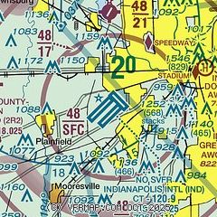
| Sectional chart |
|---|
|
CAUTION: Diagram may not be current
 Download PDF
of official airport diagram from the FAA
| Airport distance calculator |
|---|
|
|
| Sunrise and sunset |
|---|
|
Times for 18-Jun-2026
| | Local
(UTC-4) | | Zulu
(UTC) |
|---|
| Morning civil twilight | | 05:45 | | 09:45 |
| Sunrise | | 06:18 | | 10:18 |
| Sunset | | 21:15 | | 01:15 |
| Evening civil twilight | | 21:47 | | 01:47 |
|
| Current date and time |
|---|
| Zulu (UTC) | 18-Jun-2026 04:14:54 |
|---|
| Local (UTC-4) | 18-Jun-2026 00:14:54 |
|---|
|
| METAR |
|---|
| KIND | 180354Z 26012KT 8SM -TSRA SCT028CB BKN049 OVC090 21/20 A2953 RMK AO2 PK WND 26032/0335 RAB19 SLP993 FRQ LTGICCCCG E-S-SW TS E-S-SW MOV E P0031 T02110200
|
KEYE
7nm N | 180353Z AUTO 23009G17KT 2SM +RA BR FEW014 BKN037 OVC095 21/20 A2950 RMK AO2 LTG DSNT ALQDS RAB0259 TSB0258E22 SLP983 P0042 T02110200
|
KHFY
11nm SE | 180355Z AUTO 24008KT 5SM SCT014 BKN024 OVC055 20/20 A2953 RMK AO2 T02010195
|
KUMP
17nm NE | 180355Z AUTO 22007KT 10SM FEW004 BKN010 BKN015 BKN020 OVC029 21/21 A2952 RMK AO2 RAE0353 P0000 T02110211
|
KTYQ
19nm N | 180355Z AUTO 20012KT 10SM VCTS BKN032 OVC043 21/20 A2951 RMK AO2 LTG DSNT SE THRU SW P0001 T02100196 402150110
|
KMQJ
20nm NE | 180355Z AUTO 22007KT 170V240 5SM -RA BR SCT008 OVC035 21/21 A2952 RMK AO2 P0000 T02120212
|
|
| TAF |
|---|
| KIND | 180222Z 1802/1906 20012G20KT P6SM -SHRA VCTS SCT035CB OVC100 TEMPO 1802/1804 3SM TSRA BR SCT010 OVC020CB FM180400 25015G23KT P6SM -SHRA VCTS SCT030CB BKN090 FM180500 25014G27KT P6SM VCTS SCT018CB BKN045 FM180600 25013G23KT P6SM VCSH FEW017 SCT035 FM182100 29010KT P6SM FEW035 SCT110
|
|
| NOTAMs |
|---|
NOTAMs are issued by the DoD/FAA and will open in a separate window not controlled by AirNav.
|
|


