FAA INFORMATION EFFECTIVE 30 OCTOBER 2025
Location
| FAA Identifier: | 3I7 |
| Lat/Long: | 39-54-47.8000N 084-24-01.4850W
39-54.796667N 084-24.024750W
39.9132778,-84.4004125
(estimated) |
| Elevation: | 1028.2 ft. / 313.4 m (surveyed) |
| Variation: | 04W (1985) |
| From city: | 13 miles NW of DAYTON, OH |
| Time zone: | UTC -5 (UTC -4 during Daylight Saving Time) |
| Zip code: | 45309 |
Airport Operations
| Airport use: | Open to the public |
| Activation date: | 11/1961 |
| Control tower: | no |
| ARTCC: | INDIANAPOLIS CENTER |
| FSS: | DAYTON FLIGHT SERVICE STATION |
| NOTAMs facility: | DAY (NOTAM-D service available) |
| Attendance: | SUN 1000-1700, ALL MON-SAT 0900-1700
UNATNDD NEW YEARS, EASTER, THANKSGIVING, & CHRISTMAS. |
| Wind indicator: | yes |
| Segmented circle: | no |
| Lights: | SS-SR |
| Beacon: | white-green (lighted land airport)
Operates sunset to sunrise. |
Airport Communications
| CTAF/UNICOM: | 122.7 |
| COLUMBUS APPROACH: | 134.45 |
| COLUMBUS DEPARTURE: | 134.45 |
| WX ASOS at DAY (8 nm E): | PHONE 937-419-1421 |
| WX AWOS-3PT at VES (18 nm N): | 125.9 (937-526-3154) |
Nearby radio navigation aids
| VOR radial/distance | | VOR name | | Freq | | Var |
|---|
| DQNr182/6.2 | | DAYTON VOR/DME | | 114.50 | | 01W |
| RODr221/27.8 | | ROSEWOOD VORTAC | | 117.50 | | 05W |
| NDB name | | Hdg/Dist | | Freq | | Var | | ID |
|---|
| BRUNY | | 329/5.0 | | 315 | | 06W | | AT | .- - |
Airport Services
| Fuel available: | 100LL JET-A
100LL:100LL AVBL H24 SELF SVC VIA CREDIT CARD.
A:JET A AVBL ON REQ. |
| Parking: | hangars and tiedowns |
| Airframe service: | MAJOR |
| Powerplant service: | MAJOR |
| Bottled oxygen: | NONE |
| Bulk oxygen: | HIGH/LOW |
Runway Information
Runway 3/21
| Dimensions: | 3000 x 40 ft. / 914 x 12 m |
| Surface: | asphalt, in fair condition |
| Runway edge lights: | low intensity |
| Runway edge markings: | NSTD BASIC DUE TO NRS SML SIZE & NOT LCTD AT THR; CNTRLN SPACING. |
| RUNWAY 3 | | RUNWAY 21 |
| Latitude: | 39-54.570167N | | 39-55.023167N |
| Longitude: | 084-24.152833W | | 084-23.896667W |
| Elevation: | 1027.4 ft. | | 1021.5 ft. |
| Traffic pattern: | left | | left |
| Runway heading: | 028 magnetic, 024 true | | 208 magnetic, 204 true |
| Displaced threshold: | 130 ft. | | no |
| Markings: | NSTD, in good condition | | NSTD, in good condition |
| Runway end identifier lights: | yes | | yes |
| Touchdown point: | yes, no lights | | yes, no lights |
| Obstructions: | 73 ft. tree, 650 ft. from runway, 85 ft. left of centerline, 6:1 slope to clear
20 FT TWY, 0-92 FT DIST, 80-125 FT R. | | none
20 FT TWY, 0-60 FT DIST, 0-250 FT R. |
Airport Ownership and Management from official FAA records
| Ownership: | Privately-owned |
| Owner: | DJTM HOLDINGS
PO BOX 10
PHILLIPSBURG, OH 45354-0010
Phone 937-884-9795 |
| Manager: | DANNY POTTER
PO BOX 10
PHILLIPSBURG, OH 45354-0010
Phone 937-884-9795 |
Additional Remarks
| - | FOR CD CTC COLUMBUS APCH AT 614-338-8537. |
Instrument Procedures
NOTE: All procedures below are presented as PDF files. If you need a reader for these files, you should download the free Adobe Reader.NOT FOR NAVIGATION. Please procure official charts for flight.
FAA instrument procedures published for use from 30 October 2025 at 0901Z to 27 November 2025 at 0900Z.
IAPs - Instrument Approach Procedures |
|---|
| RNAV (GPS)-A | |
download (178KB) |
| NOTE: Special Take-Off Minimums/Departure Procedures apply | |
download (474KB) |
Other nearby airports with instrument procedures:
KDAY - James M Cox Dayton International Airport (8 nm E)
I17 - Piqua Airport/Hartzell Field (16 nm N)
I73 - Moraine Air Park (16 nm SE)
KFFO - Wright-Patterson Air Force Base (17 nm E)
KVES - Darke County Airport (18 nm N)
|
|

Road maps at:
MapQuest
Bing
Google
| Aerial photo |
|---|
WARNING: Photo may not be current or correct
 Photo by Bill Simpson
Photo taken 02-Aug-2009
Photo by Bill Simpson
Photo taken 02-Aug-2009
Do you have a better or more recent aerial photo of Dayton/Phillipsburg Airport that you would like to share? If so, please send us your photo.
|
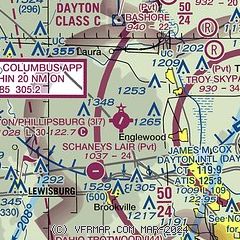
| Sectional chart |
|---|
|
| Airport distance calculator |
|---|
|
|
| Sunrise and sunset |
|---|
|
Times for 26-Nov-2025
| | Local
(UTC-5) | | Zulu
(UTC) |
|---|
| Morning civil twilight | | 07:06 | | 12:06 |
| Sunrise | | 07:36 | | 12:36 |
| Sunset | | 17:14 | | 22:14 |
| Evening civil twilight | | 17:44 | | 22:44 |
|
| Current date and time |
|---|
| Zulu (UTC) | 26-Nov-2025 19:06:37 |
|---|
| Local (UTC-5) | 26-Nov-2025 14:06:37 |
|---|
|
| METAR |
|---|
KDAY
8nm E | 261856Z 25020G39KT 10SM OVC038 03/M04 A2992 RMK AO2 PK WND 25039/1804 SLP137 T00281044
|
KFFO
18nm E | 261855Z 24021G27KT 10SM OVC037 04/M04 A2992 RMK AO2A PK WND 26031/05 SLP138 T00391038
|
KVES
18nm N | 261835Z AUTO 25016G29KT 10SM SCT027 OVC035 02/M02 A2988 RMK AO2 PK WND 28029/55
|
|
| TAF |
|---|
KDAY
8nm E | 261720Z 2618/2718 26024G36KT P6SM OVC028 TEMPO 2618/2621 OVC035 FM262200 26022G34KT P6SM OVC035 FM270200 26018G28KT P6SM OVC040 FM270600 27016G23KT P6SM BKN035 FM271400 28018G26KT P6SM BKN035
|
KFFO
18nm E | 261356Z 2613/2717 25012G18KT 9999 BKN025 OVC035 610502 520053 QNH2986INS TEMPO 2613/2615 25015G25KT BECMG 2614/2615 26014G22KT 9999 OVC040 620403 520003 QNH2988INS TEMPO 2615/2701 27025G35KT TEMPO 2701/2708 27015G25KT BECMG 2706/2708 27012G18KT 9999 OVC035 620353 QNH3003INS TX05/2613Z TNM02/2711Z
|
|
| NOTAMs |
|---|
NOTAMs are issued by the DoD/FAA and will open in a separate window not controlled by AirNav.
|
|


