FAA INFORMATION EFFECTIVE 22 JANUARY 2026
Location
| FAA Identifier: | 68C |
| Lat/Long: | 44-30-17.1973N 089-01-32.8830W
44-30.286622N 089-01.548050W
44.5047770,-89.0258008
(estimated) |
| Elevation: | 882 ft. / 269 m (estimated) |
| Variation: | 01W (1985) |
| From city: | 4 miles E of IOLA, WI |
| Time zone: | UTC -6 (UTC -5 during Daylight Saving Time) |
| Zip code: | 54945 |
Airport Operations
| Airport use: | Open to the public |
| Activation date: | 09/1947 |
| Control tower: | no |
| ARTCC: | MINNEAPOLIS CENTER |
| FSS: | GREEN BAY FLIGHT SERVICE STATION |
| NOTAMs facility: | GRB (NOTAM-D service available) |
| Attendance: | UNATNDD |
| Wind indicator: | yes |
| Segmented circle: | yes |
Airport Communications
| CTAF: | 122.9 |
| WX AWOS-3 at PCZ (10 nm S): | 118.625 (920-867-2407) |
| WX AWOS-3 at CLI (14 nm NE): | 120.675 (715-823-7691) |
Nearby radio navigation aids
| VOR radial/distance | | VOR name | | Freq | | Var |
|---|
| GRBr264/35.7 | | GREEN BAY VORTAC | | 115.50 | | 01E |
| OSHr325/36.9 | | OSHKOSH VORTAC | | 116.75 | | 02E |
Airport Services
| Parking: | tiedowns |
| Airframe service: | NONE |
| Powerplant service: | NONE |
| Bottled oxygen: | NONE |
| Bulk oxygen: | NONE |
Runway Information
Runway 5/23
| Dimensions: | 2493 x 60 ft. / 760 x 18 m |
| Surface: | turf, in fair condition |
| RUNWAY 5 | | RUNWAY 23 |
| Latitude: | 44-30.170000N | | 44-30.413000N |
| Longitude: | 089-01.795000W | | 089-01.333000W |
| Elevation: | 872.0 ft. | | 868.0 ft. |
| Traffic pattern: | left | | left |
| Runway heading: | 055 magnetic, 054 true | | 235 magnetic, 234 true |
| Runway end identifier lights: | no | | no |
| Obstructions: | 38 ft. trees, 75 ft. from runway, 100 ft. right of centerline, 1:1 slope to clear | | 50 ft. trees, 280 ft. from runway, 150 ft. left of centerline, 5:1 slope to clear |
Runway 9/27
| Dimensions: | 1783 x 40 ft. / 543 x 12 m |
| Surface: | turf, in fair condition |
| Runway edge markings: | MKD WITH ORANGE CONES. |
| RUNWAY 9 | | RUNWAY 27 |
| Latitude: | 44-30.272030N | | 44-30.271070N |
| Longitude: | 089-01.761360W | | 089-01.351440W |
| Elevation: | 872.0 ft. | | 882.0 ft. |
| Traffic pattern: | left | | left |
| Runway end identifier lights: | no | | no |
| Obstructions: | 57 ft. trees, 85 ft. left and right of centerline
CTLG OBST EXCEEDS A 45 DEG SLP. | | 35 ft. tree, 600 ft. from runway, 17:1 slope to clear |
Runway 12/30
| Dimensions: | 1745 x 40 ft. / 532 x 12 m |
| Surface: | turf, in fair condition |
| RUNWAY 12 | | RUNWAY 30 |
| Latitude: | 44-30.364680N | | 44-30.225420N |
| Longitude: | 089-01.692167W | | 089-01.341300W |
| Elevation: | 868.0 ft. | | 872.0 ft. |
| Traffic pattern: | left | | left |
| Runway end identifier lights: | no | | no |
| Touchdown point: | yes, no lights | | yes, no lights |
| Obstructions: | 50 ft. trees, 10 ft. from runway, 100 ft. left and right of centerline
CTLG OBST EXCEEDS A 45 DEG SLP. | | 56 ft. trees, 500 ft. from runway, 160 ft. right of centerline, 8:1 slope to clear |
Airport Ownership and Management from official FAA records
| Ownership: | Privately-owned |
| Owner: | CENTRAL COUNTY FLYERS
E6597 PROGRESS RD
MANAWA, WI 54949
Phone 920-572-0045 |
| Manager: | MARK HILDEBRAND
E6597 PROGRESS RD
MANAWA, WI 54949
Phone 920-572-0045
MARK57HILDEBRAND@YAHOO.COM. |
Additional Remarks
| - | ARPT CLSD TO WHEELED ACFT WHEN RYS COVERED WITH SNOW OR ICE. |
| - | DEER ON & INVOF ARPT. |
| - | FOR CD CTC MINNEAPOLIS ARTCC AT 651-463-5588. |
| - | CAMPING AVBL. |
Instrument Procedures
There are no published instrument procedures at 68C.
Some nearby airports with instrument procedures:
KPCZ - Waupaca Municipal Airport (10 nm S)
KCLI - Clintonville Municipal Airport (14 nm NE)
KSTE - Stevens Point Municipal Airport (22 nm W)
KEZS - Shawano Municipal Airport (26 nm NE)
KATW - Appleton International Airport (26 nm SE)
|
|

Road maps at:
MapQuest
Bing
Google
| Aerial photo |
|---|
WARNING: Photo may not be current or correct
 Photo by Mathieu Labs
Photo taken 23-Jun-2006
Photo by Mathieu Labs
Photo taken 23-Jun-2006
Do you have a better or more recent aerial photo of Central County Airport that you would like to share? If so, please send us your photo.
|
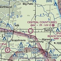
| Sectional chart |
|---|
|
| Airport distance calculator |
|---|
|
|
| Sunrise and sunset |
|---|
|
Times for 14-Feb-2026
| | Local
(UTC-6) | | Zulu
(UTC) |
|---|
| Morning civil twilight | | 06:29 | | 12:29 |
| Sunrise | | 06:59 | | 12:59 |
| Sunset | | 17:22 | | 23:22 |
| Evening civil twilight | | 17:52 | | 23:52 |
|
| Current date and time |
|---|
| Zulu (UTC) | 14-Feb-2026 10:34:05 |
|---|
| Local (UTC-6) | 14-Feb-2026 04:34:05 |
|---|
|
| METAR |
|---|
KPCZ
10nm S | 141015Z AUTO 34003KT 10SM CLR M05/M07 A3004 RMK AO2 T10491066
|
KCLI
14nm NE | 141015Z AUTO 02003KT 5SM BR CLR M05/M06 A3003 RMK AO2 T10501056
|
|
| TAF |
|---|
KATW
27nm SE | 141000Z 1410/1506 VRB03KT P6SM SKC TEMPO 1410/1414 3SM BR FM141600 18003KT P6SM SCT100
|
KCWA
32nm NW | 141002Z 1410/1506 VRB03KT 6SM BR SCT005 BKN100 TEMPO 1410/1414 3SM BR FM141400 VRB03KT 5SM BR BKN150 FM141500 19003KT P6SM SCT200
|
|
| NOTAMs |
|---|
NOTAMs are issued by the DoD/FAA and will open in a separate window not controlled by AirNav.
|
|

