FAA INFORMATION EFFECTIVE 09 JULY 2026
Location
| FAA Identifier: | ATW |
| Lat/Long: | 44-15-29.1350N 088-31-08.6600W
44-15.485583N 088-31.144333W
44.2580931,-88.5190722
(estimated) |
| Elevation: | 918 ft. / 279.8 m (surveyed) |
| Variation: | 02W (1995) |
| From city: | 3 miles W of APPLETON, WI |
| Time zone: | UTC -5 (UTC -6 during Standard Time) |
| Zip code: | 54914 |
Airport Operations
| Airport use: | Open to the public |
| Activation date: | 05/1965 |
| Control tower: | yes |
| ARTCC: | MINNEAPOLIS CENTER |
| FSS: | GREEN BAY FLIGHT SERVICE STATION |
| NOTAMs facility: | ATW (NOTAM-D service available) |
| Attendance: | CONTINUOUS |
| Wind indicator: | lighted |
| Segmented circle: | no |
| Lights: | WHEN ATCT CLSD HIRL RWY 03/21 PRESET ON LOW INTST; TO INCR INTST & ACTVT MALSR RWY 03, 30; REIL RWY 12, 21; PAPI RWY 12; HIRL RWY 03/21, 12/30 - CTAF. |
| Beacon: | white-green (lighted land airport)
Operates sunset to sunrise. |
| Fire and rescue: | ARFF index B |
| International operations: | US CUSTOMS USER FEE ARPT. |
Airport Communications
| CTAF: | 119.6 |
| UNICOM: | 122.95 |
| ATIS: | 127.15 |
| WX AWOS-3: | PHONE 920-832-2597 |
| APPLETON GROUND: | 121.7 [0530-2300] |
| APPLETON TOWER: | 119.6 [0530-2300] |
| GREEN BAY APPROACH: | 126.3 |
| GREEN BAY DEPARTURE: | 126.3 |
| WX ASOS at OSH (17 nm S): | PHONE 920-426-1644 |
- APCH/DEP SVC PRVDD BY MINNEAPOLIS ARTCC (ZMP) ON FREQS 126.3 (APPLETON RCAG)/317.7 (MOSINEE RCAG) WHEN GREEN BAY APCH CLSD.
Nearby radio navigation aids
| VOR radial/distance | | VOR name | | Freq | | Var |
|---|
| OSHr004/16.1 | | OSHKOSH VOR/DME | | 116.75 | | 02E |
| GRBr217/22.6 | | GREEN BAY VORTAC | | 115.50 | | 01E |
| NDB name | | Hdg/Dist | | Freq | | Var | | ID |
|---|
| KOOKY | | 298/5.8 | | 407 | | 02W | | AQ | .- --.- |
Airport Services
| Fuel available: | 100LL JET-A |
| Parking: | hangars and tiedowns |
| Airframe service: | MAJOR |
| Powerplant service: | MAJOR |
| Bottled oxygen: | NONE |
| Bulk oxygen: | HIGH/LOW |
Runway Information
Runway 3/21
| Dimensions: | 8003 x 150 ft. / 2439 x 46 m |
| Surface: | concrete/grooved, in good condition |
| Weight bearing capacity: | | Single wheel: | 120.0 | | Double wheel: | 250.0 | | Double tandem: | 524.0 | | Dual double tandem: | 1043.0 |
|
| Runway edge lights: | high intensity |
| RUNWAY 3 | | RUNWAY 21 |
| Latitude: | 44-14.935403N | | 44-16.118023N |
| Longitude: | 088-31.571000W | | 088-30.764360W |
| Elevation: | 887.5 ft. | | 877.9 ft. |
| Traffic pattern: | left | | left |
| Runway heading: | 028 magnetic, 026 true | | 208 magnetic, 206 true |
| Declared distances: | TORA:8002 TODA:8002 ASDA:8002 LDA:8002 | | TORA:8002 TODA:8002 ASDA:8002 LDA:8002 |
| Markings: | precision, in good condition | | precision, in good condition |
| Visual slope indicator: | 4-light PAPI on left (3.00 degrees glide path)
OPERATES CONTINUOUSLY. | | 4-light PAPI on left (3.00 degrees glide path)
OPERATES CONTINUOUSLY. PAPI RESTRICTED BYD 8.5 DEG RGT OF COURSE. |
| RVR equipment: | touchdown | | rollout |
| Approach lights: | MALSR: 1,400 foot medium intensity approach lighting system with runway alignment indicator lights | | |
| Runway end identifier lights: | no | | yes |
| Touchdown point: | yes, no lights | | yes, no lights |
| Instrument approach: | ILS/DME | | |
| Obstructions: | 56 ft. tree, 2400 ft. from runway, 200 ft. left of centerline, 39:1 slope to clear | | 62 ft. tree, 2600 ft. from runway, 350 ft. left of centerline, 38:1 slope to clear |
Runway 12/30
| Dimensions: | 6502 x 150 ft. / 1982 x 46 m |
| Surface: | concrete/grooved, in good condition |
| Weight bearing capacity: | | Single wheel: | 120.0 | | Double wheel: | 224.0 | | Double tandem: | 360.0 | | Dual double tandem: | 835.0 |
|
| Runway edge lights: | high intensity |
| RUNWAY 12 | | RUNWAY 30 |
| Latitude: | 44-15.670428N | | 44-15.199375N |
| Longitude: | 088-31.783967W | | 088-30.447165W |
| Elevation: | 918.0 ft. | | 858.1 ft. |
| Traffic pattern: | left | | left |
| Runway heading: | 118 magnetic, 116 true | | 298 magnetic, 296 true |
| Declared distances: | TORA:6501 TODA:6501 ASDA:6501 LDA:6501 | | TORA:6501 TODA:6501 ASDA:6501 LDA:6501 |
| Markings: | precision, in good condition | | precision, in good condition |
| Visual slope indicator: | 4-light PAPI on left (3.00 degrees glide path) | | 4-light PAPI on left (3.00 degrees glide path)
OPERATES CONTINUOUSLY. |
| Approach lights: | | | MALSR: 1,400 foot medium intensity approach lighting system with runway alignment indicator lights |
| Runway end identifier lights: | yes | | |
| Touchdown point: | yes, no lights | | yes, no lights |
| Instrument approach: | | | ILS/DME |
| Obstructions: | 57 ft. tree, 2800 ft. from runway, 350 ft. right of centerline, 45:1 slope to clear | | none |
Airport Ownership and Management from official FAA records
| Ownership: | Publicly-owned |
| Owner: | OUTAGAMIE COUNTY
W6390 CHALLENGER DR-SUITE 201
APPLETON, WI 54915
Phone 920-832-5267 |
| Manager: | ABE WEBER, AIRPORT DIRECTOR
W6390 CHALLENGER DR-SUITE 201
APPLETON, WI 54914-9119
Phone 920-832-5267 |
Additional Remarks
| A39-12/30 | PCR VALUE: 730/R/C/W/T |
| A39-03/21 | PCR VALUE: 1000/R/C/W/T |
| - | BIRDS & MIGRATORY WATERFOWL ON & INVOF ARPT. |
| - | SNOW REMOVAL OPNS IN PROGRESS WINTER MONTHS. VEHICLE OPERATORS WILL BE MONITORING CTAF; ACFT LNDG/DEP APPLETON SHOULD USE CTAF WHEN ATCT CLSD. |
| - | US CSTMS AND BORDER PROTECTION. PPR US CSTMS SVC MON-FRI 1300-2100Z (0800-1600 LOCAL) CALL 920-968-2348. |
| - | WHEN ATCT CLSD, FOR CD CTC GREEN BAY APCH ON FREQ, IF UNA CTC MINNEAPOLIS ARTCC AT 651-463-5588. |
| - | PERIODIC LIVE FIRE TRNG SOUTH SIDE OF ARPT. |
| - | COML RAMP DEICING PADS ARE AVBL FOR LIVE ENG RUN OPN DRG DEICING. |
Instrument Procedures
NOTE: All procedures below are presented as PDF files. If you need a reader for these files, you should download the free Adobe Reader.NOT FOR NAVIGATION. Please procure official charts for flight.
FAA instrument procedures published for use from 09 July 2026 at 0901Z to 06 August 2026 at 0900Z.
IAPs - Instrument Approach Procedures |
|---|
| ILS OR LOC RWY 03 | |
download (298KB) |
| ILS OR LOC RWY 30 | |
download (255KB) |
| RNAV (GPS) RWY 03 | |
download (250KB) |
| RNAV (GPS) RWY 12 | |
download (245KB) |
| RNAV (GPS) RWY 21 | |
download (221KB) |
| RNAV (GPS) RWY 30 | |
download (256KB) |
| NOTE: Special Alternate Minimums apply | |
download (59KB) |
| NOTE: Special Take-Off Minimums/Departure Procedures apply | |
download (300KB) |
Other nearby airports with instrument procedures:
KOSH - Wittman Regional Airport (17 nm S)
KGRB - Green Bay/Austin Straubel International Airport (22 nm NE)
KPCZ - Waupaca Municipal Airport (22 nm W)
KCLI - Clintonville Municipal Airport (23 nm NW)
8D1 - New Holstein Municipal Airport (26 nm SE)
|
|

Road maps at:
MapQuest
Bing
Google
| Aerial photo |
|---|
WARNING: Photo may not be current or correct
 Looking north.
Do you have a better or more recent aerial photo of Appleton International Airport that you would like to share? If so, please send us your photo.
|
| Sectional chart |
|---|
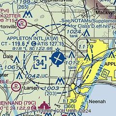
|
 Download PDF
of official airport diagram from the FAA
| Airport distance calculator |
|---|
|
|
| Sunrise and sunset |
|---|
|
Times for 16-Jul-2026
| | Local
(UTC-5) | | Zulu
(UTC) |
|---|
| Morning civil twilight | | 04:51 | | 09:51 |
| Sunrise | | 05:26 | | 10:26 |
| Sunset | | 20:34 | | 01:34 |
| Evening civil twilight | | 21:09 | | 02:09 |
|
| Current date and time |
|---|
| Zulu (UTC) | 17-Jul-2026 00:28:36 |
|---|
| Local (UTC-5) | 16-Jul-2026 19:28:36 |
|---|
|
| METAR |
|---|
| KATW | 162345Z 03005KT 3/4SM R03/6000 FU OVC029 29/18 A3007
|
KOSH
18nm S | 162353Z AUTO 06004KT 1 1/4SM HZ OVC030 28/16 A3005 RMK AO2 SLP162 T02830161 10294 20272 56006
|
|
| TAF |
|---|
| KATW | 161956Z 1620/1718 VRB03KT 1SM FU BKN020 FM170000 13003KT 1SM FU BKN022 FM171200 19004KT 1 1/2SM FU BKN022
|
KOSH
18nm S | 162040Z 1621/1718 06005KT 1SM FU OVC017 FM170200 14005KT 2SM FU BKN020 FM171600 15004KT 3SM FU BKN035
|
|
| NOTAMs |
|---|
NOTAMs are issued by the DoD/FAA and will open in a separate window not controlled by AirNav.
|
|


