FAA INFORMATION EFFECTIVE 17 APRIL 2025
Location
| FAA Identifier: | CII |
| Lat/Long: | 47-49-42.0520N 112-10-06.0090W
47-49.700867N 112-10.100150W
47.8283478,-112.1683358
(estimated) |
| Elevation: | 3946.6 ft. / 1202.9 m (surveyed) |
| Variation: | 12E (2020) |
| From city: | 1 mile NE of CHOTEAU, MT |
| Time zone: | UTC -6 (UTC -7 during Standard Time) |
| Zip code: | 59422 |
Airport Operations
| Airport use: | Open to the public |
| Activation date: | 02/1945 |
| Control tower: | no |
| ARTCC: | SALT LAKE CITY CENTER |
| FSS: | GREAT FALLS FLIGHT SERVICE STATION |
| NOTAMs facility: | GTF (NOTAM-D service available) |
| Attendance: | MON-FRI 0800-1700 |
| Wind indicator: | lighted |
| Segmented circle: | yes |
| Lights: | ACTVT PAPI RWY 05, 23,15 & 33; MIRL RWY 05/23 & 15/33 - CTAF. |
| Beacon: | white-green (lighted land airport)
Operates sunset to sunrise. |
Airport Communications
| CTAF/UNICOM: | 122.8 |
| WX AWOS-2: | 119.275 (406-466-2259) |
- APCH/DEP CTL SVC PRVDD BY SALT LAKE CITY ARTCC ( ZLC) ON FREQS 133.4/285.4 (GREAT FALLS RCAG).
Nearby radio navigation aids
| VOR radial/distance | | VOR name | | Freq | | Var |
|---|
| GTFr291/38.1 | | GREAT FALLS VORTAC | | 115.10 | | 16E |
Airport Services
| Fuel available: | 100LL JET-A |
| Parking: | hangars and tiedowns |
Runway Information
Runway 15/33
| Dimensions: | 5000 x 75 ft. / 1524 x 23 m |
| Surface: | asphalt, in good condition |
| Weight bearing capacity: | |
| Runway edge lights: | medium intensity |
| RUNWAY 15 | | RUNWAY 33 |
| Latitude: | 47-50.220075N | | 47-49.448452N |
| Longitude: | 112-10.414730W | | 112-09.993067W |
| Elevation: | 3940.9 ft. | | 3942.2 ft. |
| Traffic pattern: | left | | left |
| Runway heading: | 148 magnetic, 160 true | | 328 magnetic, 340 true |
| Markings: | nonprecision, in good condition | | nonprecision, in good condition |
| Visual slope indicator: | 2-light PAPI on left (3.00 degrees glide path) | | 2-light PAPI on left (3.00 degrees glide path) |
| Touchdown point: | yes, no lights | | yes, no lights |
Runway 5/23
| Dimensions: | 3699 x 60 ft. / 1127 x 18 m |
| Surface: | asphalt, in good condition |
| Weight bearing capacity: | |
| Runway edge lights: | medium intensity |
| RUNWAY 5 | | RUNWAY 23 |
| Latitude: | 47-49.400158N | | 47-49.640948N |
| Longitude: | 112-10.374718W | | 112-09.545208W |
| Elevation: | 3946.6 ft. | | 3939.2 ft. |
| Traffic pattern: | left | | left |
| Runway heading: | 055 magnetic, 067 true | | 235 magnetic, 247 true |
| Markings: | basic, in good condition | | basic, in good condition |
| Visual slope indicator: | 2-light PAPI on left (3.00 degrees glide path) | | 2-light PAPI on left (3.00 degrees glide path) |
| Touchdown point: | yes, no lights | | yes, no lights |
| Obstructions: | none | | 20 ft. road, 590 ft. from runway, 19:1 slope to clear |
Airport Ownership and Management from official FAA records
| Ownership: | Publicly-owned |
| Owner: | CHOTEAU CITY AND TETON CO
PO BOX 610, COUNTY COURT HOUSE
CHOTEAU, MT 59422
Phone 406-466-3337 |
| Manager: | CHRISSY HODGSKISS
PO BOX 1445
CHOTEAU, MT 59422
Phone 303-881-8809 |
Additional Remarks
| - | 100LL 24/7 SELF SVC. JET A+ FULL SVC CALL OUT ONLY AFT HRS. |
| - | FOR CD CTC SALT LAKE ARTCC AT 801-320-2568. |
Instrument Procedures
NOTE: All procedures below are presented as PDF files. If you need a reader for these files, you should download the free Adobe Reader.NOT FOR NAVIGATION. Please procure official charts for flight.
FAA instrument procedures published for use from 17 April 2025 at 0901Z to 15 May 2025 at 0900z.
IAPs - Instrument Approach Procedures |
|---|
| RNAV (GPS) RWY 15 | |
download (207KB) |
| RNAV (GPS) RWY 33 | |
download (199KB) |
| NOTE: Special Take-Off Minimums/Departure Procedures apply | |
download (620KB) |
Other nearby airports with instrument procedures:
S01 - Conrad Airport (22 nm N)
KGTF - Great Falls International Airport (38 nm SE)
KSBX - Shelby Airport (44 nm N)
KCTB - Cut Bank International Airport (48 nm N)
79S - Fort Benton Airport (62 nm E)
|
|

Road maps at:
MapQuest
Bing
Google
| Aerial photo |
|---|
WARNING: Photo may not be current or correct
 Photo by Sam Tarrel
Do you have a better or more recent aerial photo of Choteau Airport that you would like to share? If so, please send us your photo.
|
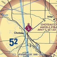
| Sectional chart |
|---|
|
CAUTION: Diagram may not be current

| Airport distance calculator |
|---|
|
|
| Sunrise and sunset |
|---|
|
Times for 20-Apr-2025
| | Local
(UTC-6) | | Zulu
(UTC) |
|---|
| Morning civil twilight | | 05:58 | | 11:58 |
| Sunrise | | 06:31 | | 12:31 |
| Sunset | | 20:24 | | 02:24 |
| Evening civil twilight | | 20:57 | | 02:57 |
|
| Current date and time |
|---|
| Zulu (UTC) | 20-Apr-2025 09:26:03 |
|---|
| Local (UTC-6) | 20-Apr-2025 03:26:03 |
|---|
|
| TAF |
|---|
KGTF
38nm SE | 200541Z 2006/2106 23008KT P6SM SCT080 BKN150 FM201700 25011G18KT P6SM SCT120 BKN200 PROB30 2021/2024 6SM -SHRA SCT030 BKN060 FM210000 27008KT P6SM VCSH SCT030 BKN060
|
KCTB
47nm N | 200541Z 2006/2106 28013G20KT P6SM SCT050 BKN150 FM201000 29009KT P6SM SCT025 BKN050 PROB30 2013/2018 6SM -SHRA SCT015 BKN025 FM201800 24010G18KT P6SM SCT040 BKN080 FM210000 34009G18KT P6SM SCT025 BKN050
|
|
| NOTAMs |
|---|
NOTAMs are issued by the DoD/FAA and will open in a separate window not controlled by AirNav.
|
|


