FAA INFORMATION EFFECTIVE 17 APRIL 2025
Location
| FAA Identifier: | CLM |
| Lat/Long: | 48-07-12.7000N 123-29-58.9000W
48-07.211667N 123-29.981667W
48.1201944,-123.4996944
(estimated) |
| Elevation: | 291.3 ft. / 88.8 m (surveyed) |
| Variation: | 16E (2020) |
| From city: | 3 miles NW of PORT ANGELES, WA |
| Time zone: | UTC -7 (UTC -8 during Standard Time) |
| Zip code: | 98363 |
Airport Operations
| Airport use: | Open to the public |
| Activation date: | 08/1937 |
| Control tower: | no |
| ARTCC: | SEATTLE CENTER |
| FSS: | SEATTLE FLIGHT SERVICE STATION |
| NOTAMs facility: | CLM (NOTAM-D service available) |
| Attendance: | 0900-1930 |
| Wind indicator: | lighted |
| Segmented circle: | yes |
| Lights: | ACTVT MALSR RWY 09; MIRL RWY 09/27 - CTAF. |
| Beacon: | white-green (lighted land airport)
Operates sunset to sunrise. |
| Landing fee: | yes, LANDING FEE FOR ACFT IN EXCESS OF 4000 LBS. |
| International operations: | customs landing rights airport |
Airport Communications
| CTAF/UNICOM: | 122.975 |
| WX ASOS: | 135.175 (360-457-1070) |
| WHIDBEY APPROACH: | 118.2 |
| WHIDBEY DEPARTURE: | 118.2 |
| CLEARANCE DELIVERY: | 124.15 |
| WX AWOS-3P at NOW (4 nm E): | 118.325 (360-457-7529) |
- COMMUNICATIONS PRVDD BY SEATTLE RADIO ON FREQ 122.6 (PORT ANGELES RCO).
Nearby radio navigation aids
| VOR radial/distance | | VOR name | | Freq | | Var |
|---|
| CVVr237/31.9 | | PENN COVE VOR/DME | | 117.20 | | 19E |
| YYJr164/36.4 | | VICTORIA VOR/DME | | 113.70 | | 17E |
| NDB name | | Hdg/Dist | | Freq | | Var | | ID |
|---|
| FRIDAY HARBOR | | 202/30.2 | | 284 | | 17E | | FHR | ..-. .... .-. |
Airport Services
| Fuel available: | 100LL JET-A
100LL:FOR AFT HRS JET A CALL 360-452-6226. |
| Parking: | tiedowns |
| Airframe service: | MAJOR |
| Powerplant service: | MAJOR |
Runway Information
Runway 9/27
| Dimensions: | 6347 x 150 ft. / 1935 x 46 m |
| Surface: | asphalt/grooved, in good condition |
| Weight bearing capacity: | | Single wheel: | 55.0 | | Double wheel: | 66.0 | | Double tandem: | 115.0 |
|
| Runway edge lights: | medium intensity |
| RUNWAY 9 | | RUNWAY 27 |
| Latitude: | 48-07.262192N | | 48-06.999388N |
| Longitude: | 123-30.690842W | | 123-29.182027W |
| Elevation: | 283.8 ft. | | 291.3 ft. |
| Traffic pattern: | left | | right |
| Runway heading: | 089 magnetic, 105 true | | 269 magnetic, 285 true |
| Displaced threshold: | no | | 1354 ft. |
| Markings: | precision, in good condition | | nonprecision, in good condition |
| Visual slope indicator: | 4-light PAPI on left (3.00 degrees glide path)
UNUSBL BYD 5.0 NM DUE TO HIGH TERRAIN | | 4-light PAPI on left (3.70 degrees glide path)
UNUSBL BYD 8 DEGS L OF CNTRLN. |
| Approach lights: | MALSR: 1,400 foot medium intensity approach lighting system with runway alignment indicator lights | | |
| Runway end identifier lights: | | | yes |
| Touchdown point: | yes, no lights | | yes, no lights |
| Instrument approach: | ILS/DME | | |
| Obstructions: | 111 ft. trees, 3200 ft. from runway, 27:1 slope to clear | | 19 ft. ant, 300 ft. from runway, 300 ft. right of centerline, 15:1 slope to clear
+35' BLDG; DIST 520'; 500' LEFT; 15:1 BASED ON DSPLCD THR. |
Runway 13/31
| Dimensions: | 3255 x 50 ft. / 992 x 15 m |
| Surface: | asphalt, in fair condition |
| Weight bearing capacity: | |
| RUNWAY 13 | | RUNWAY 31 |
| Latitude: | 48-07.594057N | | 48-07.142262N |
| Longitude: | 123-30.285502W | | 123-29.856550W |
| Elevation: | 227.2 ft. | | 271.3 ft. |
| Traffic pattern: | left | | right |
| Runway heading: | 132 magnetic, 148 true | | 312 magnetic, 328 true |
| Markings: | basic, in good condition | | basic, in good condition |
| Touchdown point: | yes, no lights | | yes, no lights |
| Obstructions: | 27 ft. trees, 522 ft. from runway, 11:1 slope to clear | | 37 ft. trees, 1080 ft. from runway, 23:1 slope to clear |
Airport Ownership and Management from official FAA records
| Ownership: | Publicly-owned |
| Owner: | PORT OF PORT ANGELES
PO BOX 1350
PORT ANGELES, WA 98362
Phone 360-457-8527 |
| Manager: | JAMES ALTON
338 WEST FIRST STREET, PO BOX 1350
PORT ANGELES, WA 98362
Phone 360-417-3437 |
Additional Remarks
| - | RWY 13/31 CLSD DUSK TO DAWN. |
| - | FOR CD IF UNA TO CTC ON FSS FREQ, CTC WHIDBEY APCH AT 360-257-3310. |
Instrument Procedures
NOTE: All procedures below are presented as PDF files. If you need a reader for these files, you should download the free Adobe Reader.NOT FOR NAVIGATION. Please procure official charts for flight.
FAA instrument procedures published for use from 17 April 2025 at 0901Z to 15 May 2025 at 0900z.
IAPs - Instrument Approach Procedures |
|---|
| ILS OR LOC RWY 09 **CHANGED** | |
download (471KB) |
| RNAV (GPS) RWY 09 | |
download (403KB) |
| RNAV (GPS) RWY 27 | |
download (377KB) |
| NOTE: Special Alternate Minimums apply **CHANGED** | |
download (213KB) |
|
|---|
| WATTR ONE (OBSTACLE) (RNAV) **NEW** | |
2 pages:
[1] [2] (531KB) |
| NOTE: Special Take-Off Minimums/Departure Procedures apply **CHANGED** | |
download (558KB) |
Other nearby airports with instrument procedures:
KNOW - Port Angeles Coast Guard Air Station Airport (4 nm E)
0S9 - Jefferson County International Airport (28 nm E)
KFHR - Friday Harbor Airport (31 nm NE)
KOKH - Delaurentis Airport (34 nm E)
KNUW - Whidbey Island Naval Air Station (Ault Field) Airport (36 nm NE)
|
|

Road maps at:
MapQuest
Bing
Google
| Aerial photo |
|---|
WARNING: Photo may not be current or correct
 Photo by Trent Thomas
Photo taken 13-Apr-2021
taken facing to the northeast at approximately 800 AGL
Photo by Trent Thomas
Photo taken 13-Apr-2021
taken facing to the northeast at approximately 800 AGL
Do you have a better or more recent aerial photo of William R Fairchild International Airport that you would like to share? If so, please send us your photo.
|
| Sectional chart |
|---|
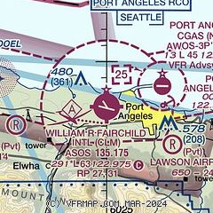
|
| Airport distance calculator |
|---|
|
|
| Sunrise and sunset |
|---|
|
Times for 28-Apr-2025
| | Local
(UTC-7) | | Zulu
(UTC) |
|---|
| Morning civil twilight | | 05:27 | | 12:27 |
| Sunrise | | 06:01 | | 13:01 |
| Sunset | | 20:22 | | 03:22 |
| Evening civil twilight | | 20:56 | | 03:56 |
|
| Current date and time |
|---|
| Zulu (UTC) | 28-Apr-2025 17:13:55 |
|---|
| Local (UTC-7) | 28-Apr-2025 10:13:55 |
|---|
|
| METAR |
|---|
| KCLM | 281653Z AUTO 36004KT 10SM OVC095 12/05 A3027 RMK AO2 SLP252 T01170050
|
KNOW
4nm W | 281650Z AUTO 30005KT 10SM OVC022 10/07 A3028 RMK AO2 T01020068
|
CWQK
10nm N | 281600Z AUTO 25014KT 09/06 RMK AO1 PK WND 25018/1514 SLP250 T00900056 51016
|
CWPF
18nm N | 281645Z AUTO 22012KT 10/06 RMK AO1 PK WND 22019/1645 SLP246 T01020061 51016
|
CWLM
19nm N | 281600Z AUTO 23012G17KT 10/06 RMK AO1 PK WND 24020/1500 SLP240 T00970061 51017
|
CYWH
19nm N | 281600Z 23015KT 15SM FEW020 BKN140 OVC200 10/06 A3026 RMK SC2AC3CI3 SLP248
|
|
| TAF |
|---|
| KCLM | 281142Z 2812/2912 27006KT P6SM OVC020 FM281800 VRB03KT P6SM BKN025 OVC050 FM282000 VRB03KT P6SM SCT030 BKN050 OVC150 FM290500 VRB03KT P6SM -RA SCT015 BKN025 OVC040
|
CYWH
19nm N | 281410Z 2814/2902 23015KT P6SM SCT015 BKN130 TEMPO 2814/2818 BKN015 FM281800 21010KT P6SM FEW015 OVC070 TEMPO 2818/2823 P6SM -RA BKN015 OVC050 FM282300 19008KT 6SM -RA BR SCT006 OVC015 TEMPO 2823/2902 3SM -RA BR OVC006 RMK NXT FCST BY 282100Z
|
|
| NOTAMs |
|---|
NOTAMs are issued by the DoD/FAA and will open in a separate window not controlled by AirNav.
|
|


