FAA INFORMATION EFFECTIVE 09 JULY 2026
Location
| FAA Identifier: | INT |
| Lat/Long: | 36-08-01.3697N 080-13-19.1558W
36-08.022828N 080-13.319263W
36.1337138,-80.2219877
(estimated) |
| Elevation: | 969.4 ft. / 295.5 m (surveyed) |
| Variation: | 07W (2000) |
| From city: | 3 miles NE of WINSTON SALEM, NC |
| Time zone: | UTC -4 (UTC -5 during Standard Time) |
| Zip code: | 27105 |
Airport Operations
| Airport use: | Open to the public |
| Activation date: | 01/1938 |
| Control tower: | yes |
| ARTCC: | ATLANTA CENTER |
| FSS: | RALEIGH FLIGHT SERVICE STATION |
| NOTAMs facility: | INT (NOTAM-D service available) |
| Attendance: | CONTINUOUS |
| Wind indicator: | lighted |
| Segmented circle: | yes |
| Lights: | SS-SR |
| Beacon: | white-green (lighted land airport)
Operates sunset to sunrise. |
| Fire and rescue: | ARFF index A |
| Airline operations: | ARFF INDEX B COVERAGE AVBL, CALL OPS 336-607-6122. |
| International operations: | customs landing rights airport |
Airport Communications
| CTAF: | 123.75 |
| UNICOM: | 122.95 |
| ATIS: | 121.3 |
| WX ASOS: | PHONE 336-661-3096 |
| WINSTON-SALEM GROUND: | 128.25 [0645 - 2130] |
| WINSTON-SALEM TOWER: | 123.75 257.8 [0645 - 2130] |
| GREENSBORO APPROACH: | 124.35 |
| GREENSBORO DEPARTURE: | 124.35 |
| BLOCC STAR: | 124.35 ;250-049 126.6 ;050-249 |
| HENBY STAR: | 124.35 ;250-049 126.6 ;050-249 |
| TRIAD DP: | 124.35 |
| TRSHA DP: | 124.35 |
| VFR ADZY: | 123.75 257.8 |
| WX ASOS at GSO (14 nm E): | 128.55 (336-355-1608) |
Nearby radio navigation aids
| VOR radial/distance | | VOR name | | Freq | | Var |
|---|
| GSOr297/13.0 | | GREENSBORO VORTAC | | 116.20 | | 03W |
| LIBr306/35.3 | | LIBERTY VORTAC | | 113.00 | | 03W |
| NDB name | | Hdg/Dist | | Freq | | Var | | ID |
|---|
| SLAMMER | | 243/26.7 | | 423 | | 07W | | SIF | ... .. ..-. |
Airport Services
| Fuel available: | 100LL JET-A |
| Parking: | hangars and tiedowns |
| Airframe service: | MAJOR |
| Powerplant service: | MAJOR |
| Bottled oxygen: | HIGH/LOW |
| Bulk oxygen: | HIGH/LOW |
Runway Information
Runway 15/33
| Dimensions: | 6655 x 150 ft. / 2028 x 46 m |
| Surface: | asphalt/grooved, in fair condition |
| Weight bearing capacity: | | Single wheel: | 120.0 | | Double wheel: | 250.0 | | Double tandem: | 550.0 | | Dual double tandem: | 1087.0 |
|
| Runway edge lights: | high intensity |
| Operational restrictions: | ARRESTING GEAR/SYSTEM: ENGINEERED MATERIALS ARRESTING SYSTEM (EMAS) 304 FT IN LENGTH BY 170 FT WIDTH AT THE DEPARTURE END OF RWY 15. |
| RUNWAY 15 | | RUNWAY 33 |
| Latitude: | 36-08.328300N | | 36-07.433935N |
| Longitude: | 080-13.577420W | | 080-12.795028W |
| Elevation: | 967.7 ft. | | 900.0 ft. |
| Traffic pattern: | left | | left |
| Runway heading: | 152 magnetic, 145 true | | 332 magnetic, 325 true |
| Displaced threshold: | 585 ft. | | no |
| Declared distances: | TORA:6655 TODA:6655 ASDA:6655 LDA:6069 | | TORA:6655 TODA:6655 ASDA:6655 LDA:6655 |
| Markings: | nonprecision, in good condition | | precision, in good condition |
| Visual slope indicator: | 4-light PAPI on left (3.00 degrees glide path) | | 4-light PAPI on left (3.00 degrees glide path) |
| RVR equipment: | rollout | | touchdown |
| Approach lights: | | | MALSR: 1,400 foot medium intensity approach lighting system with runway alignment indicator lights |
| Runway end identifier lights: | yes | | no |
| Touchdown point: | yes, no lights | | yes, no lights |
| Instrument approach: | | | ILS |
| Obstructions: | 57 ft. bldg, 1250 ft. from runway, 450 ft. left of centerline, 18:1 slope to clear
APCH RATIO 32:1 FM DSPLCD THR. | | none |
Runway 4/22
| Dimensions: | 3938 x 150 ft. / 1200 x 46 m |
| Surface: | asphalt, in good condition |
| Weight bearing capacity: | | Single wheel: | 51.0 | | Double wheel: | 82.0 | | Double tandem: | 145.0 |
|
| Runway edge lights: | medium intensity |
| Operational restrictions: | RWY 04/22 NOT AVBL FOR PART 121/PART 380 OPS WITH SKED PAX CARRYING OPS MORE THAN 9 PAX SEATS AND NON-SKED PAX CARRYING OPS MORE THAN 30 PAX SEATS. NO PART 121/PART 380 OPS EXC FOR TAX. |
| RUNWAY 4 | | RUNWAY 22 |
| Latitude: | 36-07.983390N | | 36-08.541235N |
| Longitude: | 080-13.748463W | | 080-13.339718W |
| Elevation: | 949.7 ft. | | 960.5 ft. |
| Traffic pattern: | left | | left |
| Runway heading: | 038 magnetic, 031 true | | 218 magnetic, 211 true |
| Declared distances: | TORA:3938 TODA:3938 ASDA:3938 LDA:3938 | | TORA:3938 TODA:3938 ASDA:3938 LDA:3938 |
| Markings: | basic, in good condition | | basic, in good condition |
| Visual slope indicator: | | | 2-light PAPI on left (3.00 degrees glide path) |
| Touchdown point: | yes, no lights | | yes, no lights |
| Obstructions: | 85 ft. trees, 1700 ft. from runway, 100 ft. right of centerline, 20:1 slope to clear | | 50 ft. trees, 1400 ft. from runway, 150 ft. right of centerline, 24:1 slope to clear |
Airport Ownership and Management from official FAA records
| Ownership: | Publicly-owned |
| Owner: | FORSYTH COUNTY
3801 N LIBERTY ST., STE 204
WINSTON SALEM, NC 27105
Phone 336-607-6120 |
| Manager: | MARK R. DAVIDSON, A.A.E.
3801 N. LIBERTY ST., STE 204
WINSTON SALEM, NC 27105
Phone 336-607-6120 |
Additional Remarks
| A39-04/22 | PCR VALUE: 180/F/B/X/T |
| A39-15/33 | PCR VALUE: 1320/F/D/X/T |
| - | FOR CD CTC GREENSBORO APCH AT 743-222-6129. |
| - | ARPT SFC COND NOT RPRT DLY 1630-0830L, OR ON WKEND AND HOL. |
Instrument Procedures
NOTE: All procedures below are presented as PDF files. If you need a reader for these files, you should download the free Adobe Reader.NOT FOR NAVIGATION. Please procure official charts for flight.
FAA instrument procedures published for use from 09 July 2026 at 0901Z to 06 August 2026 at 0900Z.
STARs - Standard Terminal Arrivals |
|---|
| BLOCC TWO **NEW** | |
download (166KB) |
| HENBY ONE (RNAV) **NEW** | |
download (135KB) |
| TRAKS FOUR (RNAV) **NEW** | |
download (254KB) |
IAPs - Instrument Approach Procedures |
|---|
| ILS OR LOC RWY 33 | |
download (231KB) |
| RNAV (GPS) RWY 15 | |
download (229KB) |
| RNAV (GPS) RWY 33 | |
download (288KB) |
| NOTE: Special Alternate Minimums apply | |
download (167KB) |
Departure Procedures |
|---|
| HOPRZ ONE (RNAV) | |
download (141KB) |
| JEANY ONE (RNAV) | |
download (166KB) |
| TRIAD NINE | |
download (241KB) |
| TRSHA ONE (RNAV) | |
download (225KB) |
| NOTE: Special Take-Off Minimums/Departure Procedures apply | |
download (389KB) |
Other nearby airports with instrument procedures:
N63 - Meadow Brook Field Airport (11 nm N)
KGSO - Piedmont Triad International Airport (14 nm E)
8A7 - Twin Lakes Airport (17 nm SW)
KEXX - Davidson County Executive Airport (22 nm S)
KMWK - Mount Airy/Surry County Airport (25 nm NW)
|
|

Road maps at:
MapQuest
Bing
Google
| Aerial photo |
|---|
WARNING: Photo may not be current or correct
 Photo by AirNav, LLC
Photo taken 18-Oct-2010
from the north.
Photo by AirNav, LLC
Photo taken 18-Oct-2010
from the north.
Do you have a better or more recent aerial photo of Smith Reynolds Airport that you would like to share? If so, please send us your photo.
|
| Sectional chart |
|---|
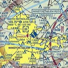
|
 Download PDF
of official airport diagram from the FAA
| Airport distance calculator |
|---|
|
|
| Sunrise and sunset |
|---|
|
Times for 03-Aug-2026
| | Local
(UTC-4) | | Zulu
(UTC) |
|---|
| Morning civil twilight | | 06:02 | | 10:02 |
| Sunrise | | 06:30 | | 10:30 |
| Sunset | | 20:24 | | 00:24 |
| Evening civil twilight | | 20:52 | | 00:52 |
|
| Current date and time |
|---|
| Zulu (UTC) | 03-Aug-2026 18:49:48 |
|---|
| Local (UTC-4) | 03-Aug-2026 14:49:48 |
|---|
|
| METAR |
|---|
| KINT | 031654Z VRB03KT 10SM SCT029 BKN036 28/20 A2990
|
KGSO
13nm E | 031754Z 26010G16KT 10SM BKN033 29/22 A2988 RMK AO2 SLP106 T02940217 10294 20222 50000
|
|
| TAF |
|---|
| KINT | 031720Z 0318/0418 VRB03KT P6SM SCT029 BKN035 FM040800 01002KT P6SM OVC007 FM041400 04009KT P6SM OVC015
|
KGSO
13nm E | 031720Z 0318/0418 23005KT P6SM BKN035 FM040800 01002KT P6SM OVC007 FM041400 06008KT P6SM OVC015
|
|
| NOTAMs |
|---|
NOTAMs are issued by the DoD/FAA and will open in a separate window not controlled by AirNav.
|
|


