FAA INFORMATION EFFECTIVE 09 JULY 2026
Location
| FAA Identifier: | COI |
| Lat/Long: | 28-20-29.7590N 080-41-07.7450W
28-20.495983N 080-41.129083W
28.3415997,-80.6854847
(estimated) |
| Elevation: | 5.9 ft. / 1.8 m (surveyed) |
| Variation: | 05W (2000) |
| Time zone: | UTC -4 (UTC -5 during Standard Time) |
| Zip code: | 32952 |
Airport Operations
| Airport use: | Open to the public |
| Activation date: | 06/1952 |
| Control tower: | no |
| ARTCC: | JACKSONVILLE CENTER |
| FSS: | SAINT PETERSBURG FLIGHT SERVICE STATION |
| NOTAMs facility: | PIE (NOTAM-D service available) |
| Attendance: | 0800-1800 |
| Wind indicator: | lighted |
| Segmented circle: | yes |
| Lights: | ACTVT MIRL RWY 11/29 - CTAF. |
| Beacon: | white-green (lighted land airport)
ACTVT ROTG BCN - CTAF. |
Airport Communications
| CTAF/UNICOM: | 122.975 |
| WX AWOS-3PT: | 119.025 (321-986-8864) |
| ORLANDO APPROACH: | 134.95 |
| ORLANDO DEPARTURE: | 134.95 |
| BITHO STAR: | 128.375 |
| MINEE STAR: | 134.05 |
| WX ASOS at XMR (10 nm NE): | 119.325 |
| WX AWOS-3PT at TIX (12 nm NW): | 120.625 (321-567-6090) |
| WX ASOS at MLB (14 nm S): | 132.55 (321-237-1257) |
| WX AWOS-3PT at X21 (19 nm NW): | 119.725 (321-385-0383) |
Nearby radio navigation aids
| VOR radial/distance | | VOR name | | Freq | | Var |
|---|
| MLBr356/14.4 | | MELBOURNE VOR/DME | | 115.85 | | 07W |
| ORLr109/36.3 | | ORLANDO VORTAC | | 112.20 | | 00E |
Airport Services
| Fuel available: | 100LL JET-A |
| Parking: | tiedowns |
| Airframe service: | MAJOR |
| Powerplant service: | MAJOR |
| Bottled oxygen: | NONE |
| Bulk oxygen: | NONE |
Runway Information
Runway 11/29
| Dimensions: | 3601 x 75 ft. / 1098 x 23 m |
| Surface: | asphalt, in fair condition |
| Weight bearing capacity: | | PCN 23 /F/A/X/T | | Single wheel: | 22.0 |
|
| Runway edge lights: | medium intensity |
| Runway edge markings: | RWY 29 MARKINGS FADED W/ NO BLACK OUTLINE. |
| RUNWAY 11 | | RUNWAY 29 |
| Latitude: | 28-20.594402N | | 28-20.397537N |
| Longitude: | 080-41.445930W | | 080-40.812232W |
| Elevation: | 5.8 ft. | | 2.6 ft. |
| Traffic pattern: | left | | left |
| Runway heading: | 114 magnetic, 109 true | | 294 magnetic, 289 true |
| Markings: | nonprecision, in poor condition | | nonprecision, in poor condition |
| Visual slope indicator: | 2-light PAPI on left (3.00 degrees glide path) | | 2-light PAPI on left (3.00 degrees glide path) |
| Touchdown point: | yes, no lights | | yes, no lights |
| Obstructions: | 20 ft. bldg, 122 ft. from runway, 250 ft. left of centerline, 1:1 slope to clear
UNLGT OBS IN APCH; 20 FT BLDG 122 FT FM RWY 250 FT L. | | 25 ft. boat, 700 ft. from runway, 250 ft. right of centerline, 20:1 slope to clear |
Airport Ownership and Management from official FAA records
| Ownership: | Publicly-owned |
| Owner: | TITUSVILLE-COCOA AIRPORT DISTRICT
355 GOLDEN KNIGHTS BLVD
TITUSVILLE, FL 32780
Phone 321-267-8780
CTC PERSON: KEVIN DAUGHERTY, AAE |
| Manager: | KEVIN DAUGHERTY
355 GOLDEN KNIGHTS BLVD
TITUSVILLE, FL 32780
Phone 321-267-8780
321-453-2222. |
Additional Remarks
| - | BANNER TOWING. |
| - | 24 HR HELI OPS SW RAMP. |
| - | PATRICK AFB (KCOF) CLASS D AIRSPACE IN CLOSE PROXIMITY; KCOF CROSSING RWY 11/29 HAS SAME ORIENTATION AS MERRITT ISLAND ARPT. |
| - | FOR CD OR TO CNL IFR CTC ORLANDO APCH AT 407-852-7500. |
| - | NOISE SENSITIVE ARPT. VOLUNTARY NOISE ABATEMENT PROC IN EFCT. CLIMB OUT AT BEST ANGLE (VX), TURN CROSSWIND AT 700 FT (MID-RIVER, IF POSS) & MERGE WITH DOWNWIND TFC AT 1000 FT PAT ALT. NO TOUCH-AND-GO OPS BTN 8 PM AND 8 AM. NO REPETITIVE FLT OPS AT THE ARPT BTN 8 PM AND 7 AM. NO REPETITIVE FLT T OPS ON SUN AND NTL HOLS. IN LIEU OF TOUCH-AND-GO OPS PERFORM FULL STOP, TAXI-BACK OPS. AVOID FLYING AT LOW ALTS OVR NOISE SENSITIVE AREAS (NEWFOUND HARBOR DR). |
Instrument Procedures
NOTE: All procedures below are presented as PDF files. If you need a reader for these files, you should download the free Adobe Reader.NOT FOR NAVIGATION. Please procure official charts for flight.
FAA instrument procedures published for use from 09 July 2026 at 0901Z to 06 August 2026 at 0900Z.
STARs - Standard Terminal Arrivals |
|---|
| BITHO SEVEN **NEW** | |
download (215KB) |
| MINEE SIX **NEW** | |
2 pages:
[1] [2] (325KB) |
| SLOAO ONE (RNAV) **NEW** | |
download (162KB) |
IAPs - Instrument Approach Procedures |
|---|
| RNAV (GPS) RWY 11 | |
download (231KB) |
| NOTE: Special Take-Off Minimums/Departure Procedures apply | |
download (162KB) |
Other nearby airports with instrument procedures:
KCOF - Patrick Space Force Base Airport (8 nm SE)
KXMR - Cape Canaveral Space Force Station Skid Strip Airport (10 nm NE)
KTIX - Space Coast Regional Airport (12 nm NW)
KMLB - Melbourne Orlando International Airport (14 nm S)
KTTS - Space Florida Launch and Landing Facility Airport (16 nm N)
X21 - Arthur Dunn Air Park (19 nm NW)
|
|

Road maps at:
MapQuest
Bing
Google
| Aerial photo |
|---|
WARNING: Photo may not be current or correct
 Photo by Whitney Van Brink
Photo taken 19-Feb-2007
from a Cessna 177B
Photo by Whitney Van Brink
Photo taken 19-Feb-2007
from a Cessna 177B
Do you have a better or more recent aerial photo of Merritt Island Airport that you would like to share? If so, please send us your photo.
|
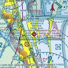
| Sectional chart |
|---|
|
| Airport distance calculator |
|---|
|
|
| Sunrise and sunset |
|---|
|
Times for 31-Jul-2026
| | Local
(UTC-4) | | Zulu
(UTC) |
|---|
| Morning civil twilight | | 06:20 | | 10:20 |
| Sunrise | | 06:45 | | 10:45 |
| Sunset | | 20:13 | | 00:13 |
| Evening civil twilight | | 20:39 | | 00:39 |
|
| Current date and time |
|---|
| Zulu (UTC) | 01-Aug-2026 00:04:19 |
|---|
| Local (UTC-4) | 31-Jul-2026 20:04:19 |
|---|
|
| METAR |
|---|
| KCOI | 312355Z AUTO 17005KT 10SM FEW037 29/27 A2997 RMK AO2
|
KCOF
9nm SE | 312355Z AUTO 23010KT 10SM FEW034 30/25 A2994 RMK AO2 RAE02DZB02E10 SLP143 P0000 60005 T02950248 10336 20262 58002 $
|
KXMR
11nm NE | 311855Z 13007KT 10SM BKN020 23/22 A2999 RMK A02A LTG DSNT NW-SE SLPNO WND DATA ESTMD ALSTG ESTMD RVRNO $
|
KTIX
12nm NW | 312347Z 00000KT 7SM SCT100 A2999
|
KMLB
15nm S | 312353Z 26008KT 10SM SCT023 28/24 A2998 RMK AO2 RAB10E21 SLP151 P0000 60000 T02780244 10339 20278 55004
|
KTTS
17nm N | 312355Z AUTO 15006KT 10SM BKN130 27/23 A2994 RMK AO2 SLP143 60039 T02690233 10329 20241 58003 $
|
|
| TAF |
|---|
KCOF
9nm SE | 312130Z 3121/0203 15010G15KT 9999 SCT040 QNH2995INS BECMG 3123/3124 19008KT 9999 SCT040 QNH2997INS BECMG 0103/0104 23008KT 9999 FEW050 QNH3001INS TX28/3121Z TN23/0110Z
|
KTIX
12nm NW | 311944Z 3120/0118 27006KT P6SM SCT012 BKN100 BKN250 FM312200 23007KT P6SM SCT050 SCT100 BKN250 FM010200 25004KT P6SM SCT040 SCT120 BKN250 FM011400 26007KT P6SM SCT035 BKN150 FM011700 22009KT P6SM VCTS SCT035CB BKN100 BKN250 AMD NOT SKED
|
KMLB
15nm S | 312251Z 3123/0118 14009KT P6SM VCTS SCT045CB BKN060 BKN200 TEMPO 3123/3124 VRB20G32KT 3SM TSRA SCT025 BKN030CB OVC040 FM010300 24005KT P6SM SCT040 SCT120 BKN250 FM011400 24007KT P6SM SCT035 BKN150 FM011730 19009KT P6SM VCTS SCT035CB BKN100 BKN250
|
|
| NOTAMs |
|---|
NOTAMs are issued by the DoD/FAA and will open in a separate window not controlled by AirNav.
|
|


