FAA INFORMATION EFFECTIVE 09 JULY 2026
Location
| FAA Identifier: | OXC |
| Lat/Long: | 41-28-41.8100N 073-08-06.6570W
41-28.696833N 073-08.110950W
41.4782806,-73.1351825
(estimated) |
| Elevation: | 730.1 ft. / 222.5 m (surveyed) |
| Variation: | 14W (1995) |
| From city: | 3 miles N of OXFORD, CT |
| Time zone: | UTC -4 (UTC -5 during Standard Time) |
| Zip code: | 06478 |
Airport Operations
| Airport use: | Open to the public |
| Activation date: | 12/1969 |
| Control tower: | yes |
| ARTCC: | NEW YORK CENTER |
| FSS: | BRIDGEPORT FLIGHT SERVICE STATION |
| NOTAMs facility: | OXC (NOTAM-D service available) |
| Attendance: | CONTINUOUS |
| Pattern altitude: | 973 FT AGL ACFT UP TO 12500 LBS; 1473 FT AGL ACFT OVR 12500 LBS. |
| Wind indicator: | lighted |
| Segmented circle: | yes |
| Lights: | ACTVT REIL RWY 36; PAPI RWYS 18 & 36; HIRL RWY 18/36 - CTAF. |
| Beacon: | white-green (lighted land airport)
Operates sunset to sunrise. |
| Landing fee: | no, LDG FEE FOR BUS/CORPORATE & REVENUE PRODUCING ACFT. |
| International operations: | customs landing rights airport |
Airport Communications
| CTAF: | 118.475 |
| UNICOM: | 122.95 |
| ATIS: | 132.975 |
| WX AWOS-3PT: | 132.975 (203-262-1190) |
| OXFORD GROUND: | 121.65 [0600-2100] |
| OXFORD TOWER: | 118.475 [0600-2100] |
| NEW YORK APPROACH: | 124.075 135.1 |
| NEW YORK DEPARTURE: | 124.075 135.1 |
| CLEARANCE DELIVERY: | 121.65 135.1 ;WHEN OXC TWR CLSD |
| DENNA STAR: | 124.075 |
| WX ASOS at MMK (14 nm E): | 134.925 (203-639-9405) |
| WX ASOS at DXR (17 nm W): | 127.75 (203-791-8227) |
| WX ASOS at HVN (17 nm SE): | PHONE 203-466-6205 |
| WX AWOS-3PT at 4B8 (18 nm NE): | 119.175 (860-351-5362) |
| WX ASOS at BDR (19 nm S): | 119.15 (203-381-9453) |
Nearby radio navigation aids
| VOR radial/distance | | VOR name | | Freq | | Var |
|---|
| BDRr011/19.1 | | BRIDGEPORT VOR/DME | | 108.80 | | 12W |
| MADr309/22.2 | | MADISON VOR/DME | | 110.40 | | 13W |
| CMKr071/23.3 | | CARMEL VOR/DME | | 116.60 | | 12W |
| PWLr142/27.2 | | PAWLING VOR/DME | | 114.30 | | 12W |
| HFDr263/28.1 | | HARTFORD VOR/DME | | 114.90 | | 13W |
| IGNr122/32.8 | | KINGSTON VOR/DME | | 117.60 | | 12W |
| CCCr348/36.3 | | CALVERTON VOR/DME | | 114.55 | | 13W |
Airport Services
| Fuel available: | 100LL JET-A |
| Parking: | hangars and tiedowns |
| Airframe service: | MAJOR |
| Powerplant service: | MAJOR |
| Bottled oxygen: | NONE |
| Bulk oxygen: | NONE |
Runway Information
Runway 18/36
| Dimensions: | 5801 x 100 ft. / 1768 x 30 m |
| Surface: | asphalt/grooved, in excellent condition |
| Weight bearing capacity: | | Single wheel: | 50.0 | | Double wheel: | 85.0 | | Double tandem: | 145.0 |
|
| Runway edge lights: | high intensity |
| RUNWAY 18 | | RUNWAY 36 |
| Latitude: | 41-29.168187N | | 41-28.225487N |
| Longitude: | 073-08.212807W | | 073-08.009133W |
| Elevation: | 730.1 ft. | | 680.1 ft. |
| Traffic pattern: | right | | left |
| Runway heading: | 185 magnetic, 171 true | | 005 magnetic, 351 true |
| Displaced threshold: | no | | 500 ft. |
| Declared distances: | TORA:5801 TODA:5801 ASDA:5801 LDA:5801 | | TORA:5801 TODA:5801 ASDA:5801 LDA:5301 |
| Markings: | precision, in good condition | | precision, in good condition |
| Visual slope indicator: | 4-light PAPI on left (3.00 degrees glide path)
LGTS BAFFLED BYD 6 DEGS L OF CNTRLN. | | 4-light PAPI on left (3.00 degrees glide path)
LGTS BAFFLED DUE TO TREES & PWR LN TWR BYD 5 DEGS R OF CNTRLN. |
| Runway end identifier lights: | no | | yes |
| Touchdown point: | yes, no lights | | yes, no lights |
| Instrument approach: | | | ILS/DME |
| Obstructions: | none | | 50 ft. pline, lighted, 1000 ft. from runway, 600 ft. right of centerline, 16:1 slope to clear
PWR LN RUNS DGNLY ACRS THE APCH. |
Airport Ownership and Management from official FAA records
| Ownership: | Publicly-owned |
| Owner: | CONNECTICUT AIRPORT AUTHORITY
SUITE 160, 334 ELLA GRASSO TURNPIKE
WINDSOR LOCKS, CT 06096
Phone 860-292-2000 |
| Manager: | WILLIE MCBRIDE
300 CHRISTIAN ST
OXFORD, CT 06478
Phone 203-264-8010 |
Additional Remarks
| E94 | SAWRS. |
| - | TGLS & PLAS PROHIBITED 2300-0700. |
| - | TWY B, SOUTH OF TWY G, REFLECTORS ONLY. |
| - | FOR CD WHEN TWR CLSD CTC NEW YORK APCH AT 516-683-2449. |
| - | STEEP DROP OFF AFT SAFETY AREA NORTH & SOUTH OF TWY A. |
| - | PLA RWY 36 NA WHEN RWY 18 ACTV. |
| - | ARPT CLSD TO ACR OPS. |
| - | PAEW VCNTY RWY 18/36 SAFETY ZONE SUMMER ONLY SR-SS (MOWING IN PROG DLY). |
| - | RWY 36 CALM WIND RWY. |
| - | 748 FT ELEC TRANSMISSION TWRS RUNNING NE TO SW 0.2 MI N OF MID MKR. |
| - | DEER & BIRDS ON & INVOF ARPT. |
Instrument Procedures
NOTE: All procedures below are presented as PDF files. If you need a reader for these files, you should download the free Adobe Reader.NOT FOR NAVIGATION. Please procure official charts for flight.
FAA instrument procedures published for use from 09 July 2026 at 0901Z to 06 August 2026 at 0900Z.
STARs - Standard Terminal Arrivals |
|---|
| DENNA ONE (RNAV) **NEW** | |
download (149KB) |
| SARDI ONE (RNAV) **NEW** | |
2 pages:
[1] [2] (474KB) |
IAPs - Instrument Approach Procedures |
|---|
| ILS OR LOC RWY 36 **CHANGED** | |
download (310KB) |
| RNAV (GPS) RWY 18 **CHANGED** | |
download (279KB) |
| RNAV (GPS) RWY 36 **CHANGED** | |
download (281KB) |
| NOTE: Special Alternate Minimums apply | |
download (153KB) |
| NOTE: Special Take-Off Minimums/Departure Procedures apply | |
download (178KB) |
Other nearby airports with instrument procedures:
KMMK - Meriden Markham Municipal Airport (14 nm E)
KDXR - Danbury Municipal Airport (17 nm W)
KHVN - Tweed/New Haven Airport (17 nm SE)
4B8 - Robertson Field Airport (18 nm NE)
KBDR - Bridgeport/Sikorsky Airport (19 nm S)
|
|

Road maps at:
MapQuest
Bing
Google
| Aerial photo |
|---|
WARNING: Photo may not be current or correct
 Photo courtesy of AirNav, LLC
Photo taken 18-Oct-2013
looking south.
Photo courtesy of AirNav, LLC
Photo taken 18-Oct-2013
looking south.
Do you have a better or more recent aerial photo of Waterbury-Oxford Airport that you would like to share? If so, please send us your photo.
|
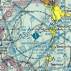
| Sectional chart |
|---|
|
 Download PDF
of official airport diagram from the FAA
| Airport distance calculator |
|---|
|
|
| Sunrise and sunset |
|---|
|
Times for 13-Jul-2026
| | Local
(UTC-4) | | Zulu
(UTC) |
|---|
| Morning civil twilight | | 04:58 | | 08:58 |
| Sunrise | | 05:31 | | 09:31 |
| Sunset | | 20:25 | | 00:25 |
| Evening civil twilight | | 20:58 | | 00:58 |
|
| Current date and time |
|---|
| Zulu (UTC) | 13-Jul-2026 18:48:34 |
|---|
| Local (UTC-4) | 13-Jul-2026 14:48:34 |
|---|
|
| METAR |
|---|
| KOXC | 131756Z 22013G16KT 10SM FEW035 26/16 A3020 RMK AO2 SLP236 T02610161 10267 20194 58012 $
|
KMMK
14nm E | 131753Z AUTO 20012G18KT 10SM CLR 28/17 A3016 RMK AO2 SLP213 T02780172 10289 20217 58014
|
KDXR
17nm SW | 131753Z 24013KT 10SM CLR 27/16 A3019 RMK AO2 SLP219 T02670156 10272 20200 58016
|
KHVN
18nm SE | 131753Z 21006KT 10SM BKN070 BKN090 27/18 A3018 RMK AO2 SLP220 T02670183 10267 20222 58013
|
KBDR
19nm S | 131752Z 24007KT 10SM BKN075 OVC090 27/16 A3018 RMK AO2 SLP219 T02720156 10278 20222 58015
|
|
| TAF |
|---|
KBDR
19nm S | 131727Z 1318/1418 21010KT P6SM BKN090 FM131900 20010G19KT P6SM BKN090 FM140000 21012KT P6SM SKC FM140400 22008KT P6SM SKC FM141300 24010KT P6SM SKC
|
|
| NOTAMs |
|---|
NOTAMs are issued by the DoD/FAA and will open in a separate window not controlled by AirNav.
|
|


