FAA INFORMATION EFFECTIVE 19 MARCH 2026
Location
| FAA Identifier: | RPD |
| Lat/Long: | 45-25-12.4000N 091-46-24.0000W
45-25.206667N 091-46.400000W
45.4201111,-91.7733333
(estimated) |
| Elevation: | 1109.2 ft. / 338.1 m (surveyed) |
| Variation: | 01E (1995) |
| From city: | 5 miles SW of RICE LAKE, WI |
| Time zone: | UTC -5 (UTC -6 during Standard Time) |
| Zip code: | 54822 |
Airport Operations
| Airport use: | Open to the public |
| Activation date: | 07/1995 |
| Control tower: | no |
| ARTCC: | MINNEAPOLIS CENTER |
| FSS: | GREEN BAY FLIGHT SERVICE STATION |
| NOTAMs facility: | RPD (NOTAM-D service available) |
| Attendance: | MON - FRI 0700-2000, ALL SAT 0800-1500 |
| Wind indicator: | lighted |
| Segmented circle: | yes |
| Lights: | HIRL RY 01/19 PRESET ON LOW INTST SS-SR; TO INCR INTST & ACTVT REIL RY 19, PAPI RYS 01 & 19 & MALSR RY 01 - CTAF. |
| Beacon: | white-green (lighted land airport)
Operates sunset to sunrise. |
Airport Communications
| CTAF/UNICOM: | 122.7 |
| WX AWOS-3: | 120.525 (715-458-4481) |
| WX AWOS-3P at Y23 (9 nm SE): | 119.05 (715-924-1836) |
| WX AWOS-3PT at UBE (10 nm NW): | 119.175 (715-822-3452) |
- APCH/DEP SVC PRVDD BY MINNEAPOLIS ARTCC ON FREQS 125.3/335.6 (EAU CLAIRE RCAG).
Nearby radio navigation aids
| VOR radial/distance | | VOR name | | Freq | | Var |
|---|
| EAUr334/33.7 | | EAU CLAIRE VORTAC | | 113.65 | | 04E |
| NDB name | | Hdg/Dist | | Freq | | Var | | ID |
|---|
| WICKR | | 010/6.2 | | 221 | | 01E | | RP | .-. .--. |
| BIG DOCTOR | | 135/34.6 | | 203 | | 01W | | BXR | -... -..- .-. |
Airport Services
| Fuel available: | 100LL JET-A+
100LL:24 HR SELF SVC FUEL AVBL WITH CREDIT CARD. |
| Parking: | hangars and tiedowns |
| Airframe service: | MAJOR |
| Powerplant service: | MAJOR |
| Bottled oxygen: | HIGH |
| Bulk oxygen: | HIGH |
Runway Information
Runway 1/19
| Dimensions: | 6700 x 100 ft. / 2042 x 30 m |
| Surface: | asphalt, in fair condition |
| Weight bearing capacity: | | Single wheel: | 85.0 | | Double wheel: | 110.0 |
|
| Runway edge lights: | high intensity |
| RUNWAY 1 | | RUNWAY 19 |
| Latitude: | 45-24.840577N | | 45-25.921385N |
| Longitude: | 091-46.539090W | | 091-46.230570W |
| Elevation: | 1095.0 ft. | | 1109.1 ft. |
| Traffic pattern: | right | | left |
| Runway heading: | 010 magnetic, 011 true | | 190 magnetic, 191 true |
| Displaced threshold: | 200 ft. | | no |
| Markings: | precision, in fair condition | | precision, in fair condition |
| Visual slope indicator: | 2-light PAPI on left (3.00 degrees glide path) | | 4-light PAPI on left (3.00 degrees glide path) |
| Approach lights: | MALSR: 1,400 foot medium intensity approach lighting system with runway alignment indicator lights | | |
| Runway end identifier lights: | no | | yes |
| Touchdown point: | yes, no lights | | yes, no lights |
| Instrument approach: | ILS | | |
| Obstructions: | 68 ft. trees, 3300 ft. from runway, 45:1 slope to clear
APCH RATIO 50:1 TO DSPLCD THR. | | none |
Runway 13/31
| Dimensions: | 3500 x 75 ft. / 1067 x 23 m |
| Surface: | asphalt, in fair condition |
| Runway edge lights: | medium intensity |
| RUNWAY 13 | | RUNWAY 31 |
| Latitude: | 45-25.056097N | | 45-24.685537N |
| Longitude: | 091-46.739705W | | 091-46.113782W |
| Elevation: | 1092.1 ft. | | 1099.5 ft. |
| Traffic pattern: | left | | right |
| Runway heading: | 130 magnetic, 131 true | | 310 magnetic, 311 true |
| Markings: | nonprecision, in fair condition | | nonprecision, in fair condition |
| Visual slope indicator: | 2-light PAPI on left (3.75 degrees glide path) | | 2-light PAPI on left (3.50 degrees glide path) |
| Runway end identifier lights: | yes | | yes |
| Touchdown point: | yes, no lights | | yes, no lights |
| Obstructions: | 22 ft. trees, 345 ft. from runway, 130 ft. right of centerline, 6:1 slope to clear | | 72 ft. trees, 1320 ft. from runway, 210 ft. left of centerline, 15:1 slope to clear |
Airport Ownership and Management from official FAA records
| Ownership: | Publicly-owned |
| Owner: | CITY OF RICE LAKE
CITY HALL
RICE LAKE, WI 54868
Phone 715-234-7800 |
| Manager: | CHRISTOPHER BREKKEN
1872 14 1/2 AVE
CAMERON, WI 54822
Phone (715) 458-4400 |
Additional Remarks
| - | FOR CD IF UNA TO CTC ON FSS FREQ, CTC MINNEAPOLIS ARTCC AT 651-463-5588. |
Instrument Procedures
NOTE: All procedures below are presented as PDF files. If you need a reader for these files, you should download the free Adobe Reader.NOT FOR NAVIGATION. Please procure official charts for flight.
FAA instrument procedures published for use from 19 March 2026 at 0901Z to 16 April 2026 at 0900Z.
IAPs - Instrument Approach Procedures |
|---|
| ILS OR LOC RWY 01 | |
download (239KB) |
| RNAV (GPS) RWY 01 | |
download (277KB) |
| RNAV (GPS) RWY 19 | |
download (224KB) |
| NOTE: Special Alternate Minimums apply | |
download (139KB) |
| NOTE: Special Take-Off Minimums/Departure Procedures apply | |
download (483KB) |
Other nearby airports with instrument procedures:
Y23 - Chetek Municipal/Southworth Airport (9 nm SE)
KUBE - Cumberland Municipal Airport (10 nm NW)
KSSQ - Shell Lake Municipal Airport (20 nm N)
3T3 - Boyceville Municipal Airport (25 nm SW)
KAHH - Amery Municipal Airport (27 nm W)
|
|

Road maps at:
MapQuest
Bing
Google
| Aerial photo |
|---|
WARNING: Photo may not be current or correct
 Photo by Daniel L Johnson
Photo taken 24-May-2017
looking north.
Photo by Daniel L Johnson
Photo taken 24-May-2017
looking north.
Do you have a better or more recent aerial photo of Rice Lake Regional Airport - Carl's Field that you would like to share? If so, please send us your photo.
|
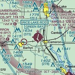
| Sectional chart |
|---|
|
| Airport distance calculator |
|---|
|
|
| Sunrise and sunset |
|---|
|
Times for 13-Apr-2026
| | Local
(UTC-5) | | Zulu
(UTC) |
|---|
| Morning civil twilight | | 05:56 | | 10:56 |
| Sunrise | | 06:26 | | 11:26 |
| Sunset | | 19:49 | | 00:49 |
| Evening civil twilight | | 20:20 | | 01:20 |
|
| Current date and time |
|---|
| Zulu (UTC) | 13-Apr-2026 12:20:40 |
|---|
| Local (UTC-5) | 13-Apr-2026 07:20:40 |
|---|
|
| METAR |
|---|
KRPD
4nm NE | 131155Z AUTO 00000KT 10SM SCT011 BKN016 BKN080 08/07 A2981 RMK AO2 70035 T00750067 10152 20067
|
KY23
9nm SE | 131155Z AUTO 00000KT 1/4SM FG OVC011 09/09 A2979 RMK AO2 VIS 1/4V5 70009 T00900085 10165 20083
|
KUBE
10nm NW | 131155Z AUTO 00000KT M1/4SM FG BKN003 OVC090 10/10 A2979 RMK AO2
|
|
| TAF |
|---|
KEAU
36nm S | 131146Z 1312/1412 VRB04KT P6SM FEW080 TEMPO 1312/1314 1/4SM FG VV003 FM131500 10005KT P6SM SCT150 FM132300 05008KT 4SM -SHRA BR VCTS BKN020CB OVC050 TEMPO 1323/1403 1 1/2SM +TSRA BR OVC012CB FM140400 05008KT 4SM BR OVC007 FM140800 VRB03KT 1/4SM FG VV002
|
KRNH
36nm SW | 131131Z 1312/1412 02005KT P6SM SKC FM131400 06006KT P6SM SCT120 TEMPO 1322/1402 2SM TSRA BR BKN012 OVC022CB FM140400 04006KT 4SM BR OVC007 FM140800 VRB03KT 3/4SM BR VV004
|
KHYR
38nm N | 131120Z 1312/1412 VRB03KT P6SM BKN008 FM131600 VRB04KT P6SM BKN010 FM132300 04007KT P6SM VCSH BKN040 FM140100 03007G14KT P6SM -SHRA OVC040 PROB30 1401/1406 3SM -TSRAGR BKN050CB FM140600 06007KT P6SM BKN007 FM140800 05005KT 2SM BR BKN005
|
|
| NOTAMs |
|---|
NOTAMs are issued by the DoD/FAA and will open in a separate window not controlled by AirNav.
|
|


