FAA INFORMATION EFFECTIVE 20 MARCH 2025
Location
| FAA Identifier: | EWR |
| Lat/Long: | 40-41-32.9274N 074-10-07.2724W
40-41.548790N 074-10.121207W
40.6924798,-74.1686868
(estimated) |
| Elevation: | 17.4 ft. / 5.3 m (surveyed) |
| Variation: | 13W (1985) |
| From city: | 3 miles S of NEWARK, NJ |
| Time zone: | UTC -4 (UTC -5 during Standard Time) |
| Zip code: | 07114 |
Airport Operations
| Airport use: | Open to the public |
| Activation date: | 11/1939 |
| Control tower: | yes |
| ARTCC: | NEW YORK CENTER |
| FSS: | NEW YORK FLIGHT SERVICE STATION |
| NOTAMs facility: | EWR (NOTAM-D service available) |
| Attendance: | CONTINUOUS |
| Wind indicator: | lighted |
| Segmented circle: | no |
| Beacon: | white-green (lighted land airport)
Operates sunset to sunrise. |
| Landing fee: | yes, GA/INTRNT LDG FEES PAYABLE BY MAJOR CREDIT CARDS ONLY. |
| Fire and rescue: | ARFF index E |
| International operations: | customs landing rights airport |
Airport Communications
| UNICOM: | 122.95 |
| WX ASOS: | PHONE 973-621-2892 |
| NEWARK GROUND: | 121.8 126.15 |
| NEWARK TOWER: | 118.3 257.6 ;WITHIN 6.5 NM ARE TWR CONTROL 134.05 |
| NEWARK APPROACH: | 127.6 ;270-330 128.55 ;090-240 132.7 ;331-089 132.8 ;241-269 |
| NEWARK DEPARTURE: | 119.2 |
| CLEARANCE DELIVERY: | 118.85 |
| PRE-TAXI CLEARANCE: | 118.85 |
| BRAND STAR: | 124.55 119.75 128.55 |
| CLASS B: | 127.85 ;WITHIN 6.5 NM ARE TWR CONTRO 257.6 ;WITHIN 6.5 NM ARE TWR CONTROL |
| D-ATIS: | 115.7 ;ARR 134.825 |
| EMERG: | 121.5 243.0 |
| IC: | 128.55 ;090-240 |
| PHLBO STAR: | 128.55 |
| RAMP CTL: | 132.45 |
| SHAFF STAR: | 121.15 |
| WX AWOS-3 at LDJ (6 nm SW): | 124.025 (908-862-7383) |
| WX AWOS-3PT at JRB (7 nm E): | 128.175 (212-425-1534) |
| WX ASOS at TEB (11 nm NE): | PHONE 201-426-9519 |
| WX ASOS at CDW (12 nm NW): | 135.5 (973-575-4417) |
| WX AWOS-3 at MMU (13 nm NW): | PHONE 973-290-0135 |
| WX ASOS at LGA (14 nm E): | PHONE 718-672-6317 |
| WX ASOS at JFK (18 nm E): | PHONE 718-656-0956 |
- ASDE-X IN USE. OPERATE TRANSPONDERS WITH ALTITUDE REPORTING MODE AND ADS-B (IF EQUIPPED) ENABLED ON ALL AIRPORT SURFACES.
- (CLASS_B_AIRSPACE) EXPECT TO LEAVE AND RE-ENTER CLASS B ASP DURG MOD TO HVY ARR PDS.
Nearby radio navigation aids
| VOR radial/distance | | VOR name | | Freq | | Var |
|---|
| TEBr218/10.5 | | TETERBORO VOR/DME | | 108.40 | | 11W |
| CRIr302/13.4 | | CANARSIE VOR/DME | | 112.30 | | 11W |
| LGAr260/14.7 | | LA GUARDIA VOR/DME | | 113.10 | | 12W |
| JFKr293/18.4 | | KENNEDY VOR/DME | | 115.90 | | 12W |
| COLr010/22.9 | | COLTS NECK VOR/DME | | 115.40 | | 11W |
| SBJr086/26.9 | | SOLBERG VOR/DME | | 112.90 | | 10W |
| SAXr154/28.1 | | SPARTA VORTAC | | 115.70 | | 11W |
| BWZr113/30.4 | | BROADWAY VOR/DME | | 114.20 | | 11W |
| RBVr037/33.0 | | ROBBINSVILLE VORTAC | | 113.80 | | 10W |
| STWr131/36.6 | | STILLWATER VOR/DME | | 109.60 | | 11W |
| DPKr273/39.8 | | DEER PARK VOR/DME | | 117.70 | | 12W |
| NDB name | | Hdg/Dist | | Freq | | Var | | ID |
|---|
| LAKEHURST | | 022/39.6 | | 396 | | 11W | | NEL | -. . .-.. |
Airport Services
| Fuel available: | 100LL JET-A |
| Parking: | hangars |
| Airframe service: | MAJOR |
| Powerplant service: | MAJOR |
| Bottled oxygen: | HIGH |
Runway Information
Runway 4L/22R
| Dimensions: | 11000 x 150 ft. / 3353 x 46 m |
| Surface: | asphalt/concrete/grooved, in excellent condition
S 1779 FT CONC, N 1228 FT CONC, CENTER 7993 FT ASPH. |
| Weight bearing capacity: | | Double wheel: | 210.0 | | Double tandem: | 520.0 | | Dual double tandem: | 1000.0 |
|
| Runway edge lights: | high intensity |
| RUNWAY 4L | | RUNWAY 22R |
| Latitude: | 40-40.522860N | | 40-42.153485N |
| Longitude: | 074-10.767015W | | 074-09.730425W |
| Elevation: | 10.1 ft. | | 8.9 ft. |
| Traffic pattern: | left | | left |
| Runway heading: | 039 magnetic, 026 true | | 219 magnetic, 206 true |
| Displaced threshold: | 2540 ft. | | 1440 ft. |
| Declared distances: | TORA:11000 TODA:11000 ASDA:11000 LDA:8460 | | TORA:11000 TODA:11000 ASDA:11000 LDA:9560 |
| Markings: | precision, in good condition | | precision, in good condition |
| Visual slope indicator: | 4-light PAPI on left (3.10 degrees glide path) | | 4-light PAPI on left (3.10 degrees glide path) |
| RVR equipment: | touchdown, midfield, rollout | | touchdown, midfield, rollout |
| Approach lights: | MALSR: 1,400 foot medium intensity approach lighting system with runway alignment indicator lights | | MALSR: 1,400 foot medium intensity approach lighting system with runway alignment indicator lights |
| Runway end identifier lights: | | | yes |
| Centerline lights: | yes | | yes |
| Touchdown point: | yes, lighted | | yes, lighted |
| Instrument approach: | ILS/DME | | ILS/DME |
| Obstructions: | 65 ft. tree, 1926 ft. from runway, 572 ft. left of centerline, 26:1 slope to clear
APCH RATIO 50:1 TO DTHR. | | 28 ft. pole, 295 ft. from runway, 477 ft. right of centerline, 3:1 slope to clear
APCH RATIO 50:1 TO DTHR. |
Runway 4R/22L
| Dimensions: | 10000 x 150 ft. / 3048 x 46 m |
| Surface: | asphalt/grooved, in excellent condition |
| Weight bearing capacity: | | Double wheel: | 210.0 | | Double tandem: | 520.0 | | Dual double tandem: | 1000.0 |
|
| Runway edge lights: | high intensity |
| RUNWAY 4R | | RUNWAY 22L |
| Latitude: | 40-40.654973N | | 40-42.137397N |
| Longitude: | 074-10.454725W | | 074-09.512180W |
| Elevation: | 11.1 ft. | | 9.4 ft. |
| Traffic pattern: | left | | left |
| Runway heading: | 039 magnetic, 026 true | | 219 magnetic, 206 true |
| Displaced threshold: | 1190 ft. | | 1793 ft. |
| Declared distances: | TORA:10000 TODA:10000 ASDA:10000 LDA:8810 | | TORA:10000 TODA:10000 ASDA:10000 LDA:8207 |
| Markings: | precision, in good condition | | precision, in good condition |
| Visual slope indicator: | 4-light PAPI on left (2.95 degrees glide path) | | 4-light PAPI on left (3.00 degrees glide path) |
| RVR equipment: | touchdown, midfield, rollout | | touchdown, midfield, rollout |
| Approach lights: | ALSF2: standard 2,400 foot high intensity approach lighting system with centerline sequenced flashers (category II or III) | | ALSF2: standard 2,400 foot high intensity approach lighting system with centerline sequenced flashers (category II or III) |
| Centerline lights: | yes | | yes |
| Touchdown point: | yes, lighted | | yes, lighted |
| Instrument approach: | ILS/DME | | ILS/DME |
| Obstructions: | 28 ft. pole, lighted, 953 ft. from runway, 600 ft. right of centerline, 26:1 slope to clear
+5 FT POLE 25 FT FROM RWY END 175 FT RIGHT. | | 30 ft. ant, 540 ft. from runway, 534 ft. right of centerline, 11:1 slope to clear
APCH RATIO 50:1 TO DTHR. |
Runway 11/29
| Dimensions: | 6726 x 150 ft. / 2050 x 46 m |
| Surface: | asphalt/grooved, in excellent condition |
| Weight bearing capacity: | | Double wheel: | 210.0 | | Double tandem: | 520.0 | | Dual double tandem: | 1000.0 |
|
| Runway edge lights: | high intensity |
| RUNWAY 11 | | RUNWAY 29 |
| Latitude: | 40-42.168258N | | 40-42.071968N |
| Longitude: | 074-10.842445W | | 074-09.392525W |
| Elevation: | 17.4 ft. | | 9.7 ft. |
| Traffic pattern: | left | | left |
| Runway heading: | 108 magnetic, 095 true | | 288 magnetic, 275 true |
| Displaced threshold: | no | | 224 ft. |
| Declared distances: | TORA:6726 TODA:6726 ASDA:6726 LDA:6726 | | TORA:6726 TODA:6726 ASDA:6726 LDA:6502 |
| Markings: | precision, in good condition | | nonprecision, in good condition |
| Visual slope indicator: | 4-light PAPI on right (3.00 degrees glide path) | | 4-light PAPI on right (3.00 degrees glide path)
PAPI UNUSBL 4 DEGS LEFT OF CNTRLN. |
| RVR equipment: | touchdown, midfield, rollout | | |
| Runway end identifier lights: | yes | | yes |
| Centerline lights: | yes | | yes |
| Touchdown point: | yes, lighted | | yes, lighted |
| Instrument approach: | ILS/DME | | |
| Obstructions: | 158 ft. bldg, lighted, 6197 ft. from runway, 1437 ft. left of centerline, 37:1 slope to clear | | 54 ft. sign, lighted, 818 ft. from runway, 514 ft. right of centerline, 11:1 slope to clear
APCH RATIO 13:1 TO DTHR. |
Helipad H1
| Dimensions: | 54 x 54 ft. / 16 x 16 m |
| Surface: | asphalt, in excellent condition |
| Runway edge lights: | PERI |
| Operational restrictions: | BREWSTER PAD; H1 LCTD ON TWY Z5. OPS LIMITS ARE D65. |
| Latitude: | 40-42.264167N | | |
| Longitude: | 074-10.083333W | | |
| Elevation: | 8.0 ft. | | |
| Traffic pattern: | left | | left |
| Markings: | nonprecision, in good condition | | |
Airport Ownership and Management from official FAA records
| Ownership: | Publicly-owned |
| Owner: | PORT AUTHORITY OF NY & NJ
4 WTC 150 GREENWICH ST, 18TH FLOOR
NEW YORK, NY 10006
Phone 212-435-3720
PROPERTY OWNED BY CITY OF NEWARK. |
| Manager: | AIDAN O'DONNELL
BUILDING #1- CONRAD ROAD
NEWARK, NJ 07114
Phone 973-961-6161 |
Additional Remarks
| A39-11/29 | PCR VALUE: 950/F/C/X/T |
| A39-04R/22L | PCR VALUE: 1020/F/C/X/T |
| A39-04L/22R | PCR VALUE: 960/F/C/X/T |
| E60-11 | ENGINEERED MATERIALS ARRESTING SYSTEM (EMAS) 182 FT IN LENGTH BY 170 FT IN WIDTH LCTD AT THE DER. |
| E60-29 | ENGINEERED MATERIALS ARRESTING SYSTEM (EMAS) 437 FT IN LENGTH BY 178 FT IN WIDTH LCTD AT THE DER. |
| - | RWY 4R & 4L DEP USE UPPER ANT FOR ATC COM. |
| - | HIGH VOLUME OF LOW LEVEL HEL TFC ARR AND DEP HELO KEARNY HELI (65NJ) LCTD 3.5 MILES NE OF ARPT. |
| - | RWY STATUS LIGHTS IN OPR. |
| - | CPDLC DEPARTURE CLEARANCE SERVICE AVAILABLE. |
| - | ADG IV ACFT RSTR FM PSG TWY Z3 ON Z. |
| - | TWY Z EAST OF TWY U ACFT SPEED RSTR OF 17 KTS/20 MPH MAX FOR ALL ACFT WITH WINGSPANS IN EXCESS OF 171 FT. |
| - | FLOCKS OF BIRDS ON & INVOF ARPT. |
| - | ALL TWYS SURROUNDING "BALLPARK" PRKG AREA (TWY Y BTN TWY S AND TWY U, TWY S BTN TWY Y AND TWY K, TWAY K BTN TWY S AND TWY B, TWY B BTN TWY K AND TWY U, AND TWY U BTN TWY B AND TWY Y) ACFT SPEED RSTR OF 17KTS/20MPH FOR ALL AFCT WITH WINGSPANS IN EXCESS OF 171 FT. |
| - | TWY EE BTN RWY 4R-22L AND RWY 11-29 CLSD TO AFCT WITH WINGSPANS IN EXCESS OF 171 FT. |
| - | TWY Y BTN RM AND TWY U, SPEED RESTRICTION OF 17KT (20MPH). |
| - | TWY Z5 CLSD TO ACFT WITH WINGSPANS IN EXCESS OF 118 FT. |
| - | TWY A BTN TWY AA AND RAMP CLSD TO ACFT WITH WINGSPANS IN EXCESS OF 171 FT. |
| - | TWY A11 W OF TWY A ACFT SPD RSTR OF 17 KTS/20 MPH MAX FOR ALL ACFT WITH WINGSPANS IN EXCESS OF 171 FT. |
| - | ACFT WITH WINGSPANS IN EXCESS OF 118 FEET PROHIBITED FROM TURNING S ON TWY R FROM TWY B1. |
| - | DURNG ATC ZERO EVENTS; ARPT OPS WILL MNT 118.3 AND PROVIDE EMERG NOTIFICATIONS TO ARFF. |
| - | NOISE RSTR CALL 212-435-3784 DRG NML BUS HRS. |
| - | WHEN RWY 04R/L IN USE, ACFT PRKG AT TRML A CAN EXP TO ENTER RAMP VIA TWY A8, UNLESS ADZD BY ATC. |
| - | WHEN RWY 22L/R IN USE, ACFT PRKG AT TRML A CAN EXP TO ENTER RAMP VIA TWY A10 OR A12, UNLESS ADZD BY ATC. |
| - | PARA-SAIL & BANNER TOWING OPS 1000 FT & BLO IN UPPER & LOWER NY BAYS INCLUDING ROCKAWAY INLET INDEF. |
| - | TWY Z BTN TWY Z2 & Z4 CLSD TO ACFT WITH WINGSPANS IN EXCESS OF 171 FT. |
Instrument Procedures
NOTE: All procedures below are presented as PDF files. If you need a reader for these files, you should download the free Adobe Reader.NOT FOR NAVIGATION. Please procure official charts for flight.
FAA instrument procedures published for use from 20 March 2025 at 0901Z to 17 April 2025 at 0900z.
STARs - Standard Terminal Arrivals |
|---|
| BRAND ONE (RNAV) | |
download (231KB) |
| FLOSI FOUR (RNAV) | |
download (253KB) |
| PENNS TWO | |
download (160KB) |
| PHLBO FOUR (RNAV) | |
2 pages:
[1] [2] (386KB) |
| SHAFF SEVEN | |
2 pages:
[1] [2] (411KB) |
| WILLIAMSPORT THREE | |
download (179KB) |
IAPs - Instrument Approach Procedures |
|---|
| ILS OR LOC RWY 04R | |
download (350KB) |
| ILS OR LOC RWY 11 | |
download (318KB) |
| ILS OR LOC RWY 22L | |
download (358KB) |
| ILS OR LOC RWY 22R | |
download (346KB) |
| ILS Z OR LOC Z RWY 04L | |
download (333KB) |
| ILS RWY 22L (SA CAT I) | |
download (318KB) |
| ILS Z RWY 04L (SA CAT I - II) | |
download (314KB) |
| ILS RWY 04R (CAT II - III) | |
download (292KB) |
| ILS RWY 22L (CAT II - III) | |
download (328KB) |
| GLS RWY 04L | |
download (259KB) |
| GLS RWY 04R | |
download (259KB) |
| GLS RWY 11 | |
download (242KB) |
| GLS RWY 22L | |
download (239KB) |
| GLS RWY 22R | |
download (237KB) |
| RNAV (RNP) Y RWY 22L | |
download (236KB) |
| RNAV (RNP) Y RWY 29 | |
download (262KB) |
| RNAV (RNP) Z RWY 04R | |
download (284KB) |
| RNAV (RNP) Z RWY 29 | |
download (291KB) |
| RNAV (GPS) RWY 04L | |
download (304KB) |
| RNAV (GPS) RWY 11 | |
download (269KB) |
| RNAV (GPS) RWY 22R | |
download (283KB) |
| RNAV (GPS) T RWY 29 **NEW** | |
download (267KB) |
| RNAV (GPS) W RWY 29 **CHANGED** | |
download (275KB) |
| RNAV (GPS) X RWY 29 | |
download (279KB) |
| RNAV (GPS) Y RWY 04R | |
download (288KB) |
| RNAV (GPS) Z RWY 22L | |
download (281KB) |
| COPTER ILS Y OR LOC Y RWY 04L | |
download (269KB) |
| COPTER ILS/DME RWY 22L | |
download (260KB) |
| BRIDGE VISUAL RWY 29 | |
download (196KB) |
| STADIUM VISUAL RWY 29 | |
download (285KB) |
| NOTE: Special Alternate Minimums apply **CHANGED** | |
download (163KB) |
Departure Procedures |
|---|
| DEVIL ONE | |
2 pages:
[1] [2] (374KB) |
| LIBERTY FIVE | |
2 pages:
[1] [2] (460KB) |
| NEWARK FIVE | |
2 pages:
[1] [2] (461KB) |
| NEWARK FIVE, CONT.2 | |
download (211KB) |
| PORTT FOUR (RNAV) | |
2 pages:
[1] [2] (331KB) |
| NOTE: Special Take-Off Minimums/Departure Procedures apply | |
download (452KB) |
Other nearby airports with instrument procedures:
KLDJ - Linden Airport (6 nm SW)
KJRB - Downtown Manhattan/Wall Street Heliport (7 nm E)
KJRA - West 30th St Heliport (8 nm NE)
6N5 - East 34th Street Heliport (9 nm E)
KTEB - Teterboro Airport (11 nm NE)
KCDW - Essex County Airport (12 nm NW)
KMMU - Morristown Municipal Airport (13 nm NW)
KLGA - LaGuardia Airport (14 nm E)
N07 - Lincoln Park Airport (17 nm NW)
KJFK - John F Kennedy International Airport (18 nm E)
|
|

Road maps at:
MapQuest
Bing
Google
| Aerial photo |
|---|
WARNING: Photo may not be current or correct
 Photo by David Newcomer
Photo taken 24-Feb-2020
from 8,000' altitude looking northwest.
Photo by David Newcomer
Photo taken 24-Feb-2020
from 8,000' altitude looking northwest.
Do you have a better or more recent aerial photo of Newark Liberty International Airport that you would like to share? If so, please send us your photo.
|
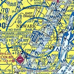
| Sectional chart |
|---|
|
 Download PDF
of official airport diagram from the FAA
| Airport distance calculator |
|---|
|
|
| Sunrise and sunset |
|---|
|
Times for 16-Apr-2025
| | Local
(UTC-4) | | Zulu
(UTC) |
|---|
| Morning civil twilight | | 05:49 | | 09:49 |
| Sunrise | | 06:17 | | 10:17 |
| Sunset | | 19:36 | | 23:36 |
| Evening civil twilight | | 20:04 | | 00:04 |
|
| Current date and time |
|---|
| Zulu (UTC) | 17-Apr-2025 01:27:52 |
|---|
| Local (UTC-4) | 16-Apr-2025 21:27:52 |
|---|
|
| METAR |
|---|
| KEWR | 170051Z 32010G18KT 10SM BKN055 09/M03 A2991 RMK AO2 PK WND 30032/0046 SLP128 T00941033
|
KLDJ
6nm SW | 170115Z AUTO 31011G23KT 10SM OVC050 09/M03 A2993 RMK AO2 T00861031
|
KJRB
7nm E | 170056Z AUTO 00000KT 10SM BKN050 09/M02 A2992 RMK AO2 PK WND 29031/0010 SLP133 T00891017 PNO $
|
KNYC
11nm NE | 170051Z AUTO 30010G17KT 260V340 10SM OVC050 08/M04 A2993 RMK AO2 SLP126 T00831039
|
KTEB
12nm NE | 170051Z 30015G23KT 10SM OVC050 08/M03 A2991 RMK AO2 PK WND 28029/0028 SLP127 T00781028
|
KMMU
13nm NW | 170050Z 34005G21KT 10SM OVC050 08/M02 A2993
|
KCDW
13nm NW | 170053Z 31012G20KT 10SM OVC049 08/M02 A2992 RMK AO2 SLP138 T00831022
|
KLGA
14nm NE | 170051Z 31023G30KT 10SM BKN050 08/M03 A2990 RMK AO2 PK WND 31035/0025 SLP125 T00831033
|
KJFK
19nm E | 170051Z 31018G26KT 10SM BKN055 09/M02 A2991 RMK AO2 PK WND 32029/0030 SLP129 T00941022 $
|
|
| TAF |
|---|
| KEWR | 162223Z 1622/1724 28014G28KT P6SM BKN060 FM170000 29014G22KT P6SM FEW040 FM170600 29010G15KT P6SM FEW040 FM171500 30014G22KT P6SM SKC
|
KTEB
12nm NE | 161931Z 1620/1724 29016G26KT P6SM BKN050 FM170100 30010G21KT P6SM FEW040 FM170600 29009G15KT P6SM FEW040 FM171300 31013G21KT P6SM SKC
|
KLGA
14nm NE | 161931Z 1620/1724 29020G30KT P6SM BKN050 FM170000 30015G22KT P6SM FEW040 FM170600 30011G17KT P6SM FEW040 FM171500 31015G24KT P6SM SKC
|
KJFK
19nm E | 162222Z 1622/1724 31018G26KT P6SM BKN060 FM170000 30016G24KT P6SM FEW040 FM170600 30012G18KT P6SM FEW040 FM171500 31015G25KT P6SM SKC
|
|
| NOTAMs |
|---|
NOTAMs are issued by the DoD/FAA and will open in a separate window not controlled by AirNav.
|
|


