FAA INFORMATION EFFECTIVE 23 JANUARY 2025
Location
| FAA Identifier: | POE |
| Lat/Long: | 31-02-41.2165N 093-11-29.9115W
31-02.686942N 093-11.498525W
31.0447824,-93.1916421
(estimated) |
| Elevation: | 330 ft. / 100.6 m (surveyed) |
| Variation: | 02E (2010) |
| From city: | 7 miles SE of FORT JOHNSON, LA |
| Time zone: | UTC -6 (UTC -5 during Daylight Saving Time) |
| Zip code: | 71459 |
Airport Operations
| Airport use: | Private use. Permission required prior to landing |
| Control tower: | yes |
| ARTCC: | HOUSTON CENTER |
| FSS: | DE RIDDER FLIGHT SERVICE STATION |
| NOTAMs facility: | POE (NOTAM-D service available) |
| Attendance: | MON-FRI 1300-0500Z++, ALL SAT-SUN 1300-2100Z++
CLSD FEDERAL HOLS. |
| Wind indicator: | yes |
| Segmented circle: | no |
| Lights: | SS-SR |
| Beacon: | white-green (lighted land airport)
Operates sunset to sunrise. |
Airport Communications
| CTAF: | 119.0 |
| ATIS: | 134.85 282.2 |
| WX ASOS: | 134.85 (337-531-4100) |
| POLK GROUND: | 121.8 239.25 [1300-0500Z++ DLY] |
| POLK TOWER: | 119.0 257.75 41.5FM [1300-0500Z++ DLY] |
| POLK APPROACH: | 123.7 261.3 |
| POLK DEPARTURE: | 123.7 261.3 |
| FLT FLW: | 123.7 254.8 |
| MEDEVAC: | 42.5 |
| OPS: | 118.575 ;POE OPS 374.2 ;POE OPS |
| PMSV METRO: | 134.1 249.75 |
| RANGE CTL: | 143.2 373.3 40.95 |
| WX AWOS-3PT at DRI (15 nm SW): | 118.225 (337-463-8278) |
- ALL FLTS CTC POLK APCH 30 NM OUT
- ATCT-ARAC.
Nearby radio navigation aids
| VOR radial/distance | | VOR name | | Freq | | Var |
|---|
| FXUr159/(4.2) | | POLK VOR | | 108.40 | | 02E |
| AEXr247/37.7 | | ALEXANDRIA VORTAC | | 116.10 | | 03E |
| NDB name | | Hdg/Dist | | Freq | | Var | | ID |
|---|
| DE RIDDER | | 019/19.0 | | 385 | | 04E | | DXB | -.. -..- -... |
| NATCHITOCHES | | 185/37.2 | | 407 | | 04E | | OOC | --- --- -.-. |
Airport Services
| Airframe service: | NONE |
| Powerplant service: | NONE |
| Bottled oxygen: | NONE |
| Bulk oxygen: | NONE |
Runway Information
Runway 16/34
| Dimensions: | 4107 x 100 ft. / 1252 x 30 m |
| Surface: | asphalt |
| Weight bearing capacity: | |
| Runway edge lights: | high intensity |
| RUNWAY 16 | | RUNWAY 34 |
| Latitude: | 31-03.006232N | | 31-02.367688N |
| Longitude: | 093-11.630383W | | 093-11.366708W |
| Elevation: | 329.4 ft. | | 277.5 ft. |
| Traffic pattern: | left | | left |
| Runway heading: | 158 magnetic, 160 true | | 338 magnetic, 340 true |
| Displaced threshold: | 194 ft. | | no |
| Markings: | nonprecision, in good condition | | nonprecision, in good condition |
| Visual slope indicator: | 4-light PAPI on right (3.00 degrees glide path) | | 4-light PAPI on left (3.00 degrees glide path) |
| Approach lights: | | | ALSF1: standard 2,400 foot high intensity approach lighting system with centerline sequenced flashers (category I) |
| Runway end identifier lights: | yes | | yes |
| Touchdown point: | yes, no lights | | yes, no lights |
| Obstructions: | trees, 1500 ft. from runway, 26:1 slope to clear
4' SIDE FENCES 200' FM CNTRLN BOTH RWY ENDS. | | trees, 2500 ft. from runway, 29:1 slope to clear |
Airport Ownership and Management from official FAA records
| Ownership: | U.S. Army |
| Owner: | U.S.ARMY
AVIATION DIVISION DPTM
FT FOLK, LA 71459-5000
Phone 318-535-2314 |
| Manager: | AIRFIELD COMMANDER
AVIATION DIVISION DITM
FT POLK, LA 71459-5000
Phone 337-531-6195 |
Additional Remarks
| - | TFC PAT: ALL PAT W OF FLD. F/W TFC 1800' R/W TFC 1000'. |
| - | SEE FLIP AP/1 SUPPLEMENTARY ARPT INFO. |
| - | PRIOR PERMISSION REQUIRED (PPR)-FIXED WING AIRCRAFT ONLY MUST OBTAIN A PPR NUMBER AT DSN 863-4831, C337-531-4831. |
| - | AIRFIELD OPERATIONS CONTACT NUMBER IS DSN 863-4831, C337-531-4831. UNITS UTILIZING RANGE FACILITY/RESTRICTED AREAS OR STAGING OPERATIONS AT POLK AAF (KPOE) MUST CONTACT AT&A OFFICER AT DSN 863-1151, C337-531-1151 FOR BRIEFING. |
| - | MISC: SFC VIS OBSN BLOCKED NW-SE BY HILLS, BLDG AND TREES. |
| - | AFLD MGMT OPR 1300-1500Z++ MON-FRI, CLSD HOL. |
| - | C130 PRKG LTD TO 2 ACFT. C130 MAY LND ONLY WHEN PRKG IS AVBL |
| - | WHEN ATCT CLSD, FOR CD CTC POLK APP 123.7, 261.3. |
| - | MISC- WX SVC AVBL 1400-0600++ DLY AND 24/7 DLY DURING JRTC ROTATIONS WHEN SPT'D BY 1-5 AVN, DSN 863-4100, C337-531-4100. WX SENSOR AUTOMATED 24/7. HOURS WILL VARY WITH LCL MSN SKED. |
| - | ATTENDED 1400-0600++ MON-FRI, CLSD HOL. AFLD MGMT OPR 1400-0600++ MON-FRI, CLSD HOL. |
| - | SERVICE-FUEL: A++. |
| - | OIL: O-156. |
| - | SERVICE TRAN ALERT: LTD SVC. |
| - | MISC: S-VFR DALGT 500-1, NGT UNAIDED/NVD 500-2. |
Instrument Procedures
NOTE: All procedures below are presented as PDF files. If you need a reader for these files, you should download the free Adobe Reader.NOT FOR NAVIGATION. Please procure official charts for flight.
FAA instrument procedures published for use from 23 January 2025 at 0901Z to 20 February 2025 at 0900z.
IAPs - Instrument Approach Procedures |
|---|
| RNAV (GPS) RWY 16 | |
download (143KB) |
| RNAV (GPS) RWY 34 | |
download (154KB) |
| VOR RWY 16 | |
download (154KB) |
| Radar Approach Procedures available | |
download (191KB) |
| NOTE: Special Take-Off Minimums/Departure Procedures apply | |
download (306KB) |
Other nearby airports with instrument procedures:
L39 - Leesville Airport (11 nm NW)
KDRI - Beauregard Regional Airport (15 nm SW)
KACP - Allen Parish Airport (31 nm SE)
3R4 - Hart Airport (34 nm NW)
KAEX - Alexandria International Airport (37 nm NE)
|
|

Road maps at:
MapQuest
Bing
Google
| Aerial photo |
|---|
WARNING: Photo may not be current or correct

Do you have a better or more recent aerial photo of Maks Army Air Field that you would like to share? If so, please send us your photo.
|
| Sectional chart |
|---|
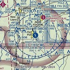
|
| Airport distance calculator |
|---|
|
|
| Sunrise and sunset |
|---|
|
Times for 02-Feb-2025
| | Local
(UTC-6) | | Zulu
(UTC) |
|---|
| Morning civil twilight | | 06:40 | | 12:40 |
| Sunrise | | 07:05 | | 13:05 |
| Sunset | | 17:48 | | 23:48 |
| Evening civil twilight | | 18:13 | | 00:13 |
|
| Current date and time |
|---|
| Zulu (UTC) | 02-Feb-2025 07:08:08 |
|---|
| Local (UTC-6) | 02-Feb-2025 01:08:08 |
|---|
|
| METAR |
|---|
KPOE
12nm NE | 020655Z AUTO 00000KT 10SM CLR 08/07 A3014 RMK AO2 SLP208 T00790067
|
KBKB
15nm E | 020649Z AUTO 00000KT 10SM CLR 08/06 A3014 RMK AO2 SLP233 T00780056
|
KDRI
15nm SW | 020655Z AUTO 00000KT 9SM CLR 07/06 A3017 RMK AO2 T00680062
|
|
| TAF |
|---|
KPOE
12nm NE | 012300Z 0123/0305 VRB06KT 9999 SKC QNH3012INS BECMG 0211/0212 VRB04KT 6000 BR SKC QNH3016INS BECMG 0213/0214 18007KT 9999 NSW SKC QNH3017INS BECMG 0217/0218 20010G15KT 9999 SKC QNH3008INS BECMG 0222/0223 18007KT 9999 FEW020 QNH3009INS TX22/0221Z TN06/0213Z LAST NO AMDS AFT 0206 NEXT 0215
|
|
| NOTAMs |
|---|
NOTAMs are issued by the DoD/FAA and will open in a separate window not controlled by AirNav.
|
|


