FAA INFORMATION EFFECTIVE 14 MAY 2026
Location
| FAA Identifier: | CGS |
| Lat/Long: | 38-58-49.7200N 076-55-19.8070W
38-58.828667N 076-55.330117W
38.9804778,-76.9221686
(estimated) |
| Elevation: | 48.9 ft. / 14.9 m (surveyed) |
| Variation: | 11W (2000) |
| From city: | 1 mile SE of COLLEGE PARK, MD |
| Time zone: | UTC -4 (UTC -5 during Standard Time) |
| Zip code: | 20740 |
Airport Operations
| Airport use: | Open to the public |
| Activation date: | 04/1940 |
| Control tower: | no |
| ARTCC: | WASHINGTON CENTER |
| FSS: | LEESBURG FLIGHT SERVICE STATION |
| NOTAMs facility: | CGS (NOTAM-D service available) |
| Attendance: | 0700-2200 |
| Wind indicator: | lighted |
| Segmented circle: | yes |
| Lights: | ACTVT REIL RWY 15 & 33; PAPI RWY 15 & 33; MIRL RWY 15/33 - CTAF. |
| Beacon: | white-green (lighted land airport)
Operates sunset to sunrise. |
Airport Communications
| CTAF/UNICOM: | 122.975 |
| WX AWOS-3: | 121.225 (301-864-5497) |
| POTOMAC APPROACH: | 125.65 ;DC FRZ 124.7 |
| POTOMAC DEPARTURE: | 125.65 ;DC FRZ 124.7 |
| IRONS STAR: | 126.4 |
| WX ASOS at DCA (9 nm SW): | 132.65 (276-200-0159) |
| WX AWOS-3 at FME (10 nm NE): | 123.925 |
| WX AWOS-3PT at GAI (16 nm NW): | 128.275 (301-977-2971) |
| WX ASOS at BWI (17 nm NE): | PHONE 227-217-0474 |
Nearby radio navigation aids
| VOR radial/distance | | VOR name | | Freq | | Var |
|---|
| DCAr045/9.0 | | WASHINGTON VOR/DME | | 111.00 | | 09W |
| ADWr356/10.7 | | ANDREWS VORTAC | | 113.10 | | 10W |
| BALr238/16.7 | | BALTIMORE VORTAC | | 115.10 | | 11W |
| AMLr092/25.6 | | ARMEL VOR/DME | | 113.50 | | 08W |
| EMIr183/31.0 | | WESTMINSTER VORTAC | | 117.90 | | 08W |
| FDKr149/33.4 | | FREDERICK VOR/DME | | 116.85 | | 08W |
| NDB name | | Hdg/Dist | | Freq | | Var | | ID |
|---|
| GEORGETOWN | | 081/9.9 | | 323 | | 09W | | GTN | --. - -. |
| OXONN | | 032/13.8 | | 332 | | 11W | | VQK | ...- --.- -.- |
| ELLICOTT | | 211/19.6 | | 371 | | 11W | | FND | ..-. -. -.. |
Airport Services
| Fuel available: | 100LL JET-A1+ |
| Parking: | tiedowns |
| Airframe service: | NONE |
| Powerplant service: | NONE |
| Bottled oxygen: | NONE |
| Bulk oxygen: | NONE |
Runway Information
Runway 15/33
| Dimensions: | 2980 x 60 ft. / 908 x 18 m |
| Surface: | asphalt, in good condition |
| Runway edge lights: | medium intensity |
| RUNWAY 15 | | RUNWAY 33 |
| Latitude: | 38-59.012083N | | 38-58.645260N |
| Longitude: | 076-55.539173W | | 076-55.121088W |
| Elevation: | 48.9 ft. | | 38.5 ft. |
| Traffic pattern: | left | | left |
| Runway heading: | 149 magnetic, 138 true | | 329 magnetic, 318 true |
| Displaced threshold: | 564 ft. | | 171 ft. |
| Declared distances: | TORA:2980 TODA:2980 ASDA:2740 LDA:2176 | | TORA:2980 TODA:2980 ASDA:2846 LDA:2675 |
| Markings: | nonprecision, in good condition | | nonprecision, in good condition |
| Visual slope indicator: | 2-light PAPI on left (4.00 degrees glide path) | | 2-light PAPI on right (4.00 degrees glide path) |
| Runway end identifier lights: | yes | | yes |
| Touchdown point: | yes, no lights | | yes, no lights |
| Obstructions: | 32 ft. trees, 322 ft. from runway, 51 ft. right of centerline, 3:1 slope to clear
+33 FT RAILROAD, 117 FM THR WITH OBS LTS. | | 64 ft. trees, 1086 ft. from runway, 172 ft. left of centerline, 13:1 slope to clear
+15 FT FENCE 87 FT R AT THR; -6 FT DITCH 65 FT L AT THR. |
Airport Ownership and Management from official FAA records
| Ownership: | Publicly-owned |
| Owner: | MNCPPC
6611 KENILWORTH AVENUE
RIVERDALE, MD 20737
Phone 301-699-2255
THE MARYLAND NATIONAL CAPITAL PARK & PLANNING CMSN. |
| Manager: | DREW MYERS
1909 CORPORAL FRANK SCOTT DRIVE
COLLEGE PARK, MD 20740
Phone 301-864-5844 |
Additional Remarks
| - | NO TKOFS 2200-0700; LNDG ONLY. |
| - | TSNT PRKG: FIRST 4 HRS FREE; FEE AFT, WAIVED W/MIN FUEL PURCHASE; OVNGT FEE. |
| - | HEL RAMP FEE; WAIVED IF UNDER 3500 LBS OR MIN FUEL PURCHASE. |
| - | ACFT HANDLING FEE IF RELOCATION TO/FROM FUEL AREA RQRD BY ARPT PSNL. |
| - | BLDG 0.1 NM S OF ARPT 23 FT AGL LGTD. |
| - | NO ACFT OVR 12500 LBS MFR GWT; HELS ONLY WITH 24 HR PPR - CALL AMGR 301-864-5844. |
| - | NOISE ABATEMENT PROCEDURES IN EFFECT CTC AMGR 301-864-5844. |
| - | AER 15 HEAVY SMOKE & FIREFIGHTING TRAINING OPNS INTERMITTENTLY IN PROGRESS. |
| - | NO STUDENT TGL OR SOLO OPNS PERMITTED. |
| - | DEER AND OTHER WILDLIFE ON & INVOF ARPT. |
| - | COMPLIANCE WITH 14CFR SECTION 93.335 IS REQUIRED BEFORE PILOTS MAY OPERATE TO/FROM THIS AIRPORT. |
| - | FOR CD CTC POTOMAC APCH AT 866-599-3874. |
Instrument Procedures
NOTE: All procedures below are presented as PDF files. If you need a reader for these files, you should download the free Adobe Reader.NOT FOR NAVIGATION. Please procure official charts for flight.
FAA instrument procedures published for use from 14 May 2026 at 0901Z to 11 June 2026 at 0900Z.
IAPs - Instrument Approach Procedures |
|---|
| RNAV (GPS) RWY 15 | |
download (198KB) |
| RNAV (GPS)-A | |
download (176KB) |
| NOTE: Special Alternate Minimums apply | |
download (166KB) |
| NOTE: Special Take-Off Minimums/Departure Procedures apply | |
download (366KB) |
Other nearby airports with instrument procedures:
W00 - Freeway Airport (7 nm E)
KDCA - Ronald Reagan Washington National Airport (9 nm SW)
KFME - Fort Meade Executive Airport (10 nm NE)
KADW - Joint Base Andrews (10 nm S)
KVKX - Potomac Airfield (14 nm S)
KGAI - Montgomery County Airpark (16 nm NW)
KBWI - Baltimore/Washington International Thurgood Marshall Airport (17 nm NE)
KANP - Lee Airport (17 nm E)
W50 - Davis Airport (19 nm NW)
|
|

Road maps at:
MapQuest
Bing
Google
| Aerial photo |
|---|
WARNING: Photo may not be current or correct
 Photo taken 19-Oct-2016
looking north.
Photo taken 19-Oct-2016
looking north.
Do you have a better or more recent aerial photo of College Park Airport that you would like to share? If so, please send us your photo.
|
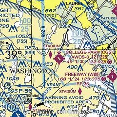
| Sectional chart |
|---|
|
| Airport distance calculator |
|---|
|
|
| Sunrise and sunset |
|---|
|
Times for 03-Jun-2026
| | Local
(UTC-4) | | Zulu
(UTC) |
|---|
| Morning civil twilight | | 05:13 | | 09:13 |
| Sunrise | | 05:44 | | 09:44 |
| Sunset | | 20:27 | | 00:27 |
| Evening civil twilight | | 20:59 | | 00:59 |
|
| Current date and time |
|---|
| Zulu (UTC) | 03-Jun-2026 07:24:19 |
|---|
| Local (UTC-4) | 03-Jun-2026 03:24:19 |
|---|
|
| METAR |
|---|
| KCGS | 030655Z AUTO 00000KT 10SM CLR 11/09 A3022 RMK AO2 T01130086
|
KDCA
9nm SW | 030652Z 35005KT 10SM FEW130 FEW250 16/08 A3021 RMK AO2 SLP230 T01560078
|
KFME
10nm NE | 030655Z AUTO 00000KT 10SM CLR 09/08 A3024 RMK AO1
|
KADW
10nm S | 030655Z AUTO 00000KT 10SM CLR 13/07 A3021 RMK AO2 SLP236 T01330071
|
KBWI
16nm NE | 030654Z 28004KT 10SM FEW250 12/08 A3020 RMK AO2 SLP226 T01220078 $
|
KGAI
16nm NW | 030656Z AUTO 00000KT 10SM CLR 11/10 A3024 RMK AO2 SLP252 T01060100
|
KDAA
20nm SW | 030655Z AUTO 00000KT 10SM CLR 10/08 A3019 RMK AO2 SLP226 T00970076 $
|
|
| TAF |
|---|
KDCA
9nm SW | 030536Z 0306/0412 24004KT P6SM SCT250 FM031300 35007KT P6SM FEW220 FM031500 36012KT P6SM SKC FM032200 01007KT P6SM SKC FM040100 00000KT P6SM SKC
|
KADW
10nm S | 030115Z 0301/0407 VRB05KT 9999 FEW250 QNH3019INS BECMG 0312/0313 36010KT 9999 SKC QNH3016INS BECMG 0403/0404 16002KT 9999 SKC QNH3018INS TX28/0320Z TN12/0310Z
|
KBWI
16nm NE | 030536Z 0306/0412 26004KT P6SM SCT250 FM031300 35007KT P6SM FEW220 FM031500 01010KT P6SM SKC FM032200 03007KT P6SM SKC FM040100 00000KT P6SM SKC
|
KDAA
20nm SW | 012000Z 0120/0302 05009KT 9999 BKN080 BKN250 QNH2990INS BECMG 0105/0106 10006KT 9999 BKN100 BKN200 QNH3009INS BECMG 0113/0114 04009KT 9999 FEW060 QNH3018INS WND 02003KT AFT 0200 TX27/0121Z TN11/0210Z LAST NO AMDS AFT 0201 NEXT 0212
|
|
| NOTAMs |
|---|
NOTAMs are issued by the DoD/FAA and will open in a separate window not controlled by AirNav.
|
|

