FAA INFORMATION EFFECTIVE 15 MAY 2025
Location
| FAA Identifier: | DFW |
| Lat/Long: | 32-53-50.0390N 097-02-15.7010W
32-53.833983N 097-02.261683W
32.8972331,-97.0376947
(estimated) |
| Elevation: | 606.4 ft. / 184.8 m (surveyed) |
| Variation: | 04E (2015) |
| From city: | 12 miles NW of DALLAS-FORT WORTH, TX |
| Time zone: | UTC -5 (UTC -6 during Standard Time) |
| Zip code: | 75261 |
Airport Operations
| Airport use: | Open to the public |
| Activation date: | 01/1974 |
| Control tower: | yes |
| ARTCC: | FORT WORTH CENTER |
| FSS: | FORT WORTH FLIGHT SERVICE STATION |
| NOTAMs facility: | DFW (NOTAM-D service available) |
| Attendance: | CONTINUOUS |
| Wind indicator: | lighted |
| Segmented circle: | no |
| Lights: | SS-SR |
| Beacon: | white-green (lighted land airport)
Operates sunset to sunrise. |
| Landing fee: | yes |
| Fire and rescue: | ARFF index E |
| International operations: | customs landing rights airport |
Airport Communications
| UNICOM: | 122.95 |
| WX ASOS: | PHONE 214-600-7784 |
| DFW GROUND: | 121.65 ;EAST 121.8 ;EAST 121.85 ;WEST |
| DFW TOWER: | 124.15 ;WEST 126.55 ;EAST 127.5 ;EAST 134.9 ;WEST |
| LONE STAR APPROACH: | 118.1 118.1 ;RWY 13R 118.425 ;RWY 18L 118.425 ;RWY 18R 118.425 ;RWY 31L 118.425 ;RWY 36L 118.425 ;RWY 36R 119.4 ;RWY 17L 119.4 ;RWY 31L 119.4 ;RWY 35R 119.875 ;WEST 124.3 ;NORTH 125.025 ;EAST 125.2 ;RWY 31R 125.2 ;SOUTH 127.075 ;RWY 17C 127.075 ;RWY 17R 127.075 ;RWY 31L 127.075 ;RWY 35C 127.075 ;RWY 35L 133.15 ;RWY 13R 135.5 ;RWY 31R 135.975 135.975 ;SOUTH 133.525 ;EAST 133.625 ;WEST |
| LONE STAR DEPARTURE: | 118.1 118.55 ;EAST 124.825 ;NORTH 125.125 ;SOUTH 126.475 ;WEST 135.975 135.975 ;SOUTH |
| CLEARANCE DELIVERY: | 128.25 |
| AKUNA RNAV DP: | 118.55 ;RWY 17C, 17R 125.125 ;RWY 35L, 35C, 36L, 36R 126.475 ;RWY 18L, 18R |
| ARDIA RNAV DP: | 118.55 ;RWY 35L, 35C 125.125 ;RWY 17C, 17R 126.475 ;RWY 36L, 36R |
| ARDIA RNAVE DP: | 125.125 ;RWY 18L, 18R |
| BEREE RNAV STAR: | 125.025 133.525 |
| BOOVE STAR: | 119.875 133.625 |
| BOTCH DP: | 118.1 ;RY 31L/R, 35L/C/R, 36L/R 135.975 ;RY 13L/R, 17L/C/R, 18L/R |
| BOWIE STAR: | 118.1 ;PROPS LNDG NORTH ONLY 119.875 ;PROPS LNDG SOUTH & ALL JETS |
| BRDJE RNAV STAR: | 125.025 |
| CAINE STAR: | 125.025 |
| CEDAR CREEK STAR: | 125.025 133.525 |
| CLASS B: | 118.1 ;NW 124.3 ;NE 125.2 ;SE 135.975 ;SW 282.275 ;NE 306.95 ;NW 343.65 ;SE 379.9 ;SW |
| COYOTE DP: | 118.1 ;PROPS ONLY RWY 31L/R, RWY 35L 135.975 ;PROPS ONLY RWY 13L/R, 17L/C |
| D-ATIS: | 123.775 ;ARR 135.925 ;DEP |
| DALLAS AREA DP: | 118.55 |
| DARTZ RNAV DP: | 118.55 ;RWY 35L, 35C 125.125 ;RWY 17C, 17R 125.125 ;RWY 18L, 18R 126.475 ;RWY 36L, 36R |
| EMERG: | 243.0 |
| FINGR STAR: | 124.3 125.275 |
| FORCK RNAV DP: | 118.55 |
| FORNY STAR: | 125.025 |
| GARLAND DP: | 118.55 |
| IC: | 119.875 ;WEST 125.025 ;EAST |
| JACKY DP: | 118.1 ;RY 31L/R, 36L/R, 35L/R 135.975 ;RWYS 13L/R, 17L/C/R, 18L/R 306.95 ;RWYS 31L/R, 36L/R, 35L/C/R 379.9 ;RWYS 13L/R, 17 L/C/R, 18L/R 118.1 118.1 ;RY 31L/R, 35L/C/R, 36L/R 135.975 ;RY 13L/R, 17L/C/R, 18L/R |
| JASPA RNAV DP: | 118.55 ;RWY 35L, 35C 125.125 ;RWY 17C, 17R 125.125 ;RWY 18L, 18R 126.475 ;RWY 36L, 36R |
| JOE POOL DP: | 118.55 ;RWY 35L, 35C 125.125 ;RWY 17C, 17R 125.125 ;RWY 18L, 18R 126.475 ;RWY 36L, 36R |
| JOVEM STAR: | 119.875 |
| KEENE DP: | 118.1 ;RWY 31L, 31R, 35L, 35C, 35R, 135.975 ;RWY 13L, 13R, 17L, 17C, 17R |
| KINGDOM DP: | 118.1 ;RWY 35L, 35C, 35R 118.1 ;RWY 36L, 36R 126.475 ;JETS 135.975 ;RWY 13L/R 135.975 ;RWY 17L, 17C, 17R 135.975 ;RWY 18L, 18R |
| KUSSO DP: | 124.3 ;PROPS ONLY RWY 31L/R, 35L/C/R 125.2 ;PROPS ONLY RWY 13L/R, 17L/C/R |
| MRSSH RNAV DP: | 118.55 |
| NANDR RNAV DP: | 135.975 ;RWY 18L/R |
| NELYN RNAV DP: | 118.55 ;RWY 35L, 35C 125.125 ;RWY 17C, 17R 125.125 ;RWY 18L, 18R 126.475 ;RWY 36L, 36R |
| SEEVR STAR: | 125.025 133.525 |
| SHMPP STAR: | 119.875 |
| SOCKK STAR: | 119.875 133.625 |
| TEXOMA DP: | 118.55 ;RWY 17C, 17R 125.125 ;RWY 35L, 35C 125.125 ;RWY 36L, 36R 126.475 ;RWY 18L, 18R |
| TRI-GATE DP: | 124.3 ;NORTH 125.2 ;SOUTH |
| TRYTN RNAV DP: | 118.55 |
| WILBR STAR: | 125.025 |
| WORTH DP: | 126.475 |
| YEAGR STAR: | 125.2 |
| ZACHH RNAV DP: | 118.55 |
| ZROBA RNAV STAR: | 119.875 |
| WX ASOS at DAL (10 nm E): | PHONE 214-353-1551 |
| WX AWOS-3PT at ADS (11 nm NE): | PHONE 972-386-4855 |
| WX AWOS-3P at GPM (12 nm S): | 118.475 (972-606-1433) |
| WX AWOS-3 at 49T (14 nm SE): | 135.425 (214-670-1243) |
| WX ASOS at GKY (14 nm S): | 127.375 (817-557-0251) |
| WX ASOS at AFW (15 nm W): | PHONE 817-491-6188 |
| WX ASOS at RBD (16 nm SE): | PHONE 214-330-5317 |
| WX ASOS at FTW (17 nm W): | PHONE 817-740-3346 |
- APCH CTL PROVIDES CLEARANCE DELIVERY FOR HICKS AIRFIELD ON FREQ 125.9.
- ASDE-X IN USE. OPERATE TRANSPONDERS WITH ALTITUDE REPORTING MODE AND ADS-B (IF EQUIPPED) ENABLED ON ALL AIRPORT SURFACES.
- ASR-9 SERVES AS ADDNL ASR FOR DALLAS/FORT WORTH INTL AND ALSO SERVES DALLAS LOVE FIELD.
Nearby radio navigation aids
| VOR radial/distance | | VOR name | | Freq | | Var |
|---|
| TTTr359/1.7 | | MAVERICK VOR/DME | | 113.10 | | 06E |
| CVEr268/6.8 | | COWBOY VOR/DME | | 116.20 | | 06E |
| FUZr080/7.2 | | RANGER VORTAC | | 115.70 | | 06E |
Airport Services
| Fuel available: | 100LL JET-A |
| Parking: | tiedowns |
| Bottled oxygen: | HIGH |
| Bulk oxygen: | HIGH |
Runway Information
Runway 18L/36R
| Dimensions: | 13401 x 200 ft. / 4085 x 61 m |
| Surface: | concrete/grooved, in good condition |
| Weight bearing capacity: | | PCN 83 /R/B/W/T | | Single wheel: | 120.0 | | Double wheel: | 250.0 | | Double tandem: | 550.0 | | Dual double tandem: | 1066.0 |
|
| Runway edge lights: | high intensity |
| RUNWAY 18L | | RUNWAY 36R |
| Latitude: | 32-54.947975N | | 32-52.738287N |
| Longitude: | 097-03.044185W | | 097-03.055553W |
| Elevation: | 601.5 ft. | | 575.3 ft. |
| Traffic pattern: | left | | left |
| Runway heading: | 176 magnetic, 180 true | | 356 magnetic, 000 true |
| Declared distances: | TORA:13401 TODA:13401 ASDA:13401 LDA:13401 | | TORA:13401 TODA:13401 ASDA:13401 LDA:13401 |
| Markings: | precision, in good condition | | precision, in good condition |
| Visual slope indicator: | 4-light PAPI on left (3.00 degrees glide path) | | 4-light PAPI on left (3.00 degrees glide path) |
| RVR equipment: | touchdown, midfield, rollout | | touchdown, midfield, rollout |
| Approach lights: | MALSR: 1,400 foot medium intensity approach lighting system with runway alignment indicator lights | | MALSR: 1,400 foot medium intensity approach lighting system with runway alignment indicator lights |
| Runway end identifier lights: | no | | |
| Centerline lights: | yes | | yes |
| Touchdown point: | yes, lighted | | yes, lighted |
| Instrument approach: | ILS/DME | | ILS/DME |
Runway 17C/35C
| Dimensions: | 13400 x 150 ft. / 4084 x 46 m |
| Surface: | asphalt/grooved, in excellent condition |
| Weight bearing capacity: | | PCN 93 /R/B/W/T | | Single wheel: | 120.0 | | Double wheel: | 250.0 | | Double tandem: | 550.0 | | Dual double tandem: | 1120.0 |
|
| Runway edge lights: | high intensity |
| RUNWAY 17C | | RUNWAY 35C |
| Latitude: | 32-54.942402N | | 32-52.732727N |
| Longitude: | 097-01.558495W | | 097-01.570300W |
| Elevation: | 562.2 ft. | | 563.1 ft. |
| Traffic pattern: | left | | left |
| Runway heading: | 176 magnetic, 180 true | | 356 magnetic, 000 true |
| Declared distances: | TORA:13400 TODA:13400 ASDA:13400 LDA:13400 | | TORA:13400 TODA:13400 ASDA:13400 LDA:13400 |
| Markings: | precision, in good condition | | precision, in good condition |
| Visual slope indicator: | 4-light PAPI on left (3.00 degrees glide path) | | 4-light PAPI on left (3.00 degrees glide path) |
| RVR equipment: | touchdown, midfield, rollout | | touchdown, midfield, rollout |
| Approach lights: | ALSF2: standard 2,400 foot high intensity approach lighting system with centerline sequenced flashers (category II or III) | | ALSF2: standard 2,400 foot high intensity approach lighting system with centerline sequenced flashers (category II or III) |
| Runway end identifier lights: | no | | no |
| Centerline lights: | yes | | yes |
| Touchdown point: | yes, lighted | | yes, lighted |
| Instrument approach: | ILS/DME | | ILS/DME |
Runway 17R/35L
| Dimensions: | 13400 x 200 ft. / 4084 x 61 m |
| Surface: | asphalt/grooved, in excellent condition |
| Weight bearing capacity: | | PCN 90 /R/B/X/T | | Single wheel: | 120.0 | | Double wheel: | 250.0 | | Double tandem: | 550.0 | | Dual double tandem: | 1049.0 |
|
| Runway edge lights: | high intensity |
| RUNWAY 17R | | RUNWAY 35L |
| Latitude: | 32-54.943327N | | 32-52.733672N |
| Longitude: | 097-01.793010W | | 097-01.804813W |
| Elevation: | 566.6 ft. | | 563.4 ft. |
| Traffic pattern: | left | | left |
| Runway heading: | 176 magnetic, 180 true | | 356 magnetic, 000 true |
| Declared distances: | TORA:13400 TODA:13400 ASDA:13400 LDA:13400 | | TORA:13400 TODA:13400 ASDA:13400 LDA:13400 |
| Markings: | precision, in good condition | | precision, in good condition |
| Visual slope indicator: | 4-light PAPI on left (3.00 degrees glide path) | | 4-light PAPI on left (3.00 degrees glide path) |
| RVR equipment: | touchdown, midfield, rollout | | touchdown, midfield, rollout |
| Approach lights: | MALSR: 1,400 foot medium intensity approach lighting system with runway alignment indicator lights | | MALSR: 1,400 foot medium intensity approach lighting system with runway alignment indicator lights |
| Centerline lights: | yes | | yes |
| Touchdown point: | yes, lighted | | yes, lighted |
| Instrument approach: | ILS/DME | | ILS/DME |
Runway 18R/36L
| Dimensions: | 13400 x 150 ft. / 4084 x 46 m |
| Surface: | asphalt/grooved, in good condition |
| Weight bearing capacity: | | PCN 90 /R/C/W/T | | Single wheel: | 120.0 | | Double wheel: | 250.0 | | Double tandem: | 490.0 | | Dual double tandem: | 985.0 |
|
| Runway edge lights: | high intensity |
| RUNWAY 18R | | RUNWAY 36L |
| Latitude: | 32-54.948792N | | 32-52.739155N |
| Longitude: | 097-03.278732W | | 097-03.290005W |
| Elevation: | 606.4 ft. | | 582.2 ft. |
| Traffic pattern: | left | | left |
| Runway heading: | 176 magnetic, 180 true | | 356 magnetic, 000 true |
| Declared distances: | TORA:13400 TODA:13400 ASDA:13400 LDA:13400 | | TORA:13400 TODA:13400 ASDA:13400 LDA:13400 |
| Markings: | precision, in good condition | | precision, in good condition |
| Visual slope indicator: | 4-light PAPI on left (3.00 degrees glide path) | | 4-light PAPI on left (3.00 degrees glide path) |
| RVR equipment: | touchdown, midfield, rollout | | touchdown, midfield, rollout |
| Approach lights: | ALSF2: standard 2,400 foot high intensity approach lighting system with centerline sequenced flashers (category II or III) | | MALSR: 1,400 foot medium intensity approach lighting system with runway alignment indicator lights |
| Runway end identifier lights: | no | | |
| Centerline lights: | yes | | yes |
| Touchdown point: | yes, lighted | | yes, lighted |
| Instrument approach: | ILS/DME | | ILS/DME |
Runway 13R/31L
| Dimensions: | 9300 x 150 ft. / 2835 x 46 m |
| Surface: | concrete/grooved, in good condition |
| Weight bearing capacity: | | PCN 76 /R/B/W/T | | Single wheel: | 120.0 | | Double wheel: | 250.0 | | Double tandem: | 485.0 | | Dual double tandem: | 1005.0 |
|
| Runway edge lights: | high intensity |
| Operational restrictions: | CLSD 2200-0600 EXCP PPR. |
| RUNWAY 13R | | RUNWAY 31L |
| Latitude: | 32-54.574538N | | 32-53.416193N |
| Longitude: | 097-04.987933W | | 097-03.796588W |
| Elevation: | 591.0 ft. | | 577.2 ft. |
| Traffic pattern: | left | | left |
| Runway heading: | 135 magnetic, 139 true | | 315 magnetic, 319 true |
| Declared distances: | TORA:9300 TODA:9300 ASDA:9300 LDA:9300 | | TORA:9300 TODA:9300 ASDA:9300 LDA:9300 |
| Markings: | precision, in good condition | | nonprecision, in good condition |
| Visual slope indicator: | 4-light PAPI on left (3.00 degrees glide path) | | 4-light PAPI on left (3.13 degrees glide path) |
| RVR equipment: | touchdown, rollout | | touchdown, rollout |
| Approach lights: | MALSR: 1,400 foot medium intensity approach lighting system with runway alignment indicator lights | | |
| Runway end identifier lights: | | | yes |
| Centerline lights: | yes | | yes |
| Touchdown point: | yes, lighted | | yes, no lights |
| Instrument approach: | ILS/DME | | |
Runway 13L/31R
| Dimensions: | 9000 x 200 ft. / 2743 x 61 m |
| Surface: | concrete/grooved, in good condition |
| Weight bearing capacity: | | PCN 95 /R/B/W/T | | Single wheel: | 120.0 | | Double wheel: | 250.0 | | Double tandem: | 550.0 | | Dual double tandem: | 1120.0 |
|
| Runway edge lights: | high intensity |
| Operational restrictions: | CLSD 2200-0600 EXCP PPR. |
| RUNWAY 13L | | RUNWAY 31R |
| Latitude: | 32-54.753283N | | 32-53.698867N |
| Longitude: | 097-01.288702W | | 097-00.050627W |
| Elevation: | 553.1 ft. | | 508.4 ft. |
| Traffic pattern: | left | | left |
| Runway heading: | 131 magnetic, 135 true | | 311 magnetic, 315 true |
| Displaced threshold: | 627 ft. | | no |
| Declared distances: | TORA:9000 TODA:9000 ASDA:9000 LDA:8373 | | TORA:8373 TODA:8373 ASDA:8373 LDA:8373 |
| Markings: | nonprecision, in good condition | | precision, in good condition |
| Visual slope indicator: | 4-light PAPI on left (3.00 degrees glide path) | | 4-light PAPI on left (3.00 degrees glide path) |
| RVR equipment: | touchdown, midfield, rollout | | touchdown, midfield, rollout |
| Approach lights: | | | MALSR: 1,400 foot medium intensity approach lighting system with runway alignment indicator lights |
| Runway end identifier lights: | yes | | |
| Centerline lights: | yes | | yes |
| Touchdown point: | yes, no lights | | yes, lighted |
| Instrument approach: | | | ILS/DME |
Runway 17L/35R
| Dimensions: | 8500 x 150 ft. / 2591 x 46 m |
| Surface: | concrete/grooved, in good condition |
| Weight bearing capacity: | | PCN 91 /R/B/W/T | | Single wheel: | 120.0 | | Double wheel: | 250.0 | | Double tandem: | 550.0 | | Dual double tandem: | 1120.0 |
|
| Runway edge lights: | high intensity |
| Operational restrictions: | CLSD 2200-0600 EXCP PPR. |
| RUNWAY 17L | | RUNWAY 35R |
| Latitude: | 32-53.899223N | | 32-52.497558N |
| Longitude: | 097-00.586717W | | 097-00.594477W |
| Elevation: | 524.3 ft. | | 575.6 ft. |
| Traffic pattern: | left | | left |
| Runway heading: | 176 magnetic, 180 true | | 356 magnetic, 000 true |
| Declared distances: | TORA:8500 TODA:8500 ASDA:8500 LDA:8500 | | TORA:8500 TODA:8500 ASDA:8500 LDA:8500 |
| Markings: | precision, in good condition | | precision, in good condition |
| Visual slope indicator: | 4-light PAPI on left (3.00 degrees glide path) | | 4-light PAPI on right (3.00 degrees glide path) |
| RVR equipment: | touchdown, midfield, rollout | | touchdown, midfield, rollout |
| Approach lights: | ALSF2: standard 2,400 foot high intensity approach lighting system with centerline sequenced flashers (category II or III) | | ALSF2: standard 2,400 foot high intensity approach lighting system with centerline sequenced flashers (category II or III) |
| Centerline lights: | yes | | yes |
| Touchdown point: | yes, lighted | | yes, lighted |
| Instrument approach: | ILS/DME | | ILS/DME |
| Obstructions: | 150 ft. ant, lighted, 5443 ft. from runway, 798 ft. left of centerline, 34:1 slope to clear
ANTENNA ON BUILDING. | | none |
Airport Ownership and Management from official FAA records
| Ownership: | Publicly-owned |
| Owner: | CITIES OF DALLAS AND FT WORTH
PO BOX 619428
DALLAS-FT WORTH, TX 75261
Phone 972-574-3200 |
| Manager: | SEAN DONOHUE
PO BOX 619428
DALLAS-FT WORTH, TX 75261
Phone 972-973-3112 |
Additional Remarks
| - | BIRDS ON & INVOF ARPT. |
| - | TKOF DSTC FOR RY 17L FM TWY Q2 IS 8196 FT. |
| - | TWYS MAY REQUIRE JUDGMENTAL OVERSTEERING FOR LARGE ACFT. |
| - | TKOF DSTC FOR RY 35R FM TWY Q9 IS 8196 FT. |
| - | TKOF DSTC FOR RY 35L FM TWY EQ IS 13084 FT & FM TWY EP IS 12811 FT. |
| - | PPR FM THE PRIMARY TENANT AIRLINES TO OPERATE WITHIN THE CENTRAL TERMINAL AREA. PROPER MINIMUM OBJECT FREE AREA DISTANCES MAY NOT BE MAINTAINED FOR RAMP/APRON TAXILANES. |
| - | TWY EDGE REFLECTORS ALONG ALL TWYS. |
| - | TERMINAL B APRON TAXILANE BTN APRON ENTRANCE/EXIT POINT TAXILANES 103 & 116 CLSD TO ACFT WITH WINGSPAN 95 FT AND GREATER. |
| - | TKOF DSTC FOR RY 18L FM TWY WG IS 13,082; FM TWY WH IS 12,815. |
| - | PPR FROM ARPT OPNS FOR GEN AVN ACFT TO PROCD TO AIRLINE TRML GATE EXCP GEN AVN FAC. |
| - | PPR GA OPERATIONS 0000-0500; CALL ARPT OPNS 972-973-3112. |
| - | APRON ENTRANCE/EXIT POINT 124 CLSD TO ACFT WITH WINGSPAN GREATER THAN 213 FT. |
| - | TWY A6 CLSD TO ACFT WITH WINGSPAN 171 FT AND GREATER. |
| - | TKOF DSTC FOR RY 17C FM TWY EG IS 13,082 FT. |
| - | TKOF DSTC FOR RY 18R FM TWY WG IS 13,082 FT. |
| - | STD SAWED GROOVING 160 FT WIDE FULL LENGTH RYS 13L/31R; 18L/36R & 17R/35L. STD GROOVING 130 FTWIDE FULL LENGTH RYS 17L/35R; 18R/36L; 13R/31L & 17C/35C. |
| - | APRON ENTRANCE/EXIT POINTS 9, 32, 33, 34, 35, 36, 37, 38, & 53 CLSD TO ACFT WITH WINGSPAN GREATER THAN 135 FT. |
| - | PPR ACFT WITH WINGSPAN 215 FT OR GREATER (GROUP VI) CALL ARPT OPNS 972-973-3112 FOR FOLLOW-ME SERVICES WHILE TAXIING TO & FROM RAMP & RYS. |
| - | RY VISUAL SCREEN 20 FT AGL 1180 FT S AER 35C. |
| - | RY VISUAL SCREEN 22 FT AGL 1179 FT S AER 35L. |
| - | ARPT UNDER CONSTRUCTION; PAEW IN MOVEMENT AREAS. |
| - | ACFT USING TERMINAL E GATES E2-E17 MUST OBTAIN APPROVAL FROM RAMP 131.0 PRIOR TO ENTERING RAMP AND PRIOR TO PUSHBACK. ACFT USING TERMINAL E GATES E-18-E38 MUST OBTAIN APPROVAL FROM RAMP 128.825 PRIOR TO ENTERING RAMP AND PRIOR TO PUSHBACK. |
| - | A380 OPNS ONLY AUZD ON RWYS 18R/36L AND 18L/36R. B747-8 OPNS ONLY AUZD ON RWYS 18R/36L, 18L/36R AND 17R/35L. CTC ARPT OPNS FOR ADDNL INFO. |
| - | TKOF DSTC FOR RY 17R FM TWY EG IS 13082 FT & FM TWY EH IS 12816 FT. |
| - | APRON ENTRANCE/EXIT POINTS 5, 7, 42, 44, 48, 49, 51, 52, 117, 118 AND 122 CLSD TO ACFT WITH WINGSPAN GREATER THAN 118 FT. |
| - | APRON ENTRANCE/EXIT POINTS 1 AND 2 CLSD TO ACFT WITH WINGSPAN GREATER THAN 89' EXCEPT PPR. |
| - | APRON ENTRANCE/EXIT POINT 3 CLSD TO ACFT WITH WINGSPAN GREATER THAN 214 FT EXCEPT PPR. |
| - | APRON ENTRANCE/EXIT POINTS 31 AND 39 CLSD TO ACFT WITH WINGSPAN GREATER THAN 167 FT. |
| - | UNLESS OTHERWISE SPECIFIED, ALL APRON ENTRANCE/EXIT POINTS CLSD TO ACFT WITH WINGSPAN GREATER THAN 214 FT EXCEPT PPR. |
| - | RY STATUS LGTS IN OPN. |
| - | ACFT USING TERMINAL B GATES B1-B18, ALL TERMINAL D GATES, AND APRON ENTRY POINTS 117-150 MUST OBTAIN APPROVAL FROM RAMP 129.825 PRIOR TO ENTERING RAMP AND PRIOR TO PUSHBACK. |
| - | APRON ENTRANCE/EXIT POINTS 22, 24, 105, AND 107 CLSD TO ACFT WITH WINGSPAN GREATER THAN 125 FT. |
| - | ACFT USING TWY HA NORTH OF TWY B MUST OBTAIN APPROVAL FROM RAMP 129.825 PRIOR TO ENTERING RAMP. |
| - | ACFT USING TERMINAL B GATES B19-B49 MUST OBTAIN APPROVAL FROM RAMP 130.10 PRIOR TO ENTERING RAMP AND PRIOR TO PUSHBACK. |
| - | ACFT USING TERMINAL A GATES A8-A39 AND TERMINAL C GATES C2-C12 MUST OBTAIN APPROVAL FROM RAMP 131.275 PRIOR TO ENTERING RAMP AND PRIOR TO PUSHBACK. |
| - | ACFT USING TERMINAL C GATES C14-C39 MUST OBTAIN APPROVAL FROM RAMP 131.80 PRIOR TO ENTERING RAMP AND PRIOR TO PUSHBACK. |
| - | TERMINAL B APRON TAXILANE BTN APRON ENTRANCE/EXIT POINT TAXILANES 117 & 118 CLSD TO ACFT WITH WINGSPAN 119 FT AND GREATER. |
| - | ACFT USING TERMINAL F HARDSTAND SPOTS T83 THROUGH T86 MUST CONTACT GROUND CONTROL ON 121.85 PRIOR TO TAXI. |
| - | TERMINAL C RAMP SPOTS 25 AND 26 CLSD TO ACFT WITH WINGSPAN 118 FT AND GREATER. |
| - | LAND & HOLD SHORT SIGNS ON RY 17C AT TWY 'B' 10,460 FT S OF RY 17C THLD; RY 18R AT TWY 'B' 10,100 FT S OF RY 18R THLD; RY 35C AT TWY 'EJ' 9050 FT N OF RY 35C THLD; RY 36L AT TWY 'Z' 10,650 FT N OF RY 36L THLD; LGTD & MKD WITH IN-PAVEMENT PULSATING WHITE LGTS. |
| - | TKOF DSTC FOR RY 36R FM TWY WP IS 12,815 FT; FM TWY WQ IS 13,082 FT. |
Instrument Procedures
NOTE: All procedures below are presented as PDF files. If you need a reader for these files, you should download the free Adobe Reader.NOT FOR NAVIGATION. Please procure official charts for flight.
FAA instrument procedures published for use from 15 May 2025 at 0901Z to 13 June 2025 at 0900z.
STARs - Standard Terminal Arrivals |
|---|
| BEREE THREE (RNAV) | |
download (293KB) |
| BOOVE SEVEN (RNAV) | |
2 pages:
[1] [2] (411KB) |
| BOWIE EIGHT | |
2 pages:
[1] [2] (398KB) |
| BOWIE EIGHT, CONT.2 | |
download (208KB) |
| BRDJE FIVE (RNAV) | |
2 pages:
[1] [2] (461KB) |
| CABBY TWO (RNAV) | |
download (144KB) |
| CAINE TWO (RNAV) | |
download (156KB) |
| CEDAR CREEK THREE **CHANGED** | |
2 pages:
[1] [2] (426KB) |
| CEDAR CREEK THREE, CONT.2 | |
download (355KB) |
| DAWGZ TWO (RNAV) | |
download (140KB) |
| FINGR NINE | |
2 pages:
[1] [2] (446KB) |
| FORNY THREE (RNAV) | |
download (128KB) |
| GIBBI TWO (RNAV) | |
download (159KB) |
| JOVEM SIX (RNAV) | |
2 pages:
[1] [2] (473KB) |
| PAWLZ THREE (RNAV) | |
download (158KB) |
| SEEVR FOUR (RNAV) | |
2 pages:
[1] [2] (357KB) |
| SHAAM TWO (RNAV) | |
download (150KB) |
| SHMPP THREE (RNAV) | |
2 pages:
[1] [2] (409KB) |
| SOCKK FOUR (RNAV) | |
download (250KB) |
| TILLA THREE (RNAV) | |
download (176KB) |
| VKTRY TWO (RNAV) | |
2 pages:
[1] [2] (507KB) |
| WHINY FOUR (RNAV) | |
2 pages:
[1] [2] (345KB) |
| WILBR NINE | |
2 pages:
[1] [2] (368KB) |
| WILBR NINE, CONT.2 | |
download (200KB) |
| YEAGR FOUR **CHANGED** | |
2 pages:
[1] [2] (632KB) |
| ZROBA ONE (RNAV) | |
2 pages:
[1] [2] (308KB) |
IAPs - Instrument Approach Procedures |
|---|
| ILS OR LOC RWY 17C | |
download (387KB) |
| ILS OR LOC RWY 17L | |
download (350KB) |
| ILS OR LOC RWY 17R | |
download (372KB) |
| ILS OR LOC RWY 18L | |
download (407KB) |
| ILS OR LOC RWY 18R | |
download (404KB) |
| ILS OR LOC RWY 31R | |
download (389KB) |
| ILS OR LOC RWY 35C | |
download (385KB) |
| ILS OR LOC RWY 35L | |
download (388KB) |
| ILS OR LOC RWY 35R | |
download (385KB) |
| ILS OR LOC RWY 36L | |
download (426KB) |
| ILS OR LOC RWY 36R | |
download (395KB) |
| ILS Z OR LOC Z RWY 13R | |
download (350KB) |
| ILS RWY 17C (SA CAT I) | |
download (374KB) |
| ILS RWY 17L (SA CAT I) | |
download (348KB) |
| ILS RWY 18R (SA CAT I) | |
download (362KB) |
| ILS RWY 35C (SA CAT I) | |
download (357KB) |
| ILS RWY 35R (SA CAT I) | |
download (381KB) |
| ILS RWY 17R (SA CAT I - II) | |
download (378KB) |
| ILS RWY 18L (SA CAT I - II) | |
download (371KB) |
| ILS RWY 31R (SA CAT I - II) | |
download (384KB) |
| ILS Z RWY 13R (SA CAT I - II) | |
download (368KB) |
| ILS RWY 17C (CAT II - III) | |
download (368KB) |
| ILS RWY 17L (CAT II - III) | |
download (345KB) |
| ILS RWY 18R (CAT II - III) | |
download (361KB) |
| ILS RWY 35C (CAT II - III) | |
download (359KB) |
| ILS RWY 35R (CAT II - III) | |
download (381KB) |
| ILS RWY 36L (SA CAT II) | |
download (359KB) |
| CONVERGING ILS RWY 17C | |
download (342KB) |
| CONVERGING ILS RWY 17R | |
download (340KB) |
| CONVERGING ILS RWY 31R | |
download (361KB) |
| CONVERGING ILS RWY 35C | |
download (344KB) |
| CONVERGING ILS RWY 35L | |
download (342KB) |
| CONVERGING ILS RWY 36L | |
download (349KB) |
| CONVERGING ILS RWY 36R | |
download (351KB) |
| ILS RWY 18L (CONVERGING) | |
download (350KB) |
| ILS RWY 18R (CONVERGING) | |
download (346KB) |
| ILS V RWY 13R (CONVERGING) | |
download (356KB) |
| RNAV (RNP) Z RWY 13R | |
download (326KB) |
| RNAV (RNP) Z RWY 31L | |
download (309KB) |
| RNAV (RNP) Z RWY 31R | |
download (330KB) |
| RNAV (GPS) RWY 17C | |
download (342KB) |
| RNAV (GPS) RWY 17L | |
download (325KB) |
| RNAV (GPS) RWY 17R | |
download (349KB) |
| RNAV (GPS) RWY 18L | |
download (352KB) |
| RNAV (GPS) RWY 18R | |
download (334KB) |
| RNAV (GPS) RWY 35C | |
download (329KB) |
| RNAV (GPS) RWY 35L | |
download (331KB) |
| RNAV (GPS) RWY 35R | |
download (339KB) |
| RNAV (GPS) RWY 36L | |
download (337KB) |
| RNAV (GPS) RWY 36R | |
download (340KB) |
| RNAV (GPS) Y RWY 13R | |
download (329KB) |
| RNAV (GPS) Y RWY 31L | |
download (326KB) |
| RNAV (GPS) Y RWY 31R | |
download (301KB) |
| NOTE: Special Alternate Minimums apply | |
download (138KB) |
Departure Procedures |
|---|
| AKUNA NINE (RNAV) | |
2 pages:
[1] [2] (449KB) |
| ALIAN TWO (RNAV) | |
2 pages:
[1] [2] (424KB) |
| ARDIA SEVEN (RNAV) | |
2 pages:
[1] [2] (501KB) |
| BLECO EIGHT (RNAV) | |
2 pages:
[1] [2] (486KB) |
| BOTCH ONE (RNAV) **NEW** | |
2 pages:
[1] [2] (409KB) |
| BOTCH ONE (RNAV), CONT.2 **NEW** | |
download (345KB) |
| COYOTE FOUR | |
2 pages:
[1] [2] (449KB) |
| DALLAS THREE | |
2 pages:
[1] [2] (394KB) |
| DARTZ NINE (RNAV) | |
2 pages:
[1] [2] (535KB) |
| FORCK THREE (RNAV) | |
2 pages:
[1] [2] (488KB) |
| GARLAND SIX **NEW** | |
2 pages:
[1] [2] (382KB) |
| GRABE EIGHT (RNAV) | |
2 pages:
[1] [2] (469KB) |
| HRPER THREE (RNAV) | |
2 pages:
[1] [2] (467KB) |
| HUDAD TWO (RNAV) | |
2 pages:
[1] [2] (436KB) |
| JACKY ONE | |
download (193KB) |
| JASPA SEVEN (RNAV) | |
2 pages:
[1] [2] (550KB) |
| JOE POOL SEVEN | |
2 pages:
[1] [2] (529KB) |
| KATZZ TWO (RNAV) | |
2 pages:
[1] [2] (466KB) |
| KEENE FIVE | |
download (204KB) |
| KEENE FIVE | |
download (204KB) |
| KINGDOM FIVE **NEW** | |
2 pages:
[1] [2] (439KB) |
| KUSSO ONE (RNAV) | |
2 pages:
[1] [2] (343KB) |
| LOWGN EIGHT (RNAV) | |
2 pages:
[1] [2] (474KB) |
| MRSSH THREE (RNAV) | |
2 pages:
[1] [2] (500KB) |
| NELYN SIX (RNAV) | |
2 pages:
[1] [2] (510KB) |
| TEXOMA FIVE | |
2 pages:
[1] [2] (526KB) |
| TRI-GATE FOUR | |
download (164KB) |
| TRYTN FOUR (RNAV) | |
2 pages:
[1] [2] (482KB) |
| WORTH ONE | |
2 pages:
[1] [2] (490KB) |
| WSTEX TWO (RNAV) | |
2 pages:
[1] [2] (467KB) |
| ZACHH FOUR (RNAV) | |
2 pages:
[1] [2] (470KB) |
| NOTE: Special Take-Off Minimums/Departure Procedures apply | |
download (299KB) |
Other nearby airports with instrument procedures:
KDAL - Dallas Love Field Airport (10 nm E)
KADS - Addison Airport (11 nm NE)
KGPM - Grand Prairie Municipal Airport (12 nm S)
KGKY - Arlington Municipal Airport (14 nm S)
KAFW - Perot Field/Fort Worth Alliance Airport (15 nm W)
KRBD - Dallas Executive Airport (16 nm SE)
KFTW - Fort Worth Meacham International Airport (17 nm W)
|
|

Road maps at:
MapQuest
Bing
Google
| Aerial photo |
|---|
WARNING: Photo may not be current or correct
 Photo by Stefan Coble
Taken in January 2012
looking WSW.
Photo by Stefan Coble
Taken in January 2012
looking WSW.
Do you have a better or more recent aerial photo of Dallas-Fort Worth International Airport that you would like to share? If so, please send us your photo.
|
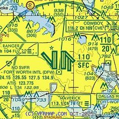
| Sectional chart |
|---|
|
 Download PDF
of official airport diagram from the FAA
| Airport distance calculator |
|---|
|
|
| Sunrise and sunset |
|---|
|
Times for 22-May-2025
| | Local
(UTC-5) | | Zulu
(UTC) |
|---|
| Morning civil twilight | | 05:58 | | 10:58 |
| Sunrise | | 06:26 | | 11:26 |
| Sunset | | 20:24 | | 01:24 |
| Evening civil twilight | | 20:52 | | 01:52 |
|
| Current date and time |
|---|
| Zulu (UTC) | 22-May-2025 07:47:02 |
|---|
| Local (UTC-5) | 22-May-2025 02:47:02 |
|---|
|
| METAR |
|---|
| KDFW | 220653Z 17007KT 10SM CLR 22/12 A2992 RMK AO2 SLP124 T02170117
|
KDAL
10nm E | 220653Z 16005KT 10SM CLR 24/12 A2994 RMK AO2 SLP130 T02440122
|
KGPM
12nm S | 220735Z AUTO 21004KT 10SM CLR 22/12 A2996 RMK AO2 T02220124
|
KADS
12nm E | 220735Z AUTO VRB04KT 10SM CLR 25/13 A2994 RMK AO2
|
KGKY
14nm S | 220653Z AUTO 15007KT 10SM CLR 20/13 A2994 RMK AO2 SLP129 T02000128
|
KAFW
15nm W | 220653Z 18004KT 10SM CLR 21/12 A2994 RMK AO2 SLP124 T02110117 $
|
KRBD
15nm SE | 220653Z AUTO 16009KT 10SM CLR 20/13 A2994 RMK AO2 SLP129 T02000128
|
KFTW
17nm W | 220653Z 16006KT 10SM R16/2600VP6000FT CLR 20/12 A2994 RMK AO2 SLP129 T02000122
|
KDTO
20nm NW | 220653Z AUTO 00000KT 10SM CLR 16/14 A2994 RMK AO2 SLP132 T01560139
|
|
| TAF |
|---|
| KDFW | 220524Z 2206/2312 16007KT P6SM FEW250 FM221100 17006KT P6SM BKN015 TEMPO 2212/2216 BKN009 FM221700 16008KT P6SM SCT025 FM222300 11015KT P6SM VCTS SCT050CB BKN150 TEMPO 2300/2302 VRB30G40KT 3SM TSRA BKN050CB FM230300 02007KT P6SM BKN150
|
KDAL
10nm E | 220524Z 2206/2306 16007KT P6SM FEW250 FM221100 17006KT P6SM BKN015 TEMPO 2212/2216 BKN009 FM221700 16008KT P6SM SCT025 FM222300 11015KT P6SM VCTS SCT050CB BKN150 TEMPO 2300/2302 VRB30G40KT 3SM TSRA BKN050CB FM230300 02007KT P6SM BKN150
|
KGKY
14nm S | 220524Z 2206/2306 16007KT P6SM FEW250 FM221100 17006KT P6SM BKN015 TEMPO 2212/2216 BKN009 FM221700 16008KT P6SM SCT025 FM222300 11015KT P6SM VCTS SCT050CB BKN150 TEMPO 2300/2302 VRB30G40KT 3SM TSRA BKN050CB FM230300 02007KT P6SM BKN150
|
KAFW
15nm W | 220524Z 2206/2306 16007KT P6SM FEW250 FM221100 17006KT P6SM BKN015 TEMPO 2212/2216 BKN009 FM221700 16008KT P6SM SCT025 FM222300 11015KT P6SM VCTS SCT050CB BKN150 TEMPO 2300/2302 VRB30G40KT 3SM TSRA BKN050CB FM230300 02007KT P6SM BKN150
|
KFTW
17nm W | 220524Z 2206/2306 16007KT P6SM FEW250 FM221100 17006KT P6SM BKN015 TEMPO 2212/2216 BKN009 FM221700 16008KT P6SM SCT025 FM222300 11015KT P6SM VCTS SCT050CB BKN150 TEMPO 2300/2302 VRB30G40KT 3SM TSRA BKN050CB FM230300 02007KT P6SM BKN150
|
|
| NOTAMs |
|---|
NOTAMs are issued by the DoD/FAA and will open in a separate window not controlled by AirNav.
|
|


