FAA INFORMATION EFFECTIVE 25 DECEMBER 2025
Location
| FAA Identifier: | AID |
| Lat/Long: | 40-06-31.0000N 085-36-46.8000W
40-06.516667N 085-36.780000W
40.1086111,-85.6130000
(estimated) |
| Elevation: | 919.1 ft. / 280.1 m (surveyed) |
| Variation: | 03W (1985) |
| From city: | 3 miles E of ANDERSON, IN |
| Time zone: | UTC -5 (UTC -4 during Daylight Saving Time) |
| Zip code: | 46017 |
Airport Operations
| Airport use: | Open to the public |
| Activation date: | 10/1959 |
| Control tower: | yes |
| ARTCC: | INDIANAPOLIS CENTER |
| FSS: | TERRE HAUTE FLIGHT SERVICE STATION |
| NOTAMs facility: | AID (NOTAM-D service available) |
| Attendance: | MON-FRI 0700-1800, ALL SAT-SUN ON CALL
UNATNDD MARTIN LUTHER KING, PRES, ELECTION, EASTER, MEMORIAL, INDEPENDENCE, LABOR, VETERANS, THANKSGIVING, CHRISTMAS, NEW YEARS DAYS & GOOD FRIDAY; AFT HR - AMGR. |
| Wind indicator: | lighted |
| Segmented circle: | yes |
| Lights: | WHEN TWR CLSD ACTVT MALSF RWY 30; PAPI RWY 12 & 18; MIRL RWY 12/30 & 18/36 - CTAF. |
| Beacon: | white-green (lighted land airport)
Operates sunset to sunrise. |
Airport Communications
| CTAF: | 126.0 |
| UNICOM: | 122.95 |
| WX AWOS-3: | 128.55 (765-442-1245) |
| ANDERSON GROUND: | 121.6 [0830-1630 MON-SAT] |
| ANDERSON TOWER: | 126.0 [0830-1630 MON-SAT] |
| INDIANAPOLIS APPROACH: | 120.65 |
| INDIANAPOLIS DEPARTURE: | 120.65 |
| WX ASOS at MIE (13 nm NE): | 114.4 (765-288-9617) |
| WX AWOS-3 at UWL (19 nm SE): | 132.375 (765-422-5701) |
- APCH/DEP SVC PRVDD BY INDIANAPOLIS TRACON ON FREQS 120.65/317.8.
Nearby radio navigation aids
| VOR radial/distance | | VOR name | | Freq | | Var |
|---|
| MIEr235/12.7 | | MUNCIE VOR/DME | | 114.40 | | 03W |
| MZZr176/23.3 | | MARION VOR/DME | | 108.60 | | 03W |
| SHBr018/30.2 | | SHELBYVILLE VOR/DME | | 116.15 | | 01E |
| VHPr062/38.9 | | BRICKYARD VORTAC | | 116.30 | | 01E |
| NDB name | | Hdg/Dist | | Freq | | Var | | ID |
|---|
| VIDEO | | 300/5.2 | | 394 | | 03W | | AI | .- .. |
| BALLL | | 255/14.1 | | 365 | | 03W | | JN | .--- -. |
| NEW CASTLE | | 321/19.3 | | 385 | | 06W | | UWL | ..- .-- .-.. |
Airport Services
| Fuel available: | 100LL JET-A MOGAS |
| Parking: | hangars and tiedowns |
| Airframe service: | MAJOR |
| Powerplant service: | MAJOR |
| Bulk oxygen: | NONE |
Runway Information
Runway 12/30
| Dimensions: | 5400 x 100 ft. / 1646 x 30 m |
| Surface: | asphalt/grooved, in excellent condition |
| Weight bearing capacity: | | PCN 44 /F/C/Y/T | | Single wheel: | 112.0 | | Double wheel: | 158.0 | | Double tandem: | 279.0 |
|
| Runway edge lights: | medium intensity |
| RUNWAY 12 | | RUNWAY 30 |
| Latitude: | 40-06.716773N | | 40-06.340428N |
| Longitude: | 085-37.376338W | | 085-36.327037W |
| Elevation: | 880.1 ft. | | 919.0 ft. |
| Traffic pattern: | left | | left |
| Runway heading: | 118 magnetic, 115 true | | 298 magnetic, 295 true |
| Displaced threshold: | no | | 80 ft. |
| Markings: | precision, in good condition | | precision, in good condition |
| Visual slope indicator: | 4-light PAPI on left (3.00 degrees glide path) | | 4-light PAPI on left (3.00 degrees glide path) |
| Approach lights: | | | MALSF: 1,400 foot medium intensity approach lighting system with sequenced flashers |
| Runway end identifier lights: | yes | | no |
| Touchdown point: | yes, no lights | | yes, no lights |
| Instrument approach: | | | ILS |
| Obstructions: | 117 ft. trees, 1831 ft. from runway, 519 ft. right of centerline, 13:1 slope to clear | | 50 ft. trees, 1700 ft. from runway, 30 ft. left of centerline, 30:1 slope to clear
APCH RATIO 35:1 TO DSPLCD THR. |
Runway 18/36
| Dimensions: | 3399 x 75 ft. / 1036 x 23 m |
| Surface: | asphalt/grooved, in good condition |
| Weight bearing capacity: | | PCN 14 /F/C/Y/T | | Single wheel: | 38.5 | | Double wheel: | 56.5 |
|
| Runway edge lights: | medium intensity |
| Operational restrictions: | NOT AVBL TO ACR MORE THAN 30 PAX SEATS. |
| RUNWAY 18 | | RUNWAY 36 |
| Latitude: | 40-06.778417N | | 40-06.218647N |
| Longitude: | 085-36.665838W | | 085-36.664383W |
| Elevation: | 912.7 ft. | | 908.0 ft. |
| Traffic pattern: | left | | left |
| Runway heading: | 183 magnetic, 180 true | | 003 magnetic, 360 true |
| Displaced threshold: | 291 ft. | | 288 ft. |
| Declared distances: | LDA:3108 | | LDA:3111 |
| Markings: | basic, in fair condition | | basic, in fair condition |
| Visual slope indicator: | 2-light PAPI on left (3.00 degrees glide path) | | |
| Runway end identifier lights: | no | | no |
| Touchdown point: | yes, no lights | | yes, no lights |
| Obstructions: | 63 ft. tree, 1314 ft. from runway, 134 ft. right of centerline, 17:1 slope to clear
11 FT RD 170 FT FM RWY END. | | 98 ft. trees, 1900 ft. from runway, 100 ft. left of centerline, 17:1 slope to clear
APCH RATIO 22:1 TO DSPLCD THR. |
Airport Ownership and Management from official FAA records
| Ownership: | Publicly-owned |
| Owner: | CITY OF ANDERSON
282 AIRPORT RD
ANDERSON, IN 46017
Phone 765-648-6293 |
| Manager: | BRIAN MCMILLEN
282 AIRPORT RD.
ANDERSON, IN 46017
Phone 765-648-6292 |
Additional Remarks
| - | DEP RWY 12, 18 & 36 UN TO SEE EACH OTHER. |
| - | DEER ON & INVOF ARPT. |
| - | TWY B CLSD INDEFLY. |
| - | WHEN ATCT IS CLSD FOR CD CTC INDIANAPOLIS APCH AT 317-227-5743. |
| - | GND COM OUTLET 121.725 COMMISSIONED KEY FREQ 4 TIMES. |
| - | TRML NOT STAFFED ON SUNDAYS - AMGR. |
| - | SELF SERVE FUEL AVBL H24. |
Instrument Procedures
NOTE: All procedures below are presented as PDF files. If you need a reader for these files, you should download the free Adobe Reader.NOT FOR NAVIGATION. Please procure official charts for flight.
FAA instrument procedures published for use from 25 December 2025 at 0901z to 22 January 2026 at 0900z.
IAPs - Instrument Approach Procedures |
|---|
| ILS OR LOC RWY 30 | |
download (216KB) |
| RNAV (GPS) RWY 12 | |
download (215KB) |
| RNAV (GPS) RWY 30 | |
download (248KB) |
| NOTE: Special Alternate Minimums apply | |
download (169KB) |
| NOTE: Special Take-Off Minimums/Departure Procedures apply | |
download (479KB) |
Other nearby airports with instrument procedures:
KMIE - Delaware County Regional Airport (13 nm NE)
KUWL - New Castle Henry County Airport / Marlatt Field (19 nm SE)
KMQJ - Indianapolis Regional Airport (21 nm SW)
KUMP - Indianapolis Metro Airport (22 nm SW)
KMZZ - Marion Municipal Airport - McKinney Field (23 nm N)
|
|

Road maps at:
MapQuest
Bing
Google
| Aerial photo |
|---|
WARNING: Photo may not be current or correct

Do you have a better or more recent aerial photo of Anderson Regional Airport that you would like to share? If so, please send us your photo.
|
| Sectional chart |
|---|
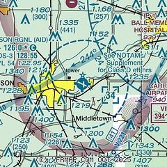
|
| Airport distance calculator |
|---|
|
|
| Sunrise and sunset |
|---|
|
Times for 27-Dec-2025
| | Local
(UTC-5) | | Zulu
(UTC) |
|---|
| Morning civil twilight | | 07:34 | | 12:34 |
| Sunrise | | 08:05 | | 13:05 |
| Sunset | | 17:22 | | 22:22 |
| Evening civil twilight | | 17:53 | | 22:53 |
|
| Current date and time |
|---|
| Zulu (UTC) | 28-Dec-2025 01:57:53 |
|---|
| Local (UTC-5) | 27-Dec-2025 20:57:53 |
|---|
|
| METAR |
|---|
| KAID | 280155Z AUTO 12007KT 3SM BR OVC004 07/07 A2994 RMK AO2 T00730065
|
KMIE
12nm NE | 280153Z 14007KT 2 1/2SM BR OVC002 08/06 A2993 RMK AO2 SLP138 T00780061
|
KUWL
19nm SE | 280130Z AUTO 12011KT 3SM BR OVC003 07/07 A2995 RMK A01
|
|
| TAF |
|---|
KIND
39nm SW | 271720Z 2718/2824 11005KT P6SM OVC008 FM272200 12008KT P6SM BKN015 FM280800 18010KT 5SM BR VCSH OVC008 FM281200 21014G21KT P6SM OVC008 FM281800 21019G30KT P6SM BKN015
|
KGUS
40nm NW | 272200Z 2722/2904 16010KT 9999 OVC006 QNH2978INS BECMG 2809/2810 17008KT 6000 SHRA BR OVC005 QNH2962INS TEMPO 2814/2417 17012KT 3200 SHRA VCTS OVC005CB BECMG 2818/2819 20015G25KT 9000 -SHRA BKN005 OVC010CB QNH2944INS BECMG 2900/2901 22020G30KT 9999 NSW SCT005 OVC015 QNH2942INS TX16/2818Z TN06/2800Z
|
|
| NOTAMs |
|---|
NOTAMs are issued by the DoD/FAA and will open in a separate window not controlled by AirNav.
|
|

