FAA INFORMATION EFFECTIVE 16 APRIL 2026
Location
| FAA Identifier: | AVL |
| Lat/Long: | 35-26-10.0070N 082-32-31.3710W
35-26.166783N 082-32.522850W
35.4361131,-82.5420475
(estimated) |
| Elevation: | 2163.9 ft. / 659.6 m (surveyed) |
| Variation: | 07W (2020) |
| From city: | 9 miles S of ASHEVILLE, NC |
| Time zone: | UTC -4 (UTC -5 during Standard Time) |
| Zip code: | 28704 |
Airport Operations
| Airport use: | Open to the public |
| Activation date: | 01/1961 |
| Control tower: | yes |
| ARTCC: | ATLANTA CENTER |
| FSS: | RALEIGH FLIGHT SERVICE STATION |
| NOTAMs facility: | AVL (NOTAM-D service available) |
| Attendance: | CONTINUOUS |
| Wind indicator: | lighted |
| Segmented circle: | yes |
| Lights: | WHEN TWR CLSD, ACTVT MALSR RWY 17 & 35; PAPI RWYS 17 & 35; HIRLS RWY 17/35 - CTAF. |
| Beacon: | white-green (lighted land airport)
Operates sunset to sunrise. |
| Fire and rescue: | ARFF index B |
| Airline operations: | PPR FOR UNSKED ACR OPNS WITH MORE THAN 30 PSGR SEATS 0400-1200Z; CALL APRT COMM 828-684-4577. |
Airport Communications
| CTAF: | 121.1 |
| UNICOM: | 122.95 |
| ATIS: | 120.2 |
| WX ASOS: | PHONE 828-202-3316 |
| ASHEVILLE GROUND: | 121.9 [0630-2300] |
| ASHEVILLE TOWER: | 121.1 257.8 [0630-2300] |
| ASHEVILLE APPROACH: | 124.65 ;080-299 125.8 ;300-079 269.575 ;300-079 351.8 ;080-299 [0630-2300] |
| ASHEVILLE DEPARTURE: | 124.65 ;080-299 125.8 ;300-079 269.575 ;300-079 351.8 ;080-299 [0630-2300] |
| ASHEVILLE DP: | 124.65 ;RWY 17 125.8 ;RWY 35 269.575 ;RWY 35 351.8 ;RWY 17 |
| CLASS C: | 124.65 ;080-299 125.8 ;300-079 269.575 ;300-079 351.8 ;080-299 |
| EMERG: | 121.5 243.0 |
| IC: | 124.65 ;080-299 351.8 ;080-299 |
- COMM UNAVBL BLO 6000 FT EXCP BY RDU RADIO ON FREQ 122.3 (SUGARLOAF MOUNTAIN RCO) WHEN AVL APCH CTL CLSD.
- APCH/DEP SVC PRVDD BY ATLANTA ARTCC ON FREQS 132.625/353.625 (SUGARLOAF MOUNTAIN RCAG) WHEN APCH CTL CLSD.
Nearby radio navigation aids
| VOR radial/distance | | VOR name | | Freq | | Var |
|---|
| SUGr280/13.5 | | SUGARLOAF MOUNTAIN VORTAC | | 112.20 | | 02W |
| SOTr134/32.7 | | SNOWBIRD VORTAC | | 108.80 | | 04W |
| SPAr311/38.6 | | SPARTANBURG VORTAC | | 115.70 | | 02W |
| NDB name | | Hdg/Dist | | Freq | | Var | | ID |
|---|
| KEANS | | 166/6.2 | | 357 | | 07W | | IM | .. -- |
| BROAD RIVER | | 347/10.4 | | 379 | | 07W | | BRA | -... .-. .- |
Airport Services
| Fuel available: | 100LL JET-A |
| Parking: | hangars and tiedowns |
| Airframe service: | MINOR |
| Powerplant service: | MINOR |
| Bottled oxygen: | HIGH |
| Bulk oxygen: | NONE |
Runway Information
Runway 17/35
| Dimensions: | 8002 x 150 ft. / 2439 x 46 m |
| Surface: | asphalt/grooved, in excellent condition |
| Weight bearing capacity: | | Single wheel: | 120.0 | | Double wheel: | 219.0 | | Double tandem: | 404.0 | | Dual double tandem: | 837.0 |
|
| Runway edge lights: | high intensity |
| RUNWAY 17 | | RUNWAY 35 |
| Latitude: | 35-26.785738N | | 35-25.547805N |
| Longitude: | 082-32.800792W | | 082-32.244983W |
| Elevation: | 2163.9 ft. | | 2117.4 ft. |
| Traffic pattern: | left | | right
RWY 35 RIGHT TRAFFIC WHEN ATCT CLSD. |
| Runway heading: | 167 magnetic, 160 true | | 347 magnetic, 340 true |
| Declared distances: | TORA:8002 TODA:8002 ASDA:8002 LDA:8002 | | TORA:8002 TODA:8002 ASDA:8002 LDA:8002 |
| Markings: | precision, in good condition | | precision, in good condition |
| Visual slope indicator: | 4-light PAPI on right (3.00 degrees glide path) | | 4-light PAPI on left (3.00 degrees glide path) |
| RVR equipment: | touchdown, rollout | | touchdown, rollout |
| Approach lights: | MALSR: 1,400 foot medium intensity approach lighting system with runway alignment indicator lights | | MALSR: 1,400 foot medium intensity approach lighting system with runway alignment indicator lights |
| Runway end identifier lights: | no | | no |
| Centerline lights: | yes | | yes |
| Touchdown point: | yes, no lights | | yes, lighted |
| Instrument approach: | ILS/DME | | ILS/DME |
Airport Ownership and Management from official FAA records
| Ownership: | Publicly-owned |
| Owner: | GREATER ASHEVILLE RGNL ARPT AUTH.
61 TERMINAL DR SUITE 1
FLETCHER, NC 28732-9442
Phone 828-684-2226 |
| Manager: | LEW S. BLEIWEIS, A.A.E.
61 TERMINAL DRIVE; SUITE 1
FLETCHER, NC 28731-9442
Phone 828-684-4577
(828) 684-4577 OR EMERG CTC - (828) 209-5100. |
Additional Remarks
| A39-17/35 | PCR VALUE: 440/F/A/X/T |
| - | FOR THE ASHEVILLE REGIONAL AIRPORT AIRCRAFT DIVERSIONS EMERGENCY CONTINGENCY PLAN AND FACILITY CONSTRAINTS CTC ARPT ADMIN AT 828-684-2226. |
| - | FLOCKS OF MIGRATORY BIRDS ON AND INVOF ARPT. |
| - | WHEN ATCT CLSD, FOR CD CTC ATLANTA ARTCC AT 770-210-7692. |
Instrument Procedures
NOTE: All procedures below are presented as PDF files. If you need a reader for these files, you should download the free Adobe Reader.NOT FOR NAVIGATION. Please procure official charts for flight.
FAA instrument procedures published for use from 16 April 2026 at 0901Z to 14 May 2026 at 0900Z.
IAPs - Instrument Approach Procedures |
|---|
| ILS OR LOC RWY 17 | |
download (378KB) |
| ILS OR LOC RWY 35 | |
download (351KB) |
| RNAV (GPS) RWY 17 | |
download (422KB) |
| RNAV (GPS) RWY 35 | |
download (435KB) |
| NOTE: Special Alternate Minimums apply | |
download (171KB) |
Departure Procedures |
|---|
| ASHEVILLE SEVEN | |
download (180KB) |
| NOTE: Special Take-Off Minimums/Departure Procedures apply | |
download (397KB) |
Other nearby airports with instrument procedures:
KFQD - Rutherford County Airport/Marchman Field (30 nm E)
24A - Jackson County Airport (33 nm W)
KGSP - Greenville Spartanburg International Airport (36 nm SE)
KGMU - Greenville Downtown Airport (37 nm S)
KLQK - Pickens County Airport (38 nm S)
|
|

Road maps at:
MapQuest
Bing
Google
| Aerial photo |
|---|
WARNING: Photo may not be current or correct
 Photo by William C Harris, Gladstone, NJ
Photo taken 21-Apr-2019
looking north.
Photo by William C Harris, Gladstone, NJ
Photo taken 21-Apr-2019
looking north.
Do you have a better or more recent aerial photo of Asheville Regional Airport that you would like to share? If so, please send us your photo.
|
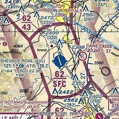
| Sectional chart |
|---|
|
 Download PDF
of official airport diagram from the FAA
| Airport distance calculator |
|---|
|
|
| Sunrise and sunset |
|---|
|
Times for 05-May-2026
| | Local
(UTC-4) | | Zulu
(UTC) |
|---|
| Morning civil twilight | | 06:08 | | 10:08 |
| Sunrise | | 06:35 | | 10:35 |
| Sunset | | 20:18 | | 00:18 |
| Evening civil twilight | | 20:46 | | 00:46 |
|
| Current date and time |
|---|
| Zulu (UTC) | 05-May-2026 16:12:41 |
|---|
| Local (UTC-4) | 05-May-2026 12:12:41 |
|---|
|
| METAR |
|---|
| KAVL | 051554Z 22011KT 10SM CLR 22/05 A3003 RMK AO2 SLP149 T02170050
|
|
| TAF |
|---|
| KAVL | 051136Z 0512/0612 17003KT P6SM FEW250 FM051500 20007KT P6SM FEW250 FM051700 20013G25KT P6SM FEW150 SCT250 FM060000 18009G16KT P6SM SCT100 BKN200 FM060500 17007KT P6SM SCT100 WS020/20035KT FM060900 20006KT P6SM VCSH BKN080 WS020/20035KT
|
|
| NOTAMs |
|---|
NOTAMs are issued by the DoD/FAA and will open in a separate window not controlled by AirNav.
|
|


