FAA INFORMATION EFFECTIVE 16 APRIL 2026
Location
| FAA Identifier: | LOM |
| Lat/Long: | 40-08-15.2000N 075-15-54.5000W
40-08.253333N 075-15.908333W
40.1375556,-75.2651389
(estimated) |
| Elevation: | 301.5 ft. / 91.9 m (surveyed) |
| Variation: | 12W (2005) |
| From city: | 3 miles NW of PHILADELPHIA, PA |
| Time zone: | UTC -4 (UTC -5 during Standard Time) |
| Zip code: | 19422 |
Airport Operations
| Airport use: | Open to the public |
| Activation date: | 12/1937 |
| Control tower: | no |
| ARTCC: | NEW YORK CENTER |
| FSS: | WILLIAMSPORT FLIGHT SERVICE STATION |
| NOTAMs facility: | LOM (NOTAM-D service available) |
| Attendance: | 0600-2200 |
| Wind indicator: | lighted |
| Segmented circle: | yes |
| Lights: | DUSK-DAWN. ACTIVATE MIRL RYS 06/24, PAPI & REIL RYS 06 & 24 - CTAF |
| Beacon: | white-green (lighted land airport)
Operates sunset to sunrise. |
Airport Communications
| CTAF/UNICOM: | 123.0 |
| WX AWOS-3: | 118.925 (215-646-1068) |
| PHILADELPHIA APPROACH: | 126.85 |
| PHILADELPHIA DEPARTURE: | 126.85 |
| CLEARANCE DELIVERY: | 118.55 |
| WX ASOS at PNE (12 nm E): | PHONE 215-897-9068 |
| WX ASOS at DYL (13 nm NE): | 118.875 (215-345-0392) |
| WX ASOS at PTW (15 nm NW): | 119.425 (610-495-0823) |
| WX AWOS-3 at CKZ (15 nm N): | 126.325 (215-257-7291) |
| WX ASOS at PHL (16 nm S): | 133.4 (215-492-9617) |
| WX AWOS-3T at OQN (17 nm SW): | 121.4 ((610) 692-6190) |
| WX AWOS-3 at UKT (19 nm N): | 119.475 (215-538-7610) |
- CLEARANCE DELIVERY PHILADELPHIA APCH TF 800-354-9884.
Nearby radio navigation aids
| VOR radial/distance | | VOR name | | Freq | | Var |
|---|
| PTWr120/14.5 | | POTTSTOWN VORTAC | | 116.50 | | 09W |
| ARDr257/17.8 | | YARDLEY VOR/DME | | 108.20 | | 10W |
| MXEr064/22.8 | | MODENA VORTAC | | 113.20 | | 09W |
| OODr013/30.1 | | WOODSTOWN VORTAC | | 112.80 | | 10W |
| GXUr296/31.6 | | MC GUIRE VORTAC | | 110.60 | | 12W |
| DQOr040/31.7 | | DUPONT VORTAC | | 114.00 | | 10W |
| ETXr153/32.8 | | EAST TEXAS VOR/DME | | 110.20 | | 09W |
| RBVr274/35.5 | | ROBBINSVILLE VORTAC | | 113.80 | | 10W |
| SBJr232/35.9 | | SOLBERG VOR/DME | | 112.90 | | 10W |
| FJCr176/36.4 | | ALLENTOWN VORTAC | | 117.50 | | 10W |
| VCNr349/38.5 | | CEDAR LAKE VOR/DME | | 115.20 | | 10W |
Airport Services
| Fuel available: | 100LL JET-A |
| Parking: | hangars and tiedowns |
| Airframe service: | MAJOR |
| Powerplant service: | MAJOR |
| Bulk oxygen: | HIGH/LOW |
Runway Information
Runway 6/24
| Dimensions: | 3700 x 75 ft. / 1128 x 23 m |
| Surface: | asphalt, in good condition |
| Weight bearing capacity: | |
| Runway edge lights: | medium intensity |
| RUNWAY 6 | | RUNWAY 24 |
| Latitude: | 40-08.070930N | | 40-08.436810N |
| Longitude: | 075-16.225372W | | 075-15.590463W |
| Elevation: | 301.5 ft. | | 278.7 ft. |
| Traffic pattern: | left | | left |
| Runway heading: | 065 magnetic, 053 true | | 245 magnetic, 233 true |
| Displaced threshold: | 177 ft. | | no |
| Markings: | nonprecision, in good condition | | nonprecision, in good condition |
| Visual slope indicator: | 2-light PAPI on left (3.00 degrees glide path) | | 2-light PAPI on left (3.00 degrees glide path) |
| Runway end identifier lights: | yes | | yes |
| Touchdown point: | yes, no lights | | yes, no lights |
| Obstructions: | 19 ft. pole, 241 ft. from runway, 175 ft. right of centerline, 2:1 slope to clear
ROAD 138 FT FM RWY END, ACRS CNTLRN. 22 FT POLE 169 FT FM RWY END 233 FT RIGHT. 32 FT OBST LT 77 FT FM RWY END 139 FT RIGHT. 17 FT OBS LT 56 FT FM RWY END 133 FT LEFT. | | 54 ft. trees, 698 ft. from runway, 282 ft. right of centerline, 9:1 slope to clear |
Airport Ownership and Management from official FAA records
| Ownership: | Privately-owned |
| Owner: | WINGS FIELD PRESERVATION ASSOC
1501 NARCISSA RD
BLUE BELL, PA 19422
Phone (215) 646-0400 |
| Manager: | PERCELL BERRY
1501 NARCISSA RD
BLUE BELL, PA 19422
Phone 215-646-0400
ALT CTC: 215-515-7356; LOMFRONTDESK@FLYADVANCED.COM |
Additional Remarks
| - | FOR CD CTC PHILADELPHIA APCH AT 800-354-9884. |
| - | RWY 6/24 NO TGLS. |
| - | NOISE ABATEMENT RYS 06 & 24 - NO TURNS AFTER TKOF BEFORE 1000 FT AGL. AVOID OVERFLIGHT OF SCHOOLS EAST & WEST OF ARPT. |
| - | LARGE FLOCKS OF GEESE ON & INVOF ARPT. |
| - | DEER ON & INVOF ARPT. |
| - | FOR SVC AFTER HRS CTC AMGR BY PHONE OR EMAIL. |
| - | PPR ALL ACFT EXCEEDING 12,500 LBS TKOF GROS WEIGHT OR ABOVE CALL 215-646-0400. |
Instrument Procedures
NOTE: All procedures below are presented as PDF files. If you need a reader for these files, you should download the free Adobe Reader.NOT FOR NAVIGATION. Please procure official charts for flight.
FAA instrument procedures published for use from 16 April 2026 at 0901Z to 14 May 2026 at 0900Z.
IAPs - Instrument Approach Procedures |
|---|
| RNAV (GPS) RWY 06 | |
download (240KB) |
| RNAV (GPS) RWY 24 | |
download (220KB) |
| NOTE: Special Alternate Minimums apply | |
download (123KB) |
| NOTE: Special Take-Off Minimums/Departure Procedures apply | |
download (428KB) |
Other nearby airports with instrument procedures:
KPNE - Northeast Philadelphia Airport (12 nm E)
KDYL - Doylestown Airport (13 nm NE)
KPTW - Heritage Field Airport (15 nm NW)
KCKZ - Pennridge Airport (15 nm N)
KPHL - Philadelphia International Airport (16 nm S)
KOQN - Brandywine Regional Airport (17 nm SW)
KUKT - Quakertown Airport (19 nm N)
N47 - Pottstown Municipal Airport (20 nm W)
|
|

Road maps at:
MapQuest
Bing
Google
| Aerial photo |
|---|
WARNING: Photo may not be current or correct
 Photo taken 14-Jun-2004
Do you have a better or more recent aerial photo of Wings Field Airport that you would like to share? If so, please send us your photo.
|
| Sectional chart |
|---|
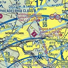
|
| Airport distance calculator |
|---|
|
|
| Sunrise and sunset |
|---|
|
Times for 25-Apr-2026
| | Local
(UTC-4) | | Zulu
(UTC) |
|---|
| Morning civil twilight | | 05:41 | | 09:41 |
| Sunrise | | 06:10 | | 10:10 |
| Sunset | | 19:48 | | 23:48 |
| Evening civil twilight | | 20:17 | | 00:17 |
|
| Current date and time |
|---|
| Zulu (UTC) | 25-Apr-2026 16:19:49 |
|---|
| Local (UTC-4) | 25-Apr-2026 12:19:49 |
|---|
|
| METAR |
|---|
| KLOM | 251550Z AUTO 10012G16KT 10SM BKN024 OVC042 10/04 A3000 RMK AO2 T00950041
|
KPNE
12nm E | 251554Z 11013G23KT 10SM OVC045 10/05 A3002 RMK AO2 SLP166 T01000050
|
KDYL
14nm NE | 251554Z AUTO 10SM FEW025 OVC045 11/04 A3000 RMK AO2 SLP160 T01060039
|
KPTW
14nm NW | 251554Z AUTO 10010G19KT 10SM OVC041 10/05 A3000 RMK AO2 SLP155 T01000050
|
KCKZ
15nm N | 251555Z AUTO VRB05G12KT 10SM SCT025 BKN029 OVC043 09/04 A3000 RMK AO2
|
KPHL
16nm S | 251554Z 10013G19KT 10SM FEW032 OVC042 12/04 A2999 RMK AO2 SLP154 T01220039 $
|
KOQN
17nm SW | 251555Z AUTO 12010G14KT 088V148 10SM OVC036 11/03 A2998 RMK AO2
|
KUKT
19nm N | 251555Z AUTO 08010G15KT 10SM SCT027 OVC044 10/05 A2999 RMK AO2
|
|
| TAF |
|---|
KPNE
12nm E | 251120Z 2512/2612 10010KT P6SM BKN060 FM251300 11010G18KT P6SM VCSH OVC045 FM251500 11012G20KT 6SM -RA BR OVC025 FM251900 11012G20KT 4SM -RA BR OVC015 FM252100 10010G18KT 3SM -RA BR OVC008 FM260000 08012G18KT 3SM -RA BR OVC006 FM261000 06012G20KT 6SM -RA BR OVC008
|
KPHL
16nm S | 251403Z 2514/2618 09010G18KT P6SM SCT025 OVC040 FM251600 11012G20KT P6SM VCSH OVC025 FM251900 11012G20KT 6SM -RA BR OVC015 FM252100 10012G20KT 4SM -RA BR OVC008 FM260000 07010G18KT 3SM -RA BR OVC006 FM261200 04012G20KT P6SM VCSH OVC008
|
|
| NOTAMs |
|---|
NOTAMs are issued by the DoD/FAA and will open in a separate window not controlled by AirNav.
|
|


