FAA INFORMATION EFFECTIVE 14 MAY 2026
Location
| FAA Identifier: | VKX |
| Lat/Long: | 38-44-55.1100N 076-57-21.3200W
38-44.918500N 076-57.355333W
38.7486417,-76.9559222
(estimated) |
| Elevation: | 117.7 ft. / 36 m (estimated) |
| Variation: | 11W (2000) |
| Time zone: | UTC -4 (UTC -5 during Standard Time) |
| Zip code: | 20744 |
Airport Operations
| Airport use: | Open to the public |
| Activation date: | 06/1958 |
| Control tower: | no |
| ARTCC: | WASHINGTON CENTER |
| FSS: | LEESBURG FLIGHT SERVICE STATION |
| NOTAMs facility: | DCA (NOTAM-D service available) |
| Attendance: | 0700-2200 |
| Wind indicator: | lighted |
| Segmented circle: | yes |
| Lights: | MIRL RWY 06/24 OPR SS-SR; TO ACTVT OTR TIMES AND ACTVT PAPI RWY 06 & 24 - CTAF. |
| Beacon: | white-green (lighted land airport)
ROTG BCN LOCATED 1000 FT N OF ARPT. Operates sunset to sunrise. |
Airport Communications
| CTAF/UNICOM: | 122.8 |
| POTOMAC APPROACH: | 124.7 ;DC FRZ 125.65 ;DC FRZ |
| POTOMAC DEPARTURE: | 124.7 ;DC FRZ 125.65 ;DC FRZ |
| IRONS STAR: | 126.4 |
| TIKEE STAR: | 120.45 |
| WX ASOS at DCA (7 nm NW): | 132.65 (276-200-0159) |
| WX AWOS-3 at CGS (14 nm N): | 121.225 (301-864-5497) |
- AUTOMATED UNICOM; 3 CLICKS ADZY & WX, 4 CLICKS RADIO CHECK.
Nearby radio navigation aids
| VOR radial/distance | | VOR name | | Freq | | Var |
|---|
| ADWr240/5.5 | | ANDREWS VORTAC | | 113.10 | | 10W |
| DCAr159/7.6 | | WASHINGTON VOR/DME | | 111.00 | | 09W |
| AMLr123/26.3 | | ARMEL VOR/DME | | 113.50 | | 08W |
| BALr219/28.8 | | BALTIMORE VORTAC | | 115.10 | | 11W |
| BRVr046/31.0 | | BROOKE VORTAC | | 114.50 | | 09W |
| NDB name | | Hdg/Dist | | Freq | | Var | | ID |
|---|
| OXONN | | 118/3.5 | | 332 | | 11W | | VQK | ...- --.- -.- |
| GEORGETOWN | | 153/13.4 | | 323 | | 09W | | GTN | --. - -. |
| ELLICOTT | | 205/33.4 | | 371 | | 11W | | FND | ..-. -. -.. |
| SHANNON | | 049/37.1 | | 237 | | 10W | | EZF | . --.. ..-. |
Airport Services
| Fuel available: | 100LL |
| Parking: | tiedowns |
| Airframe service: | MAJOR |
| Powerplant service: | MAJOR |
| Bottled oxygen: | NONE |
| Bulk oxygen: | NONE |
Runway Information
Runway 6/24
| Dimensions: | 2665 x 40 ft. / 812 x 12 m |
| Surface: | asphalt, in good condition |
| Runway edge lights: | medium intensity |
| Runway edge markings: | BASIC MKGS PLUS FIELD CARRIER LDG PRACTICE (FCLP) MKGS. |
| RUNWAY 6 | | RUNWAY 24 |
| Latitude: | 38-44.773000N | | 38-45.064000N |
| Longitude: | 076-57.565167W | | 076-57.145500W |
| Elevation: | 108.9 ft. | | 117.7 ft. |
| Traffic pattern: | left | | left |
| Runway heading: | 059 magnetic, 048 true | | 239 magnetic, 228 true |
| Displaced threshold: | 376 ft. | | 90 ft. |
| Markings: | nonprecision, in good condition | | NSTD, in good condition |
| Visual slope indicator: | 2-light PAPI on left (5.00 degrees glide path)
RWY 06 PAPI CNTRLN USE ONLY. | | 2-light PAPI on left (5.50 degrees glide path) |
| Runway end identifier lights: | yes | | yes |
| Touchdown point: | yes, no lights | | yes, no lights |
| Obstructions: | 102 ft. trees, 1074 ft. from runway, 189 ft. left of centerline, 8:1 slope to clear
RWY 06 HAS +60 FT TREES 240 FT R AT THR. | | 89 ft. trees, 1348 ft. from runway, 94 ft. left of centerline, 12:1 slope to clear
APCH SLOPE 15:1 AT CNTRLN TO DSPLCD THR. |
Airport Ownership and Management from official FAA records
| Ownership: | Privately-owned |
| Owner: | COPLEY INVESTMENTS
10 NEWBURY ST
BOSTON, MA 02116
Phone 617-267-6828 |
| Manager: | DAVID WARTOFSKY
10300 GLEN WAY
FORT WASHINGTON, MD 20744
Phone 301-248-5720 |
Additional Remarks
| - | UNLIMITED VEHICLE ACCESS TO ACFT MOVEMENT AREAS. |
| - | RENTALS AVBL AT 301-292-9700. |
| - | FOR CD CTC POTOMAC APCH AT 866-599-3874. |
| - | FRZ PILOTS MUST FILE FRZ SCTY FP THRU 703-771-3476. |
| - | SFRA OR IFR FP DOES NOT GRANT FRZ ASP ACES. |
| - | FOR ACES PILOT MUST BE PRE-APVD THRU TSA MD3 PROGRAM. TO APPLY FOR FRZ ACCESS, SEE ARPT WEBSITE. |
| - | VISITORS PLEASE TUNE 122.85 FOR PARKING INSTRUCTIONS & GND SVCS. |
| - | NOISE ABATEMENT PROCEDURES: AVOID TAKEOFF 2200-0700. |
| - | SECURITY: EXPECT 24 HR SURVEILLANCE: CIVIL & MIL, GROUND AND AIR. |
| - | ARPT WITHIN FLT RSTRD ZONE (FRZ). |
Instrument Procedures
NOTE: All procedures below are presented as PDF files. If you need a reader for these files, you should download the free Adobe Reader.NOT FOR NAVIGATION. Please procure official charts for flight.
FAA instrument procedures published for use from 14 May 2026 at 0901Z to 11 June 2026 at 0900Z.
STARs - Standard Terminal Arrivals |
|---|
| TIKEE FOUR (RNAV) **CHANGED** | |
download (220KB) |
IAPs - Instrument Approach Procedures |
|---|
| RNAV (GPS) RWY 06 | |
download (190KB) |
| NOTE: Special Take-Off Minimums/Departure Procedures apply | |
download (140KB) |
Other nearby airports with instrument procedures:
KADW - Joint Base Andrews (6 nm NE)
KDCA - Ronald Reagan Washington National Airport (7 nm NW)
2W5 - Maryland Airport (11 nm SW)
KDAA - Davison Army Airfield (11 nm W)
KCGS - College Park Airport (14 nm N)
W00 - Freeway Airport (14 nm NE)
|
|

Road maps at:
MapQuest
Bing
Google
| Aerial photo |
|---|
WARNING: Photo may not be current or correct
 Photo taken 19-Oct-2016
looking north.
Photo taken 19-Oct-2016
looking north.
Do you have a better or more recent aerial photo of Potomac Airfield that you would like to share? If so, please send us your photo.
|
| Sectional chart |
|---|
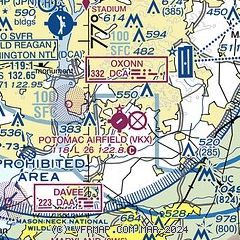
|
| Airport distance calculator |
|---|
|
|
| Sunrise and sunset |
|---|
|
Times for 18-May-2026
| | Local
(UTC-4) | | Zulu
(UTC) |
|---|
| Morning civil twilight | | 05:24 | | 09:24 |
| Sunrise | | 05:54 | | 09:54 |
| Sunset | | 20:14 | | 00:14 |
| Evening civil twilight | | 20:45 | | 00:45 |
|
| Current date and time |
|---|
| Zulu (UTC) | 18-May-2026 18:03:01 |
|---|
| Local (UTC-4) | 18-May-2026 14:03:01 |
|---|
|
| METAR |
|---|
KADW
6nm NE | 181755Z AUTO 17004KT 10SM CLR 34/16 A3014 RMK AO2 SLP210 T03400163 10342 20232 58011 $
|
KDCA
7nm NW | 181752Z 17010KT 10SM FEW050 FEW250 33/18 A3014 RMK AO2 SLP207 T03280178 10328 20217 58011
|
KDAA
10nm W | 181755Z AUTO 21007KT 10SM CLR 33/17 A3012 RMK AO2 SLP202 T03310172 10336 20211 57011 $
|
KCGS
14nm N | 181755Z AUTO 18005KT 10SM CLR 34/17 A3015 RMK AO2 T03370168 10338 20211
|
|
| TAF |
|---|
KADW
6nm NE | 181700Z 1817/1923 VRB06KT 9999 SKC QNH3008INS BECMG 1823/1824 18010KT 9999 FEW200 510103 QNH3009INS BECMG 1912/1913 23010KT 9999 SKC QNH3013INS BECMG 1916/1917 26006KT 9999 FEW250 QNH3001INS BECMG 1922/1923 18008KT 9999 FEW100 SCT250 QNH2999INS TX34/1819Z TN22/1909Z
|
KDCA
7nm NW | 181458Z 1815/1918 17006KT P6SM FEW160 BKN250 FM182000 19010G17KT P6SM FEW160 SCT250 FM190500 19007KT P6SM FEW250 FM191200 20005KT P6SM SKC
|
KDAA
10nm W | 181149Z 1812/1918 VRB06KT 9999 SKC QNH3012INS BECMG 1818/1819 19010G15KT 9999 SKC QNH3015INS TX35/1822Z TN21/1812Z
|
|
| NOTAMs |
|---|
NOTAMs are issued by the DoD/FAA and will open in a separate window not controlled by AirNav.
|
|

