FAA INFORMATION EFFECTIVE 09 JULY 2026
Location
| FAA Identifier: | BOS |
| Lat/Long: | 42-21-46.6000N 071-00-23.0000W
42-21.776667N 071-00.383333W
42.3629444,-71.0063889
(estimated) |
| Elevation: | 19.1 ft. / 5.8 m (surveyed) |
| Variation: | 15W (2020) |
| From city: | 1 mile E of BOSTON, MA |
| Time zone: | UTC -4 (UTC -5 during Standard Time) |
| Zip code: | 02128 |
Airport Operations
| Airport use: | Open to the public |
| Activation date: | 04/1940 |
| Control tower: | yes |
| ARTCC: | BOSTON CENTER |
| FSS: | BRIDGEPORT FLIGHT SERVICE STATION |
| NOTAMs facility: | BOS (NOTAM-D service available) |
| Attendance: | CONTINUOUS |
| Wind indicator: | lighted |
| Segmented circle: | no |
| Beacon: | white-green (lighted land airport)
Operates sunset to sunrise. |
| Landing fee: | yes |
| Fire and rescue: | ARFF index E |
| International operations: | customs landing rights airport |
Airport Communications
| UNICOM: | 122.95 |
| WX ASOS: | 135.0 (339-746-6855) |
| BOSTON GROUND: | 121.75 121.9 |
| BOSTON TOWER: | 124.725 ;HELICOPTERS 128.8 ;WEST 132.225 ;EAST 257.8 |
| BOSTON APPROACH: | 118.25 ;NORTH 120.6 ;WEST 127.2 ;SOUTH |
| BOSTON DEPARTURE: | 133.0 |
| CLEARANCE DELIVERY: | 121.65 257.8 |
| PRE-TAXI CLEARANCE: | 121.65 |
| CLASS B: | 124.1 ;091-269 124.4 ;270-090 |
| D-ATIS: | 135.0 ;ARR 135.0 ;DEP |
| EMERG: | 121.5 243.0 |
| IC: | 120.6 ;WEST |
| RAMP CTL: | 134.05 |
| WOONS STAR: | 120.6 |
| WX ASOS at OWD (13 nm SW): | 119.95 (781-762-4314) |
| WX ASOS at BVY (14 nm N): | 119.2 (978-921-5042) |
| WX ASOS at BED (14 nm NW): | 124.6 (781-372-5512) |
- ASDE-X IN USE. OPERATE TRANSPONDERS WITH ALTITUDE REPORTING MODE AND ADS-B (IF EQUIPPED) ENABLED ON ALL AIRPORT SURFACES.
Nearby radio navigation aids
| VOR radial/distance | | VOR name | | Freq | | Var |
|---|
| BOS at field | | BOSTON VOR/DME | | 112.70 | | 16W |
| NDB name | | Hdg/Dist | | Freq | | Var | | ID |
|---|
| PROVINCETOWN | | 313/39.0 | | 389 | | 16W | | PVC | .--. ...- -.-. |
Airport Services
| Fuel available: | 100LL JET-A |
| Airframe service: | MAJOR |
| Powerplant service: | MAJOR |
| Bottled oxygen: | HIGH/LOW |
| Bulk oxygen: | HIGH/LOW |
Runway Information
Runway 15R/33L
| Dimensions: | 10083 x 150 ft. / 3073 x 46 m |
| Surface: | asphalt/grooved, in excellent condition |
| Weight bearing capacity: | | Single wheel: | 120.0 | | Double wheel: | 250.0 | | Double tandem: | 550.0 |
|
| Runway edge lights: | high intensity |
| RUNWAY 15R | | RUNWAY 33L |
| Latitude: | 42-22.456248N | | 42-21.279047N |
| Longitude: | 071-01.073528W | | 070-59.495163W |
| Elevation: | 18.9 ft. | | 15.7 ft. |
| Traffic pattern: | left | | left |
| Runway heading: | 150 magnetic, 135 true | | 330 magnetic, 315 true |
| Displaced threshold: | 882 ft. | | no |
| Declared distances: | TORA:10083 TODA:10083 ASDA:10083 LDA:9202 | | TORA:10083 TODA:10083 ASDA:10083 LDA:10083 |
| Markings: | precision, in good condition | | precision, in good condition |
| Visual slope indicator: | 4-light PAPI on left (3.00 degrees glide path) | | 4-light PAPI on right (3.00 degrees glide path) |
| RVR equipment: | touchdown, midfield, rollout | | touchdown, midfield, rollout |
| Approach lights: | MALSR: 1,400 foot medium intensity approach lighting system with runway alignment indicator lights | | ALSF2: standard 2,400 foot high intensity approach lighting system with centerline sequenced flashers (category II or III) |
| Runway end identifier lights: | no | | no |
| Centerline lights: | yes | | yes |
| Touchdown point: | yes, lighted | | yes, lighted |
| Instrument approach: | ILS/DME | | ILS/DME |
| Obstructions: | 62 ft. trees, 3040 ft. from runway, 140 ft. left of centerline, 45:1 slope to clear
APCH RATIO 50:1 FROM DSPLCD THR. | | 160 ft. boat, 5075 ft. from runway, 30:1 slope to clear |
Runway 4R/22L
| Dimensions: | 10006 x 150 ft. / 3050 x 46 m |
| Surface: | asphalt/grooved, in good condition |
| Weight bearing capacity: | | Single wheel: | 120.0 | | Double wheel: | 250.0 | | Double tandem: | 550.0 |
|
| Runway edge lights: | high intensity |
| RUNWAY 4R | | RUNWAY 22L |
| Latitude: | 42-21.063490N | | 42-22.613998N |
| Longitude: | 071-00.707633W | | 070-59.957455W |
| Elevation: | 18.8 ft. | | 14.5 ft. |
| Traffic pattern: | left | | left |
| Runway heading: | 035 magnetic, 020 true | | 215 magnetic, 200 true |
| Displaced threshold: | 1155 ft. | | 1199 ft. |
| Declared distances: | TORA:10006 TODA:10006 ASDA:10006 LDA:8851 | | TORA:10006 TODA:10006 ASDA:10006 LDA:8806 |
| Markings: | precision, in good condition | | precision, in good condition |
| Visual slope indicator: | 4-light PAPI on left (3.00 degrees glide path) | | 4-light PAPI on right (3.00 degrees glide path)
UNUSBL BYD 7 DEGS LEFT OF CNTRLN. |
| RVR equipment: | touchdown, midfield, rollout | | touchdown, midfield, rollout |
| Approach lights: | ALSF2: standard 2,400 foot high intensity approach lighting system with centerline sequenced flashers (category II or III) | | MALSF: 1,400 foot medium intensity approach lighting system with sequenced flashers |
| Runway end identifier lights: | no | | no |
| Centerline lights: | yes | | yes |
| Touchdown point: | yes, lighted | | yes, no lights |
| Instrument approach: | ILS/DME | | ILS/DME |
| Obstructions: | 157 ft. boat, lighted, 1550 ft. from runway, 8:1 slope to clear
APCH RATIO 17:1 FROM DSPLCD THR; 43:1 WHEN CHANNEL IS CLEAR. | | 45 ft. boat, 525 ft. from runway, 7:1 slope to clear
APCH RATIO 38:1 FROM DSPLCD THR. |
Runway 4L/22R
| Dimensions: | 7864 x 150 ft. / 2397 x 46 m |
| Surface: | asphalt/grooved, in good condition |
| Weight bearing capacity: | | Single wheel: | 120.0 | | Double wheel: | 250.0 | | Double tandem: | 550.0 |
|
| Runway edge lights: | high intensity |
| RUNWAY 4L | | RUNWAY 22R |
| Latitude: | 42-21.479295N | | 42-22.697932N |
| Longitude: | 071-00.860312W | | 071-00.270832W |
| Elevation: | 13.9 ft. | | 14.9 ft. |
| Traffic pattern: | left | | left |
| Runway heading: | 035 magnetic, 020 true | | 215 magnetic, 200 true |
| Displaced threshold: | no | | 819 ft. |
| Declared distances: | TORA:7864 TODA:7864 ASDA:7864 LDA:7864 | | TORA:7864 TODA:7864 ASDA:7864 LDA:7046 |
| Markings: | precision, in good condition | | precision, in good condition |
| Visual slope indicator: | 4-light PAPI on left (3.10 degrees glide path) | | 4-light PAPI on left (3.00 degrees glide path) |
| RVR equipment: | touchdown, rollout | | touchdown, rollout |
| Runway end identifier lights: | yes | | no |
| Centerline lights: | yes | | yes |
| Touchdown point: | yes, no lights | | yes, no lights |
| Obstructions: | 161 ft. boat, 3250 ft. from runway, 18:1 slope to clear | | 44 ft. boat, 670 ft. from runway, 10:1 slope to clear
APCH RATIO 33:1 FROM DSPLCD THR; 50:1 TO THR WHEN CHANNEL IS CLEAR. |
Runway 9/27
| Dimensions: | 7001 x 150 ft. / 2134 x 46 m |
| Surface: | asphalt/grooved, in good condition |
| Weight bearing capacity: | | Single wheel: | 120.0 | | Double wheel: | 250.0 | | Double tandem: | 550.0 |
|
| Runway edge lights: | high intensity |
| RUNWAY 9 | | RUNWAY 27 |
| Latitude: | 42-21.345250N | | 42-21.612945N |
| Longitude: | 071-00.773645W | | 070-59.262127W |
| Elevation: | 16.7 ft. | | 14.8 ft. |
| Traffic pattern: | left | | left |
| Runway heading: | 092 magnetic, 077 true | | 272 magnetic, 257 true |
| Declared distances: | TORA:7001 TODA:7001 ASDA:7001 LDA:7001 | | TORA:7001 TODA:7001 ASDA:7001 LDA:7001 |
| Markings: | basic, in good condition | | precision, in good condition |
| Visual slope indicator: | | | 4-light PAPI on left (3.00 degrees glide path) |
| RVR equipment: | touchdown, rollout | | touchdown, rollout |
| Runway end identifier lights: | no | | yes |
| Centerline lights: | yes | | yes |
| Touchdown point: | yes, no lights | | yes, no lights |
| Instrument approach: | | | ILS/DME |
| Obstructions: | 158 ft. boat, lighted, 2050 ft. from runway, 11:1 slope to clear | | 45 ft. boat, lighted, 500 ft. from runway, 6:1 slope to clear |
Runway 14/32
| Dimensions: | 5000 x 100 ft. / 1524 x 30 m |
| Surface: | asphalt/grooved, in good condition |
| Weight bearing capacity: | | Single wheel: | 120.0 | | Double wheel: | 250.0 | | Double tandem: | 490.0 |
|
| Runway edge lights: | high intensity |
| Runway edge markings: | AVBL FOR DEPARTURE ONLY. |
| RUNWAY 14 | | RUNWAY 32 |
| Latitude: | 42-21.395868N | | 42-20.915942N |
| Longitude: | 071-01.396477W | | 071-00.494735W |
| Elevation: | 16.0 ft. | | 19.1 ft. |
| Traffic pattern: | left | | left |
| Runway heading: | 140 magnetic, 125 true | | 320 magnetic, 305 true |
| Declared distances: | TORA:5000 TODA:5000 ASDA:5000 | | LDA:5000 |
| Markings: | basic, in good condition | | precision, in good condition |
| Visual slope indicator: | | | 4-light PAPI on left (3.00 degrees glide path) |
| Runway end identifier lights: | | | yes |
| Touchdown point: | yes, no lights | | yes, no lights |
| Obstructions: | 174 ft. bldg, lighted, 1364 ft. from runway, 70 ft. left of centerline
APPROACHES TO RWY 14 NOT AUTHORIZED. | | none |
Runway 15L/33R
| Dimensions: | 2557 x 100 ft. / 779 x 30 m |
| Surface: | asphalt, in good condition |
| Weight bearing capacity: | | Single wheel: | 120.0 | | Double wheel: | 250.0 | | Double tandem: | 550.0 |
|
| Runway edge lights: | medium intensity |
| RUNWAY 15L | | RUNWAY 33R |
| Latitude: | 42-22.391680N | | 42-22.092985N |
| Longitude: | 071-00.516745W | | 071-00.116680W |
| Elevation: | 14.8 ft. | | 14.0 ft. |
| Traffic pattern: | left | | left |
| Runway heading: | 150 magnetic, 135 true | | 330 magnetic, 315 true |
| Declared distances: | TORA:2557 TODA:2557 ASDA:2557 LDA:2557 | | TORA:2557 TODA:2557 ASDA:2557 LDA:2557 |
| Markings: | basic, in good condition | | basic, in good condition |
| Visual slope indicator: | | | 4-light PAPI on right (3.00 degrees glide path) |
| Runway end identifier lights: | no | | no |
| Touchdown point: | yes, no lights | | yes, no lights |
Airport Ownership and Management from official FAA records
| Ownership: | Publicly-owned |
| Owner: | MASS PORT AUTHORITY
ONE HARBORSIDE DR STE 200S
BOSTON, MA 02128
Phone 617-428-2800 |
| Manager: | EDWARD FRENI
LOGAN INTERNATIONAL AIRPORT, HARBORSIDE DR STE 200S
EAST BOSTON, MA 02128-2909
Phone 617-567-5400 |
Additional Remarks
| A39-15L/33R | PCR VALUE: 850/F/C/X/T |
| A39-09/27 | PCR VALUE: 810/F/C/X/T |
| A39-15R/33L | PCR VALUE: 800/F/C/X/T |
| A39-14/32 | PCR VALUE: 780/F/C/X/T |
| A39-04R/22L | PCR VALUE: 830/F/C/X/T |
| A39-04L/22R | PCR VALUE: 800/F/C/X/T |
| E60-04L | ENGINEERING MATERIALS ARRESTING SYSTEM (EMAS) 190 FT IN LENGTH BY 170 FT IN WIDTH LCTD AT DER 04L. |
| E60-15R | ENGINEERED MATERIALS ARRESTING SYSTEM (EMAS) 158 FT IN LENGTH BY 170 FT IN WIDTH LCTD AT DER 15R. |
| - | BIRDS ON & INVOF ARPT. |
| - | NMRS CRANES ON AND INVOF ARPT. |
| - | RWY 14/32 UNIDIRECTIONAL; NO LDGS RWY 14; NO TKOFS RWY 32. |
| - | PILOTS SHOULD COMPLETE ALL CALCULATIONS PRIOR TO PUSHBACK FROM GATE. |
| - | RWY STATUS LGTS IN OPN. |
| - | FOR NOISE ABATEMENT, RWY 15R IS PREFERRED FOR TKOF, RWY 33L IS PREFERRED FOR LDG. FOR MORE INFO ON NOISE ABATEMENT PROCS CALL 617-561-3333. |
| - | THE USE OF THE RNAV SIDS AT BOSTON LOGAN ARE CRITICAL TO RDCG NOISE AND ACHIEVING OUR FLY QUIET GOALS. MASSPORT AND THE FAA ENCOURAGE PILOTS TO USE PUBLD RNAV FLIGHT PROCS AT BOSTON LOGAN ARPT WHENEVER POSS. ALL ACFT THAT HAVE REQD ALTS ABV 10,000 FT SHOULD BE FILING RNAV SIDS WITH FAA ATC. CTC MASSPORT'S NOISE ABATEMENT OFC AT 617-561-3333 WITH ANY QNS. |
| - | NO RON PARKING FOR NON-TENANT CHARTER AIRCRAFT WITHOUT PRIOR MASSPORT PERMISSION. |
| - | TERMINAL E; NORTH & SOUTH CARGO ARRIVALS CTC MASSPORT GATE CONTROL ON FREQ 131.1 BEFORE ENTERING/DEPARTING RAMP AREA. |
Instrument Procedures
NOTE: All procedures below are presented as PDF files. If you need a reader for these files, you should download the free Adobe Reader.NOT FOR NAVIGATION. Please procure official charts for flight.
FAA instrument procedures published for use from 09 July 2026 at 0901Z to 06 August 2026 at 0900Z.
STARs - Standard Terminal Arrivals |
|---|
| JFUND TWO (RNAV) **NEW** | |
2 pages:
[1] [2] (365KB) |
| JFUND TWO (RNAV), CONT.2 **NEW** | |
download (304KB) |
| OOSHN FIVE (RNAV) **NEW** | |
2 pages:
[1] [2] (606KB) |
| ROBUC THREE (RNAV) **NEW** | |
2 pages:
[1] [2] (387KB) |
| ROBUC THREE (RNAV), CONT.2 **NEW** | |
download (343KB) |
| WOONS TWO **NEW** | |
download (156KB) |
IAPs - Instrument Approach Procedures |
|---|
| ILS OR LOC RWY 04R | |
download (353KB) |
| ILS OR LOC RWY 15R | |
download (301KB) |
| ILS OR LOC RWY 22L | |
download (267KB) |
| ILS OR LOC RWY 27 | |
download (300KB) |
| ILS OR LOC RWY 33L | |
download (244KB) |
| ILS RWY 04R (SA CAT I) | |
download (318KB) |
| ILS RWY 33L (SA CAT I) | |
download (233KB) |
| ILS RWY 04R (CAT II - III) | |
download (326KB) |
| ILS RWY 33L (CAT II - III) | |
download (252KB) |
| RNAV (RNP) X RWY 33L | |
download (289KB) |
| RNAV (GPS) RWY 04L | |
download (317KB) |
| RNAV (GPS) RWY 04R | |
download (284KB) |
| RNAV (GPS) RWY 15R | |
download (232KB) |
| RNAV (GPS) RWY 27 | |
download (245KB) |
| RNAV (GPS) RWY 32 | |
download (245KB) |
| RNAV (GPS) X RWY 22L | |
download (257KB) |
| RNAV (GPS) Y RWY 22L | |
download (256KB) |
| RNAV (GPS) Z RWY 33L | |
download (253KB) |
| LIGHT VISUAL RWY 33L | |
download (184KB) |
| NOTE: Special Alternate Minimums apply | |
download (151KB) |
Departure Procedures |
|---|
| BLZZR SIX (RNAV) | |
2 pages:
[1] [2] (406KB) |
| BRUWN SEVEN (RNAV) | |
2 pages:
[1] [2] (377KB) |
| CELTK SEVEN (RNAV) | |
2 pages:
[1] [2] (378KB) |
| HYLND SEVEN (RNAV) | |
2 pages:
[1] [2] (390KB) |
| LBSTA EIGHT (RNAV) | |
2 pages:
[1] [2] (390KB) |
| LOGAN FOUR | |
2 pages:
[1] [2] (580KB) |
| PATSS SEVEN (RNAV) | |
2 pages:
[1] [2] (393KB) |
| REVSS SIX (RNAV) | |
2 pages:
[1] [2] (389KB) |
| SSOXS SEVEN (RNAV) | |
2 pages:
[1] [2] (388KB) |
| WYLYY FIVE (RNAV) | |
download (254KB) |
| NOTE: Special Take-Off Minimums/Departure Procedures apply | |
download (488KB) |
Other nearby airports with instrument procedures:
KOWD - Norwood Memorial Airport (13 nm SW)
KBVY - Beverly Regional Airport (14 nm N)
KBED - Laurence G Hanscom Field Airport (14 nm NW)
KGHG - Marshfield Municipal Airport - George Harlow Field (22 nm SE)
KLWM - Lawrence Municipal Airport (22 nm N)
|
|

Road maps at:
MapQuest
Bing
Google
| Aerial photo |
|---|
WARNING: Photo may not be current or correct
 Photo by Grace Cotton
Photo taken 31-Aug-2021
taken from the east.
Photo by Grace Cotton
Photo taken 31-Aug-2021
taken from the east.
Do you have a better or more recent aerial photo of General Edward Lawrence Logan International Airport that you would like to share? If so, please send us your photo.
|
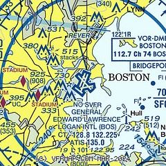
| Sectional chart |
|---|
|
| Airport distance calculator |
|---|
|
|
| Sunrise and sunset |
|---|
|
Times for 15-Jul-2026
| | Local
(UTC-4) | | Zulu
(UTC) |
|---|
| Morning civil twilight | | 04:48 | | 08:48 |
| Sunrise | | 05:21 | | 09:21 |
| Sunset | | 20:18 | | 00:18 |
| Evening civil twilight | | 20:52 | | 00:52 |
|
| Current date and time |
|---|
| Zulu (UTC) | 15-Jul-2026 11:27:08 |
|---|
| Local (UTC-4) | 15-Jul-2026 07:27:08 |
|---|
|
| METAR |
|---|
| KBOS | 151054Z 27012G18KT 6SM HZ FEW045 FEW180 BKN250 28/21 A2972 RMK AO2 SLP063 T02830206 $
|
KOWD
13nm SW | 151053Z AUTO VRB03KT 7SM CLR 24/21 A2973 RMK AO2 SLP067 T02440206
|
KBVY
14nm N | 151053Z 28003KT 7SM CLR 26/21 A2972 RMK AO2 SLP056 T02610211
|
KBED
14nm NW | 151051Z 26004KT 5SM HZ CLR 26/21 A2972 RMK AO2 SLP074 T02610206
|
|
| TAF |
|---|
| KBOS | 150842Z 1509/1612 26013G20KT P6SM SCT050 BKN150 PROB30 1509/1511 5SM -TSRA BKN050CB FM151300 31011G18KT P6SM BKN150 FM160000 31007KT P6SM BKN150
|
KBED
14nm NW | 150520Z 1506/1606 23010KT P6SM SCT200 FM150800 26007KT P6SM BKN050 PROB30 1508/1510 3SM TSRA BKN050CB FM151400 31010G22KT P6SM BKN150 FM160400 28003KT P6SM BKN150
|
|
| NOTAMs |
|---|
NOTAMs are issued by the DoD/FAA and will open in a separate window not controlled by AirNav.
|
|


