FAA INFORMATION EFFECTIVE 30 OCTOBER 2025
Location
| FAA Identifier: | MIA |
| Lat/Long: | 25-47-43.3000N 080-17-24.4170W
25-47.721667N 080-17.406950W
25.7953611,-80.2901158
(estimated) |
| Elevation: | 9.3 ft. / 2.8 m (surveyed) |
| Variation: | 05W (2000) |
| From city: | 8 miles NW of MIAMI, FL |
| Time zone: | UTC -4 (UTC -5 during Standard Time) |
| Zip code: | 33126 |
Airport Operations
| Airport use: | Open to the public |
| Activation date: | 04/1940 |
| Control tower: | yes |
| ARTCC: | MIAMI CENTER |
| FSS: | MIAMI FLIGHT SERVICE STATION |
| NOTAMs facility: | MIA (NOTAM-D service available) |
| Attendance: | CONTINUOUS |
| Wind indicator: | lighted |
| Segmented circle: | no |
| Beacon: | white-green (lighted land airport)
Operates sunset to sunrise. |
| Landing fee: | yes |
| Fire and rescue: | ARFF index E |
| International operations: | international airport of entry |
Airport Communications
| UNICOM: | 123.0 |
| WX ASOS: | 119.15 (305-870-0235) |
| MIAMI GROUND: | 121.8 ;RWY 08L/26R, 08R/26L, 12 127.5 ;RWY 09/27, 30 348.6 |
| MIAMI TOWER: | 118.3 ;270-089 123.9 ;090-269 256.9 |
| MIAMI APPROACH: | 120.5 ;090-269 124.85 ;270-089 125.75 ;270-089 322.3 ;270-089 379.9 ;090-269 125.75 263.025 ;270-089 |
| MIAMI DEPARTURE: | 119.45 ;270-089 120.5 ;090-269 125.5 ;090-269 125.75 ;270-089 290.325 ;270-089 354.1 ;090-269 379.9 ;090-269 |
| CLEARANCE DELIVERY: | 135.35 |
| ALTNN DP: | 119.45 290.325 |
| ANNEY STAR: | 125.75 322.3 |
| BNFSH STAR: | 124.85 263.025 |
| BNGOS DP: | 119.45 290.325 |
| CLASS B: | 120.5 ;090-269 125.75 ;270-089 322.3 ;270-089 379.9 ;090-269 |
| CSTAL STAR: | 124.85 263.025 |
| D-ATIS: | 119.15 ;ARRIVAL 133.675 ;DEPART |
| DORRL DP: | 119.45 290.325 |
| DVALL STAR: | 120.5 350.225 |
| EMERG: | 121.5 |
| FLMGO DP: | 119.45 290.325 |
| FOLZZ DP: | 119.45 290.325 |
| FOWEE STAR: | 120.5 124.85 350.225 |
| FROGZ STAR: | 120.5 350.225 |
| GLADZ DP: | 119.45 ;DEPARTING EAST 125.5 ;DEPARTING WEST 290.325 ;DEPARTING EAST 354.1 ;DEPARTING WEST |
| GWAVA DP: | 125.5 354.1 |
| HURCN DP: | 119.45 290.325 |
| HUSIL DP: | 119.45 290.325 |
| IC: | 118.3 ;270-089 119.45 ;270-089 121.8 ;RWY 08L/26R, 08R/26L, 12 124.85 ;270-089 127.5 ;RWY 09/27, 30 256.9 322.3 ;270-089 348.6 |
| KLADA DP: | 125.5 354.1 |
| LIFRR DP: | 119.45 290.325 |
| LUUCE STAR: | 126.05 ;9000 FT 133.775 ;7000 FT 251.1 ;9000 FT 371.9 ;7000 FT |
| MAYNR DP: | 125.5 354.1 |
| MIAMI DP: | 119.45 ;ALTNN,BEECH,BNGOS,DORRL,FLMG 125.5 ;GWAVA, KETLL, MAYNR TRANSITIO 290.325 ;ALTNN,BEECH,BNGOS,DORRL,FLM 354.1 ;GWAVA, KETLL, MAYNR TRANSITIO |
| NNOCE DP: | 125.5 354.1 |
| PALMZ STAR: | 120.5 350.225 |
| RAMP CTL: | 120.35 |
| RTIS: | 125.25 ;120-300 WITHIN 25 NM |
| SNDBR STAR: | 120.5 350.225 |
| TARPN STAR: | 126.05 ;9000 FT 133.775 ;7000 FT 251.1 ;9000 FT 371.9 ;7000 FT 124.6 ;12000 FT |
| VIICE STAR: | 120.5 350.225 |
| WX ASOS at OPF (7 nm N): | 125.9 (305-681-4063) |
| WX ASOS at TMB (12 nm SW): | 124.0 (305-235-1332) |
| WX ASOS at HWO (13 nm N): | 135.475 (954-983-5904) |
| WX ASOS at FLL (18 nm NE): | 135.0 (954-359-7857) |
- ASDE-X IN USE. OPERATE TRANSPONDERS WITH ALTITUDE REPORTING MODE AND ADS-B (IF EQUIPPED) ENABLED ON ALL AIRPORT SURFACES.
Nearby radio navigation aids
| VOR radial/distance | | VOR name | | Freq | | Var |
|---|
| DHPr099/3.2 | | DOLPHIN VORTAC | | 113.90 | | 04W |
| VKZr294/7.8 | | VIRGINIA KEY VOR/DME | | 117.10 | | 04W |
| FLLr208/18.0 | | FORT LAUDERDALE VOR/DME | | 114.40 | | 06W |
Airport Services
| Fuel available: | 100 JET-A |
| Parking: | hangars and tiedowns |
| Airframe service: | MAJOR |
| Powerplant service: | MAJOR |
| Bottled oxygen: | HIGH/LOW |
| Bulk oxygen: | HIGH/LOW |
Runway Information
Runway 9/27
| Dimensions: | 13016 x 150 ft. / 3967 x 46 m |
| Surface: | asphalt/grooved, in good condition |
| Weight bearing capacity: | | Single wheel: | 120.0 | | Double wheel: | 250.0 | | Double tandem: | 550.0 | | Dual double tandem: | 1120.0 |
|
| Runway edge lights: | high intensity |
| RUNWAY 9 | | RUNWAY 27 |
| Latitude: | 25-47.165702N | | 25-47.263880N |
| Longitude: | 080-18.890288W | | 080-16.519518W |
| Elevation: | 8.1 ft. | | 9.0 ft. |
| Traffic pattern: | right | | left |
| Runway heading: | 092 magnetic, 087 true | | 272 magnetic, 267 true |
| Displaced threshold: | 1358 ft. | | 261 ft. |
| Declared distances: | TORA:13016 TODA:13016 ASDA:12755 LDA:11397 | | TORA:13016 TODA:13016 ASDA:13016 LDA:12755 |
| Markings: | precision, in good condition | | precision, in good condition |
| Visual slope indicator: | 4-light PAPI on left (3.00 degrees glide path) | | 4-light PAPI on left (3.00 degrees glide path) |
| RVR equipment: | touchdown, midfield, rollout | | touchdown, midfield, rollout |
| Approach lights: | MALSR: 1,400 foot medium intensity approach lighting system with runway alignment indicator lights | | MALSR: 1,400 foot medium intensity approach lighting system with runway alignment indicator lights |
| Centerline lights: | yes | | yes |
| Touchdown point: | yes, no lights | | yes, no lights |
| Instrument approach: | ILS/DME | | ILS |
| Obstructions: | 23 ft. rr, 750 ft. from runway, 580 ft. right of centerline, 23:1 slope to clear
APCH RATIO 50:1 TO DSPLCD THR. | | none |
Runway 8R/26L
| Dimensions: | 10506 x 200 ft. / 3202 x 61 m |
| Surface: | asphalt/grooved, in good condition |
| Weight bearing capacity: | | Single wheel: | 120.0 | | Double wheel: | 250.0 | | Double tandem: | 550.0 | | Dual double tandem: | 1120.0 |
|
| Runway edge lights: | high intensity |
| RUNWAY 8R | | RUNWAY 26L |
| Latitude: | 25-48.041962N | | 25-48.121087N |
| Longitude: | 080-18.085980W | | 080-16.172137W |
| Elevation: | 8.5 ft. | | 8.9 ft. |
| Traffic pattern: | left | | right |
| Runway heading: | 092 magnetic, 087 true | | 272 magnetic, 267 true |
| Declared distances: | TORA:10506 TODA:10506 ASDA:10506 LDA:10506 | | TORA:10506 TODA:10506 ASDA:10220 LDA:10220 |
| Markings: | precision, in good condition | | precision, in good condition |
| Visual slope indicator: | 4-light PAPI on left (3.00 degrees glide path) | | 4-light PAPI on left (3.00 degrees glide path) |
| RVR equipment: | touchdown, rollout | | touchdown, rollout |
| Approach lights: | MALSR: 1,400 foot medium intensity approach lighting system with runway alignment indicator lights | | MALSF: 1,400 foot medium intensity approach lighting system with sequenced flashers |
| Centerline lights: | yes | | yes |
| Touchdown point: | yes, lighted | | yes, no lights |
| Instrument approach: | ILS/DME | | ILS/DME |
Runway 12/30
| Dimensions: | 9360 x 150 ft. / 2853 x 46 m |
| Surface: | asphalt/grooved, in good condition |
| Weight bearing capacity: | | Single wheel: | 120.0 | | Double wheel: | 250.0 | | Double tandem: | 550.0 | | Dual double tandem: | 1120.0 |
|
| Runway edge lights: | high intensity |
| Operational restrictions: | RWY 12/30 CLSD 0300-1200++ WHEN RWY 08R/26L & RWY 09/27 ARE IN USE. |
| RUNWAY 12 | | RUNWAY 30 |
| Latitude: | 25-47.957103N | | 25-47.197040N |
| Longitude: | 080-18.137398W | | 080-16.651342W |
| Elevation: | 9.1 ft. | | 8.7 ft. |
| Traffic pattern: | left | | left |
| Runway heading: | 124 magnetic, 119 true | | 304 magnetic, 299 true |
| Displaced threshold: | no | | 945 ft. |
| Declared distances: | TORA:9355 TODA:9355 ASDA:8579 LDA:8579 | | TORA:9355 TODA:9355 ASDA:8853 LDA:7913 |
| Markings: | precision, in good condition | | precision, in good condition |
| Visual slope indicator: | 4-light PAPI on right (3.00 degrees glide path) | | 4-light PAPI on left (3.00 degrees glide path) |
| RVR equipment: | touchdown, rollout | | touchdown, rollout |
| Approach lights: | MALSR: 1,400 foot medium intensity approach lighting system with runway alignment indicator lights | | MALS: 1,400 foot medium intensity approach lighting system |
| Centerline lights: | yes | | yes |
| Touchdown point: | yes, no lights | | yes, no lights |
| Instrument approach: | ILS/DME | | ILS/DME |
| Obstructions: | 40 ft. tower, 1700 ft. from runway, 200 ft. left of centerline, 37:1 slope to clear | | 52 ft. tree, 1600 ft. from runway, 300 ft. left of centerline, 26:1 slope to clear
+20' RR 200' FM RY END; 450'L. |
Runway 8L/26R
| Dimensions: | 8600 x 150 ft. / 2621 x 46 m |
| Surface: | asphalt/grooved, in good condition |
| Weight bearing capacity: | | Single wheel: | 120.0 | | Double wheel: | 250.0 | | Double tandem: | 550.0 | | Dual double tandem: | 1120.0 |
|
| Runway edge lights: | high intensity |
| Operational restrictions: | RWY 08L/26R CLSD 0300-1200++ WHEN RWY 08R/26L & RWY 09/27 ARE IN USE. |
| RUNWAY 8L | | RUNWAY 26R |
| Latitude: | 25-48.173867N | | 25-48.238673N |
| Longitude: | 080-18.092513W | | 080-16.525832W |
| Elevation: | 8.9 ft. | | 8.8 ft. |
| Traffic pattern: | left | | left |
| Runway heading: | 092 magnetic, 087 true | | 272 magnetic, 267 true |
| Declared distances: | TORA:8600 TODA:8600 ASDA:8600 LDA:8600 | | TORA:8600 TODA:8600 ASDA:8600 LDA:8600 |
| Markings: | nonprecision, in good condition | | nonprecision, in good condition |
| Visual slope indicator: | 4-light PAPI on left (3.00 degrees glide path) | | 4-light PAPI on left (3.00 degrees glide path) |
| Runway end identifier lights: | yes | | yes |
| Centerline lights: | yes | | yes |
| Touchdown point: | yes, no lights | | yes, no lights |
| Instrument approach: | LOC/DME | | LOC/DME |
Airport Ownership and Management from official FAA records
| Ownership: | Publicly-owned |
| Owner: | DADE COUNTY AVIATON DEPT
PO BOX 025504
MIAMI, FL 33102-5504
Phone 305-876-7077 |
| Manager: | RALPH CUTIE
MIAMI-DADE AVIATION DEPARTMENT, P.O. BOX 025504
MIAMI, FL 33102-5504
Phone 305-876-7038
JIM MURPHY, AIRPORT SUPERVISOR 305-876-7516. |
Additional Remarks
| A39-08L/26R | PCR VALUE: 711/F/A/X/T |
| A39-12/30 | PCR VALUE: 780/F/A/X/T |
| A39-09/27 | PCR VALUE: 851/F/A/X/T |
| A39-08R/26L | PCR VALUE: 851/F/A/X/T |
| - | CLSD NON ENG ACFT. |
| - | PPR 3 HRS PRIOR TO ALL ARRIVALS ON THE GENERAL AVIATION CENTER (GAC) RAMP 305-876-7550 CTC RAMP CONTROL UPON ARRIVAL ON FREQUENCY 131.600. ACFT WITH WINGSPAN GREATER THAN 78 FT ARE PROHIBITED FROM ENTERING THE GAC RAMP. |
| - | ALL MEDICAL EMERGENCIES ARRIVALS, WITH THE EXCEPTION OF AIR AMBULANCE FLIGHTS, MUST SECURE DOORS UNTIL ARFF IS ON SCENE. |
| - | PPR FOR INBOUND MILITARY FLIGHTS 100 NM ON FREQ 130.5. |
| - | ALL DIVERSION CTC FREQ 130.5 UPON ARR. |
| - | AIRPORT MANAGER: 305-876-7038. |
| - | AIRPORT OPS 305-876-7550. |
| - | US CBP AND EAPIS AVBL. |
| - | RWY 12-30 CLSD 0300-1200Z++ WHEN RWY 08R-26L AND RWY 09-27 ARE IN USE. |
| - | RWY 08L-26R CLSD 0300-1200Z++ WHEN RWY 08R-26L AND RWY 09-27 ARE IN USE. |
| - | ALL TBJT ACFT ARE REQD TO USE DSNT NOISE ABATEMENT DEP PROFILE (NADP-2) FROM ALL RWYS. |
| - | ACFT WITH A WINGSPAN GTR THAN 171 FT ARE PROHIBITED FM TXG ON TWY P E OF TWY U, EXCEPT ADG VI ACFT COMPLYING WITH MIA ADG VI OPERATIONAL PLAN WHEN ADJ AIRSIDE SVC ROAD IS CLSD TO TRAFFIC. |
| - | TRML APN TXY SPOTS 2, 4, 13,15, 22 AND 24 MAX SPAN 125 FT OR LESS. TRML APN TXY SPOTS 26, 28 MAX SPAN 167 FT OR LESS |
| - | BIRDS ON & INVOF ARPT. |
Instrument Procedures
NOTE: All procedures below are presented as PDF files. If you need a reader for these files, you should download the free Adobe Reader.NOT FOR NAVIGATION. Please procure official charts for flight.
FAA instrument procedures published for use from 30 October 2025 at 0901Z to 27 November 2025 at 0900Z.
STARs - Standard Terminal Arrivals |
|---|
| ANNEY FIVE | |
2 pages:
[1] [2] (250KB) |
| BNFSH THREE (RNAV) | |
2 pages:
[1] [2] (512KB) |
| BNFSH THREE (RNAV), CONT.2 | |
download (261KB) |
| CSTAL THREE (RNAV) | |
2 pages:
[1] [2] (417KB) |
| CSTAL THREE (RNAV), CONT.2 | |
download (353KB) |
| DVALL FOUR | |
download (144KB) |
| FOWEE TWO | |
download (181KB) |
| FROGZ FOUR (RNAV) | |
2 pages:
[1] [2] (441KB) |
| FROGZ FOUR (RNAV), CONT.2 | |
download (184KB) |
| PALMZ TWO | |
download (185KB) |
| SNDBR THREE (RNAV) | |
2 pages:
[1] [2] (467KB) |
| TARPN THREE (RNAV) | |
download (213KB) |
| VIICE TWO (RNAV) | |
2 pages:
[1] [2] (368KB) |
| VIICE TWO (RNAV), CONT.2 | |
download (158KB) |
IAPs - Instrument Approach Procedures |
|---|
| ILS OR LOC RWY 08R **CHANGED** | |
download (266KB) |
| ILS OR LOC RWY 09 **CHANGED** | |
download (275KB) |
| ILS OR LOC RWY 12 **CHANGED** | |
download (284KB) |
| ILS OR LOC RWY 26L **CHANGED** | |
download (277KB) |
| ILS OR LOC RWY 27 **CHANGED** | |
download (295KB) |
| ILS OR LOC RWY 30 **CHANGED** | |
download (256KB) |
| RNAV (RNP) Y RWY 08R **CHANGED** | |
download (241KB) |
| RNAV (RNP) Y RWY 12 **CHANGED** | |
download (206KB) |
| RNAV (RNP) Y RWY 30 **CHANGED** | |
download (230KB) |
| RNAV (RNP) Z RWY 26L **CHANGED** | |
download (221KB) |
| RNAV (RNP) Z RWY 27 **CHANGED** | |
download (212KB) |
| RNAV (GPS) RWY 08L **CHANGED** | |
download (214KB) |
| RNAV (GPS) RWY 09 **CHANGED** | |
download (254KB) |
| RNAV (GPS) RWY 26R **CHANGED** | |
download (223KB) |
| RNAV (GPS) Y RWY 26L **CHANGED** | |
download (239KB) |
| RNAV (GPS) Y RWY 27 **CHANGED** | |
download (240KB) |
| RNAV (GPS) Z RWY 08R **CHANGED** | |
download (246KB) |
| RNAV (GPS) Z RWY 12 **CHANGED** | |
download (248KB) |
| RNAV (GPS) Z RWY 30 **CHANGED** | |
download (224KB) |
| LOC RWY 08L **CHANGED** | |
download (213KB) |
| LOC RWY 26R **CHANGED** | |
download (214KB) |
| NOTE: Special Alternate Minimums apply | |
download (124KB) |
Departure Procedures |
|---|
| ALTNN TWO (RNAV) | |
2 pages:
[1] [2] (486KB) |
| BNGOS FOUR (RNAV) | |
2 pages:
[1] [2] (582KB) |
| DORRL TWO (RNAV) | |
2 pages:
[1] [2] (325KB) |
| FLMGO TWO (RNAV) | |
2 pages:
[1] [2] (600KB) |
| FOLZZ THREE (RNAV) | |
2 pages:
[1] [2] (435KB) |
| FOLZZ THREE (RNAV), CONT.2 | |
download (309KB) |
| GLADZ FOUR (RNAV) | |
2 pages:
[1] [2] (436KB) |
| GLADZ FOUR (RNAV), CONT.2 | |
download (250KB) |
| GWAVA TWO (RNAV) | |
2 pages:
[1] [2] (441KB) |
| HURCN FOUR (RNAV) | |
2 pages:
[1] [2] (382KB) |
| HURCN FOUR (RNAV), CONT.2 | |
download (260KB) |
| KLADA TWO (RNAV) | |
2 pages:
[1] [2] (503KB) |
| LIFRR TWO (RNAV) | |
2 pages:
[1] [2] (425KB) |
| MAYNR THREE (RNAV) | |
2 pages:
[1] [2] (403KB) |
| MAYNR THREE (RNAV), CONT.2 | |
download (289KB) |
| MIAMI TWO | |
2 pages:
[1] [2] (454KB) |
| MIAMI TWO | |
2 pages:
[1] [2] (454KB) |
| NNOCE TWO (RNAV) | |
download (267KB) |
| NOTE: Special Take-Off Minimums/Departure Procedures apply | |
download (400KB) |
Other nearby airports with instrument procedures:
KOPF - Miami-Opa Locka Executive Airport (7 nm N)
KTMB - Miami Executive Airport (12 nm SW)
KHWO - North Perry Airport (13 nm N)
KFLL - Fort Lauderdale/Hollywood International Airport (18 nm NE)
KHST - Homestead Air Reserve Base (19 nm S)
|
|

Road maps at:
MapQuest
Bing
Google
| Aerial photo |
|---|
WARNING: Photo may not be current or correct
 Photo courtesy of Russell Aerial Photography
Photo taken 14-Jan-2013
looking north.
Photo courtesy of Russell Aerial Photography
Photo taken 14-Jan-2013
looking north.
Do you have a better or more recent aerial photo of Miami International Airport that you would like to share? If so, please send us your photo.
|
| Sectional chart |
|---|
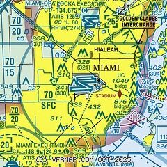
|
 Download PDF
of official airport diagram from the FAA
| Airport distance calculator |
|---|
|
|
| Sunrise and sunset |
|---|
|
Times for 31-Oct-2025
| | Local
(UTC-4) | | Zulu
(UTC) |
|---|
| Morning civil twilight | | 07:06 | | 11:06 |
| Sunrise | | 07:30 | | 11:30 |
| Sunset | | 18:40 | | 22:40 |
| Evening civil twilight | | 19:03 | | 23:03 |
|
| Current date and time |
|---|
| Zulu (UTC) | 01-Nov-2025 01:21:33 |
|---|
| Local (UTC-4) | 31-Oct-2025 21:21:33 |
|---|
|
| METAR |
|---|
KMIA
2nm SW | 010053Z 03004KT 10SM CLR 21/13 A3004 RMK AO2 SLP172 T02060128 $
|
KOPF
7nm N | 010053Z 02006KT 10SM CLR 21/13 A3004 RMK AO2 SLP174 T02060128
|
KTMB
12nm SW | 010053Z 02004KT 10SM CLR 19/14 A3004 RMK AO2 SLP171 T01890139 $
|
KHWO
13nm N | 010053Z AUTO 36005KT 10SM CLR 21/13 A3004 RMK AO2 SLP173 T02060128 PWINO $
|
KFLL
18nm NE | 010053Z 35005KT 10SM FEW035 FEW070 21/13 A3003 RMK AO2 SLP169 T02110128 $
|
|
| TAF |
|---|
KMIA
2nm SW | 312030Z 3121/0124 35008KT P6SM FEW050 FM010000 VRB04KT P6SM FEW050 FM011500 04007KT P6SM SCT050 FM011800 07008KT P6SM SCT050
|
KOPF
7nm N | 312030Z 3121/0118 35008KT P6SM FEW050 FM010000 VRB04KT P6SM FEW050 FM011500 04007KT P6SM SCT050
|
KTMB
12nm SW | 312030Z 3121/0118 35008KT P6SM FEW050 FM010000 VRB04KT P6SM FEW050 FM011500 04007KT P6SM SCT050
|
KFLL
18nm NE | 312030Z 3121/0124 35010KT P6SM FEW050 FM010000 VRB04KT P6SM FEW050 FM011500 03007KT P6SM SCT050 FM011800 06008KT P6SM SCT050
|
|
| NOTAMs |
|---|
NOTAMs are issued by the DoD/FAA and will open in a separate window not controlled by AirNav.
|
|


