FAA INFORMATION EFFECTIVE 14 MAY 2026
Location
| FAA Identifier: | FLL |
| Lat/Long: | 26-04-18.0000N 080-08-58.9000W
26-04.300000N 080-08.981667W
26.0716667,-80.1496944
(estimated) |
| Elevation: | 65 ft. / 19.8 m (surveyed) |
| Variation: | 06W (2015) |
| From city: | 3 miles SW of FORT LAUDERDALE, FL |
| Time zone: | UTC -4 (UTC -5 during Standard Time) |
| Zip code: | 33315 |
Airport Operations
| Airport use: | Open to the public |
| Activation date: | 04/1940 |
| Control tower: | yes |
| ARTCC: | MIAMI CENTER |
| FSS: | MIAMI FLIGHT SERVICE STATION |
| NOTAMs facility: | FLL (NOTAM-D service available) |
| Attendance: | CONTINUOUS |
| Wind indicator: | yes |
| Segmented circle: | no |
| Lights: | SS-SR |
| Beacon: | white-green (lighted land airport)
Operates sunset to sunrise. |
| Fire and rescue: | ARFF index E |
| International operations: | international airport of entry |
Airport Communications
| UNICOM: | 122.95 |
| WX ASOS: | 135.0 (954-359-7857) |
| FORT LAUDERDALE GROUND: | 121.4 121.7 |
| FORT LAUDERDALE TOWER: | 119.3 257.8 120.2 |
| MIAMI APPROACH: | 118.1 ;271-090 BLW 4000 FT 126.85 ;5000 FT AND ABV 133.775 ;271-090 4000 FT & ABV |
| MIAMI DEPARTURE: | 119.7 ;271-090 BLW 4000 FT 126.05 ;271-090 4000 FT & ABV 126.85 ;5000 FT AND ABV 128.6 |
| CLEARANCE DELIVERY: | 128.4 |
| PRE-TAXI CLEARANCE: | 128.4 |
| AGERS DP: | 126.05 |
| BHHIA STAR: | 120.5 |
| BNICE DP: | 126.05 |
| CLASS C: | 119.7 ;270-090 128.6 ;091-269 |
| CUUDA STAR: | 133.775 |
| D-ATIS: | 135.0 |
| DEKAL STAR: | 126.85 |
| DORRL DP: | 126.05 |
| FEALX DP: | 126.05 |
| FORT LAUDERDALE DP: | 126.05 ;AARPS, BNICE, DORRL,FRSBE, H 126.05 ;BEECH-FLL DEPARTING WEST 126.85 ;BEECH-FLL DEPARTING EAST 126.85 ;MAYNR |
| FORTL STAR: | 133.775 |
| FRSBE DP: | 126.05 |
| GLADZ DP: | 126.05 ;DEPARTING EAST 126.85 ;DEPARTING WEST |
| HROCK DP: | 126.05 |
| IC: | 126.05 ;271-090 4000 FT & ABV 128.6 133.775 ;271-090 4000 FT & ABV |
| KYAKS STAR: | 128.6 |
| LIFRR DP: | 126.05 |
| LUUCE STAR: | 126.05 ;9000 FT 133.775 ;7000 FT |
| MAYNR DP: | 126.85 |
| OLAHS STAR: | 126.85 ;6000 FT AND ABV 128.6 ;5000 FT & BLW |
| RAMP CTL: | 118.175 ;NORTH 129.875 ;SOUTH |
| REGAE DP: | 126.05 ;DEPARTING WEST 126.85 ;DEPARTING EAST |
| SNAPR DP: | 126.05 ;DEPARTING WEST 126.85 ;DEPARTING EAST |
| TARPN STAR: | 126.05 ;9000 FT 133.775 ;7000 FT 124.6 ;12000 FT |
| TEEKY STAR: | 133.775 |
| TOREZ STAR: | 126.85 |
| WX ASOS at HWO (6 nm SW): | 135.475 (954-983-5904) |
| WX ASOS at FXE (8 nm N): | 119.85 (954-772-2537) |
| WX ASOS at PMP (11 nm N): | 120.55 (954-783-3720) |
| WX ASOS at OPF (12 nm SW): | 125.9 (305-681-4063) |
| WX ASOS at MIA (18 nm SW): | 119.15 (645-231-5974) |
| WX AWOS-3 at BCT (19 nm N): | PHONE 561-391-2696 |
- ASDE-X IN USE. OPERATE TRANSPONDERS WITH ALTITUDE REPORTING MODE AND ADS-B (IF EQUIPPED) ENABLED ON ALL AIRPORT SURFACES.
Nearby radio navigation aids
| VOR radial/distance | | VOR name | | Freq | | Var |
|---|
| FLL at field | | FORT LAUDERDALE VOR/DME | | 114.40 | | 06W |
| VKZr005/19.2 | | VIRGINIA KEY VOR/DME | | 117.10 | | 04W |
| DHPr037/19.5 | | DOLPHIN VORTAC | | 113.90 | | 04W |
| PBIr188/36.7 | | PALM BEACH VORTAC | | 115.70 | | 03W |
Airport Services
| Fuel available: | 100LL JET-A |
| Parking: | hangars and tiedowns |
| Airframe service: | MAJOR |
| Powerplant service: | MAJOR |
| Bottled oxygen: | HIGH/LOW |
| Bulk oxygen: | HIGH/LOW |
Runway Information
Runway 10L/28R
| Dimensions: | 9000 x 150 ft. / 2743 x 46 m |
| Surface: | asphalt/concrete/grooved, in excellent condition |
| Weight bearing capacity: | | Single wheel: | 100.0, ST 175 | | Double wheel: | 200.0 | | Double tandem: | 468.0 | | Dual double tandem: | 800.0 |
|
| Runway edge lights: | high intensity |
| RUNWAY 10L | | RUNWAY 28R |
| Latitude: | 26-04.616943N | | 26-04.607512N |
| Longitude: | 080-09.992302W | | 080-08.347250W |
| Elevation: | 5.6 ft. | | 5.3 ft. |
| Traffic pattern: | left | | right |
| Runway heading: | 096 magnetic, 090 true | | 276 magnetic, 270 true |
| Displaced threshold: | 576 ft. | | 606 ft. |
| Declared distances: | TORA:9000 TODA:9000 ASDA:9000 LDA:8424 | | TORA:9000 TODA:9000 ASDA:9000 LDA:8394 |
| Markings: | precision, in good condition | | precision, in good condition |
| Visual slope indicator: | 4-light PAPI on left (3.00 degrees glide path) | | 4-light PAPI on left (3.00 degrees glide path) |
| RVR equipment: | touchdown | | touchdown |
| Approach lights: | MALSR: 1,400 foot medium intensity approach lighting system with runway alignment indicator lights | | MALSR: 1,400 foot medium intensity approach lighting system with runway alignment indicator lights |
| Touchdown point: | yes, no lights | | yes, no lights |
| Instrument approach: | ILS/DME | | ILS/DME |
| Obstructions: | 14 ft. road, 340 ft. from runway, 10:1 slope to clear
+8 FT FENCE 200 FT FM THR & 400 FT R; 40 FT LGT POLES PARL TO RWY BTN TWY Q & A-4 650 FT N. | | 33 ft. rr, 470 ft. from runway, 530 ft. right of centerline, 8:1 slope to clear
APCH RATIO 32:1 TO DSPLCD THR; +43 FT LGTD POLE 1414 FT FM THR 75 FT R; APCH RATIO 46:1. |
Runway 10R/28L
| Dimensions: | 8000 x 150 ft. / 2438 x 46 m |
| Surface: | concrete/grooved, in excellent condition
RWY 10R/28L NRS UNGROOVED AREAS. |
| Weight bearing capacity: | | Single wheel: | 120.0 | | Double wheel: | 247.0 | | Double tandem: | 461.0 | | Dual double tandem: | 987.0 |
|
| Runway edge lights: | high intensity |
| RUNWAY 10R | | RUNWAY 28L |
| Latitude: | 26-03.953198N | | 26-03.944530N |
| Longitude: | 080-09.500933W | | 080-08.038980W |
| Elevation: | 10.1 ft. | | 65.0 ft. |
| Traffic pattern: | right | | left |
| Runway heading: | 096 magnetic, 090 true | | 276 magnetic, 270 true |
| Declared distances: | TORA:8000 TODA:8000 ASDA:8000 LDA:8000 | | TORA:8000 TODA:8000 ASDA:8000 LDA:8000 |
| Markings: | precision, in good condition | | precision, in good condition |
| Visual slope indicator: | 4-light PAPI on right (3.00 degrees glide path) | | 4-light PAPI on left (3.00 degrees glide path) |
| RVR equipment: | touchdown | | touchdown |
| Approach lights: | MALSF: 1,400 foot medium intensity approach lighting system with sequenced flashers
RWY 10R MALSF NSTD; 370 FT GAP BTN 8+00 & STATION 11+70. | | MALSF: 1,400 foot medium intensity approach lighting system with sequenced flashers |
| Touchdown point: | yes, no lights | | yes, no lights |
| Instrument approach: | ILS/DME | | ILS/DME |
| Obstructions: | 35 ft. pole, lighted, 865 ft. from runway, 587 ft. left of centerline, 18:1 slope to clear | | none |
Airport Ownership and Management from official FAA records
| Ownership: | Publicly-owned |
| Owner: | BROWARD COUNTY
115 S. ANDREWS AVENUE, ROOM 421
DANIA BEACH, FL 33312-1872
Phone 954-359-6100 |
| Manager: | MARK GALE
320 TERMINAL DRIVE SUITE 200
FORT LAUDERDALE, FL 33315
Phone 954-359-6100 |
Additional Remarks
| A39-10L/28R | PCR VALUE: 930/R/A/W/T |
| A39-10R/28L | PCR VALUE: 820/R/A/W/T |
| E60-28L | ARSTG GEAR/SYS: ENGRD MTRLS ARSTG SYS (EMAS) 562.9 FT IN LEN BY 178.2 FT IN WID AT THE DEP END OF RWY 28L. |
| E60-10R | ARSTG GEAR/SYS: ENGRD MTRLS ARSTG SYS (EMAS) 562.9 FT IN LEN BY 178.2 FT IN WID AT THE DEP END OF RWY 10R. |
| E60-28R | ARSTG GEAR/SYS: ENGRD MTRLS ARSTG SYS (EMAS) 251 FT IN LEN BY 170 FT IN WID AT THE DEP END OF RWY 28R. |
| E60-10L | ARSTG GEAR/SYS: ENGRD MTRLS ARSTG SYS (EMAS) 409 FT IN LEN BY 170 FT IN WID AT THE DEP END OF RWY 10L. |
| - | CLSD TO ACR TRAINING. |
| - | PPR FOR ACFT WITH EXPLOSIVES. |
| - | TWY E BTN TWY C & TWY L CLSD TO ACFT WINGSPAN MORE THAN 118 FT EXC 10 MIN PPR 954-816-3179. |
| - | ARR FM N & W MNTN 6000 FT UNTIL ABM RWY 28R ON DOWNWIND; ARR FM N MNTN 6000 FT UNTIL ABM RWY 10L ON DOWNWIND. |
| - | NO VFR APCHS OR BASE LEGS UNTIL OFFSHORE. |
| - | IR CARRIER ACFT USE RAMP PUSH BACK PROCS PRESCRIBED BY ARPT OPS. |
| - | EAST SIDE OF CONCOURSE B AVBL TO ACFT WITH WINGSPAN LESS THAN 124.9 FT. |
| - | ACFT OPRG FROM TRML 1, 2, 3, 4 MUST CTC RAMP CTL. RAMP CTL EFF - CTC ARPT OPS FOR HRS. |
| - | TURB BLW 1000 FT OVR LANDFILL LCTD 2 NM W. |
| - | ALL RWYS NOISE SENSITIVE; NOISE ABATEMENT IN EFCT - 954-359-6181. |
| - | TWY J BGN TO ELEV 900 FT EAST OF TWY Q. DUE TO ELEV ALL ACFT REMAIN ON CNTRLN; TWY T8 & TAXILANE T NOT ACCESSIBLE FM TWY J. |
| - | RWY STATUS LIGHTS IN OPRN. |
| - | ACFT LDG RWY 10R & EXITING J9 FOLLOW TWY LEAD OFF LINE ONTO J9. |
| - | PREFERENTIAL RWY USE PROGRAM IN EFCT; CTC NOISE ABATEMENT OFFICE. |
| - | NMRS TREES SW QUADRANT OF ARPT. |
| - | HIGH LIGHT MASTS WNW APCH END RWY 28L. |
| - | APN TWY T EAST OF TWY T8 CLSD TO ACFT WINGSPAN MORE THAN 118 FT AND TAIL HEIGHT MORE THAN 45FT EXC ACFT UNDER TOW. |
| - | TXL T BTN T7 AND T8 CLSD TO ACFT WINGSPAN MORE THAN 171 FT. |
| - | JET RUNUPS NA 2300-0700. |
| - | DO NOT MISTAKE TWY B FOR LNDG/TKOF SFC. |
| - | RWY 10L/28R NRS UNGROOVED AREAS. |
| - | DO NOT MISTAKE TAXIWAY B FOR LANDING/TAKEOFF SURFACE. |
| - | TWY B E OF TWY B12 & TXL T E OF TWY T1 CLSD TO ACFT WITH WINGSPAN GTR THAN 118 FT & TAIL HGT GTR THAN 45 FT EXC PPR 954-816-3179. |
| - | 24 HOUR PPR FOR ACFT EQUIPPED WITH WEATHER MODIFICATION OR GEOENGINEERING EQUIPMENT 954-816-3179 |
| - | BIRDS ON & INVOF ARPT; CONCENTRATION OF BIRDS BLW 500 FT 2.0 NM W OF 10L & 10R AER. |
Instrument Procedures
NOTE: All procedures below are presented as PDF files. If you need a reader for these files, you should download the free Adobe Reader.NOT FOR NAVIGATION. Please procure official charts for flight.
FAA instrument procedures published for use from 14 May 2026 at 0901Z to 11 June 2026 at 0900Z.
STARs - Standard Terminal Arrivals |
|---|
| BHHIA THREE (RNAV) | |
2 pages:
[1] [2] (395KB) |
| BHHIA THREE (RNAV), CONT.2 | |
download (149KB) |
| CUUDA THREE (RNAV) | |
2 pages:
[1] [2] (560KB) |
| DEKAL NINE | |
download (215KB) |
| DEKAL NINE | |
download (215KB) |
| DVALL FOUR | |
download (145KB) |
| FORTL NINE | |
download (186KB) |
| KYAKS THREE (RNAV) | |
2 pages:
[1] [2] (307KB) |
| OLAHS THREE (RNAV) | |
2 pages:
[1] [2] (406KB) |
| OLAHS THREE (RNAV), CONT.2 | |
download (163KB) |
| TARPN THREE (RNAV) | |
download (214KB) |
| TEEKY FOUR (RNAV) | |
2 pages:
[1] [2] (588KB) |
| TOREZ ONE (RNAV) | |
download (152KB) |
IAPs - Instrument Approach Procedures |
|---|
| ILS OR LOC RWY 10L | |
download (328KB) |
| ILS OR LOC RWY 10R | |
download (285KB) |
| ILS OR LOC RWY 28L | |
download (281KB) |
| ILS OR LOC RWY 28R | |
download (287KB) |
| RNAV (RNP) Y RWY 10L | |
download (215KB) |
| RNAV (RNP) Z RWY 28R | |
download (222KB) |
| RNAV (GPS) RWY 10R | |
download (261KB) |
| RNAV (GPS) RWY 28L | |
download (250KB) |
| RNAV (GPS) Y RWY 28R | |
download (262KB) |
| RNAV (GPS) Z RWY 10L | |
download (271KB) |
| NOTE: Special Alternate Minimums apply | |
download (124KB) |
Departure Procedures |
|---|
| AGERS ONE (RNAV) | |
2 pages:
[1] [2] (334KB) |
| BNICE TWO (RNAV) | |
2 pages:
[1] [2] (446KB) |
| DORRL TWO (RNAV) | |
download (222KB) |
| FEALX TWO (RNAV) | |
2 pages:
[1] [2] (303KB) |
| FEALX TWO (RNAV), CONT.2 | |
download (201KB) |
| FORT LAUDERDALE TWO | |
2 pages:
[1] [2] (423KB) |
| FORT LAUDERDALE TWO | |
2 pages:
[1] [2] (423KB) |
| FRSBE TWO (RNAV) | |
download (273KB) |
| GLADZ FOUR (RNAV) | |
2 pages:
[1] [2] (352KB) |
| GLADZ FOUR (RNAV), CONT.2 | |
download (208KB) |
| HROCK TWO (RNAV) | |
2 pages:
[1] [2] (358KB) |
| LIFRR TWO (RNAV) | |
2 pages:
[1] [2] (361KB) |
| MAYNR THREE (RNAV) | |
2 pages:
[1] [2] (346KB) |
| REGAE TWO (RNAV) | |
download (331KB) |
| SNAPR TWO (RNAV) | |
2 pages:
[1] [2] (368KB) |
| NOTE: Special Take-Off Minimums/Departure Procedures apply | |
download (440KB) |
Other nearby airports with instrument procedures:
KHWO - North Perry Airport (6 nm SW)
KFXE - Fort Lauderdale Executive Airport (8 nm N)
KPMP - Pompano Beach Airpark (11 nm N)
KOPF - Miami-Opa Locka Executive Airport (12 nm SW)
KMIA - Miami International Airport (18 nm SW)
KBCT - Boca Raton Airport (19 nm N)
|
|

Road maps at:
MapQuest
Bing
Google
| Aerial photo |
|---|
WARNING: Photo may not be current or correct
 Photo courtesy of Russell Aerial Photography
Photo taken 01-May-2015
looking north.
Photo courtesy of Russell Aerial Photography
Photo taken 01-May-2015
looking north.
Do you have a better or more recent aerial photo of Fort Lauderdale/Hollywood International Airport that you would like to share? If so, please send us your photo.
|
| Sectional chart |
|---|
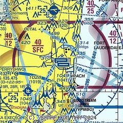
|
CAUTION: Diagram may not be current
 Download PDF
of official airport diagram from the FAA
| Airport distance calculator |
|---|
|
|
| Sunrise and sunset |
|---|
|
Times for 05-Jun-2026
| | Local
(UTC-4) | | Zulu
(UTC) |
|---|
| Morning civil twilight | | 06:03 | | 10:03 |
| Sunrise | | 06:29 | | 10:29 |
| Sunset | | 20:09 | | 00:09 |
| Evening civil twilight | | 20:35 | | 00:35 |
|
| Current date and time |
|---|
| Zulu (UTC) | 05-Jun-2026 15:25:47 |
|---|
| Local (UTC-4) | 05-Jun-2026 11:25:47 |
|---|
|
| METAR |
|---|
| KFLL | 051453Z 08010G18KT 10SM BKN055 OVC070 27/18 A3008 RMK AO2 SLP186 T02670178 51012 $
|
KHWO
6nm SW | 051453Z A3008 RMK AO2 SLP187 6//// 51010 PNO $
|
KFXE
8nm N | 051453Z 06011KT 10SM BKN055 OVC075 27/21 A3009 RMK AO2 SLP190 T02720206 51011 $
|
KPMP
11nm N | 051453Z 08011KT 10SM FEW039 SCT055 OVC070 27/18 A3009 RMK AO2 SLP191 T02670178 51010
|
KOPF
12nm SW | 051453Z 08013KT 10SM FEW080 28/19 A3008 RMK AO2 SLP186 T02780194 51014 $
|
KBCT
19nm N | 051453Z 07009KT 10SM SCT040 BKN060 BKN075 27/18 A3010
|
KMIA
20nm SW | 051453Z 07011G21KT 10SM FEW035 FEW050 BKN070 BKN210 28/19 A3008 RMK AO2 SLP184 T02780189 51010 $
|
|
| TAF |
|---|
| KFLL | 051120Z 0512/0618 08010KT P6SM FEW030 BKN050 FM051500 08012G22KT P6SM FEW030 SCT050 FM060000 08008KT P6SM FEW030 SCT050 FM061700 08012KT P6SM SCT030 SCT050
|
KFXE
8nm N | 051120Z 0512/0612 08010KT P6SM FEW030 BKN050 FM051600 08012KT P6SM FEW030 SCT050 FM060000 08008KT P6SM FEW030 SCT050
|
KOPF
12nm SW | 051120Z 0512/0612 08008KT P6SM FEW030 BKN050 FM051500 08012KT P6SM FEW030 SCT050 FM060000 08008KT P6SM FEW030 SCT050
|
KMIA
20nm SW | 051120Z 0512/0618 08008KT P6SM FEW030 BKN050 FM051500 08012KT P6SM FEW030 SCT050 FM060000 08008KT P6SM FEW030 SCT050 FM061700 08012KT P6SM SCT030 SCT050
|
|
| NOTAMs |
|---|
NOTAMs are issued by the DoD/FAA and will open in a separate window not controlled by AirNav.
|
|


