FAA INFORMATION EFFECTIVE 16 APRIL 2026
Location
| FAA Identifier: | SFO |
| Lat/Long: | 37-37-07.7000N 122-22-31.5000W
37-37.128333N 122-22.525000W
37.6188056,-122.3754167
(estimated) |
| Elevation: | 13.1 ft. / 4.0 m (surveyed) |
| Variation: | 14E (2015) |
| From city: | 8 miles SE of SAN FRANCISCO, CA |
| Time zone: | UTC -7 (UTC -8 during Standard Time) |
| Zip code: | 94128 |
Airport Operations
| Airport use: | Open to the public |
| Activation date: | 04/1940 |
| Control tower: | yes |
| ARTCC: | OAKLAND CENTER |
| FSS: | OAKLAND FLIGHT SERVICE STATION |
| NOTAMs facility: | SFO (NOTAM-D service available) |
| Attendance: | CONTINUOUS |
| Wind indicator: | lighted |
| Segmented circle: | no |
| Beacon: | white-green (lighted land airport)
Operates sunset to sunrise. |
| Landing fee: | yes |
| Fire and rescue: | ARFF index E |
| International operations: | customs landing rights airport |
Airport Communications
| UNICOM: | 122.95 |
| WX ASOS: | PHONE 650-250-5841 |
| SAN FRANCISCO GROUND: | 121.8 124.25 |
| SAN FRANCISCO TOWER: | 120.5 269.1 |
| NORCAL APPROACH: | 128.325 134.5 133.95 |
| NORCAL DEPARTURE: | 120.9 ;NW-E 135.1 ;SE-W |
| CLEARANCE DELIVERY: | 118.2 |
| PRE-TAXI CLEARANCE: | 118.2 |
| ALWYS STAR: | 128.325 |
| BDEGA STAR: | 133.95 |
| BIG SUR STAR: | 128.575 |
| CIITY DP: | 120.9 |
| CLASS B: | 120.9 ;NW 125.35 ;NE-E 127.0 ;NORTH 133.95 ;SOUTH 134.5 ;EAST 135.1 ;WEST |
| D-ATIS: | 113.7 115.8 118.85 |
| DUMB DP: | 120.9 |
| DYAMD STAR: | 128.325 |
| EMERG: | 121.5 |
| EUGEN DP: | 135.1 |
| FOGGG DP: | 120.9 |
| GAP DP: | 120.9 ;NW-E |
| GAPP DP: | 135.1 ;SE-W |
| GNNRR DP: | 135.1 |
| IC: | 134.5 |
| LUVVE DP: | 135.1 |
| MODESTO STAR: | 128.325 |
| MOLEN DP: | 135.1 |
| NIITE DP: | 120.9 |
| PIRAT STAR: | 133.95 |
| POINT REYES STAR: | 133.95 |
| PORTE DP: | 135.1 |
| QUIET DP: | 120.9 ;NW-E 135.1 ;SE-W |
| REBAS DP: | 120.9 |
| RISTI STAR: | 134.5 |
| SAHEY DP: | 135.1 |
| SAN FRANCISCO DP: | 120.9 |
| SEGUL DP: | 135.1 |
| SERFR STAR: | 128.575 |
| SHORELINE DP: | 120.9 |
| SNTNA DP: | 120.9 |
| SSTIK DP: | 135.1 |
| STINS STAR: | 133.95 |
| STLER STAR: | 133.95 |
| TRUKN DP: | 120.9 |
| WESLA DP: | 135.1 |
| WWAVS STAR: | 128.575 |
| YOSEM STAR: | 128.325 |
| WX AWOS-3 at HAF (9 nm SW): | 127.275 (650-728-5649) |
| WX AWOS-3P at SQL (9 nm SE): | 125.9 (650-593-0613) |
| WX AWOS-AV at 18CN (9 nm N): | 119.925 (415-514-4209) |
| WX ASOS at OAK (10 nm NE): | PHONE 510-214-1776 |
| WX ASOS at HWD (12 nm E): | PHONE 510-786-3052 |
| WX AWOS-3PT at NUQ (20 nm SE): | 124.175 (650-386-0655) |
- DUE TO OBSTRUCTED VISION, SFO ATCT IS ABLE TO PROVIDE ONLY LIMITED AIRPORT TRAFFIC CONTROL SVC ON TWY A BETWEEN GATES 88 AND 89. ATCT PERSONNEL ARE UNABLE TO DETERMINE WHETHER THIS AREA IS CLEAR OF TRAFFIC OR OBSTRUCTIONS.
- DUE TO OBSTD VISION, THE TWR IS UNA TO DTRM IF ACFT PULLING INTO GATE F11 ARE AT THE HOOK-UP SPOT OR IN THE GATE.
- ASSC IN USE. OPERATE TRANSPONDERS WITH ALTITUDE REPORTING MODE AND ADS-B (IF EQUIPPED) ENABLED ON ALL AIRPORT SURFACES.
- (ATIS PHONE NR) PHONE NRS 650-821-0677/1677/2677.
Nearby radio navigation aids
| VOR radial/distance | | VOR name | | Freq | | Var |
|---|
| SFO at field | | SAN FRANCISCO VOR/DME | | 115.80 | | 17E |
| OAKr211/9.7 | | OAKLAND VOR/DME | | 116.80 | | 17E |
| OSIr325/14.3 | | WOODSIDE VOR/DME | | 113.90 | | 17E |
| SAUr137/15.8 | | SAUSALITO VOR/DME | | 116.20 | | 17E |
| SJCr290/25.2 | | SAN JOSE VOR/DME | | 114.10 | | 16E |
| CCRr194/30.0 | | CONCORD VOR/DME | | 117.00 | | 17E |
| SGDr163/33.6 | | SCAGGS ISLAND VORTAC | | 112.10 | | 17E |
| PYEr123/36.2 | | POINT REYES VOR/DME | | 113.70 | | 17E |
Airport Services
| Fuel available: | 100LL JET-A JET-A++ |
| Parking: | hangars |
| Airframe service: | NONE |
| Powerplant service: | NONE |
| Bottled oxygen: | HIGH/LOW |
| Bulk oxygen: | NONE |
Runway Information
Runway 10L/28R
| Dimensions: | 11870 x 200 ft. / 3618 x 61 m |
| Surface: | asphalt/grooved, in good condition |
| Weight bearing capacity: | | Single wheel: | 75.0 | | Double wheel: | 200.0 | | Double tandem: | 400.0 | | Dual double tandem: | 877.0 |
|
| Runway edge lights: | high intensity |
| RUNWAY 10L | | RUNWAY 28R |
| Latitude: | 37-37.724323N | | 37-36.812017N |
| Longitude: | 122-23.603512W | | 122-21.428467W |
| Elevation: | 5.5 ft. | | 13.0 ft. |
| Traffic pattern: | left | | right |
| Runway heading: | 104 magnetic, 118 true | | 284 magnetic, 298 true |
| Displaced threshold: | no | | 300 ft. |
| Declared distances: | TORA:11870 TODA:11870 ASDA:11193 LDA:11193 | | TORA:11870 TODA:11870 ASDA:11870 LDA:11236 |
| Markings: | precision, in good condition | | precision, in good condition |
| Visual slope indicator: | 4-light PAPI on left (3.00 degrees glide path) | | 4-light PAPI on left (3.00 degrees glide path) |
| RVR equipment: | touchdown, midfield, rollout | | touchdown, midfield, rollout |
| Approach lights: | | | ALSF2: standard 2,400 foot high intensity approach lighting system with centerline sequenced flashers (category II or III) |
| Runway end identifier lights: | yes | | no |
| Centerline lights: | yes | | yes |
| Touchdown point: | yes, no lights | | yes, lighted |
| Instrument approach: | | | ILS/DME |
| Obstructions: | 88 ft. tower, marked and lighted, 3280 ft. from runway, 1300 ft. right of centerline, 35:1 slope to clear | | none |
Runway 10R/28L
| Dimensions: | 11381 x 200 ft. / 3469 x 61 m |
| Surface: | asphalt/grooved, in good condition |
| Weight bearing capacity: | | Single wheel: | 75.0 | | Double wheel: | 200.0 | | Double tandem: | 400.0 | | Dual double tandem: | 877.0 |
|
| Runway edge lights: | high intensity |
| RUNWAY 10R | | RUNWAY 28L |
| Latitude: | 37-37.577467N | | 37-36.702717N |
| Longitude: | 122-23.586327W | | 122-21.500950W |
| Elevation: | 7.1 ft. | | 12.6 ft. |
| Traffic pattern: | right | | left |
| Runway heading: | 104 magnetic, 118 true | | 284 magnetic, 298 true |
| Displaced threshold: | no | | 300 ft. |
| Declared distances: | TORA:11381 TODA:11381 ASDA:10704 LDA:10704 | | TORA:11381 TODA:11381 ASDA:10981 LDA:10275 |
| Markings: | precision, in good condition | | precision, in good condition |
| Visual slope indicator: | 4-light PAPI on left (3.00 degrees glide path) | | 4-light PAPI on left (2.85 degrees glide path) |
| RVR equipment: | touchdown, midfield, rollout | | touchdown, midfield, rollout |
| Approach lights: | | | MALSR: 1,400 foot medium intensity approach lighting system with runway alignment indicator lights |
| Runway end identifier lights: | no | | no |
| Centerline lights: | yes | | yes |
| Touchdown point: | yes, no lights | | yes, no lights |
| Instrument approach: | | | ILS/DME |
| Obstructions: | 87 ft. tower, marked and lighted, 3875 ft. from runway, 950 ft. right of centerline, 42:1 slope to clear | | none |
Runway 1R/19L
| Dimensions: | 8650 x 200 ft. / 2637 x 61 m |
| Surface: | asphalt/grooved, in good condition |
| Weight bearing capacity: | | Single wheel: | 75.0 | | Double wheel: | 200.0 | | Double tandem: | 400.0 | | Dual double tandem: | 877.0 |
|
| Runway edge lights: | high intensity |
| RUNWAY 1R | | RUNWAY 19L |
| Latitude: | 37-36.379793N | | 37-37.640532N |
| Longitude: | 122-22.862445W | | 122-22.026650W |
| Elevation: | 11.4 ft. | | 10.5 ft. |
| Traffic pattern: | left | | left |
| Runway heading: | 014 magnetic, 028 true | | 194 magnetic, 208 true |
| Displaced threshold: | 560 ft. | | no |
| Declared distances: | TORA:8650 TODA:8650 ASDA:8650 LDA:8090 | | TORA:8650 TODA:8650 ASDA:8650 LDA:8650 |
| Markings: | precision, in good condition | | precision, in good condition |
| Visual slope indicator: | | | 4-light PAPI on left (3.00 degrees glide path) |
| RVR equipment: | touchdown, midfield, rollout | | touchdown, midfield, rollout |
| Approach lights: | | | MALSF: 1,400 foot medium intensity approach lighting system with sequenced flashers |
| Runway end identifier lights: | yes | | no |
| Centerline lights: | yes | | yes |
| Touchdown point: | yes, no lights | | yes, lighted |
| Instrument approach: | | | ILS/DME |
| Obstructions: | 177 ft. tree, 4000 ft. from runway, 200 ft. right of centerline, 21:1 slope to clear
APCH BLOCKED BY A BLAST FENCE AND LOC ANT. | | none |
Runway 1L/19R
| Dimensions: | 7650 x 200 ft. / 2332 x 61 m |
| Surface: | asphalt/grooved, in good condition |
| Weight bearing capacity: | | Single wheel: | 75.0 | | Double wheel: | 200.0 | | Double tandem: | 400.0 | | Dual double tandem: | 877.0 |
|
| Runway edge lights: | high intensity |
| RUNWAY 1L | | RUNWAY 19R |
| Latitude: | 37-36.473872N | | 37-37.588882N |
| Longitude: | 122-22.975710W | | 122-22.236565W |
| Elevation: | 10.7 ft. | | 9.2 ft. |
| Traffic pattern: | left | | left |
| Runway heading: | 014 magnetic, 028 true | | 194 magnetic, 208 true |
| Displaced threshold: | 640 ft. | | no |
| Declared distances: | TORA:7650 TODA:7650 ASDA:7650 LDA:7010 | | TORA:7650 TODA:7650 ASDA:7650 LDA:7650 |
| Markings: | nonprecision, in good condition | | nonprecision, in good condition |
| Visual slope indicator: | | | 4-light PAPI on left (3.15 degrees glide path) |
| RVR equipment: | touchdown, midfield, rollout | | touchdown, midfield, rollout |
| Runway end identifier lights: | yes | | no |
| Centerline lights: | yes | | yes |
| Touchdown point: | yes, no lights | | yes, no lights |
Airport Ownership and Management from official FAA records
| Ownership: | Publicly-owned |
| Owner: | CITY & COUNTY OF SAN FRANCISCO
PO BOX 8097
SAN FRANCISCO, CA 94128
Phone 650-821-5000
GLENN BROTMAN: AIRFIELD OPERATIONS PHONE 650-821-3349 AND FAX 650-821-4670. SHANNON WILSON: AIRFIELD OPERATIONS PHONE 650-821-3366. |
| Manager: | MIKE NAKORNKHET
PO BOX 8097
SAN FRANCISCO, CA 94128
Phone 650-821-5000
JACK BELL: AIRSIDE OPNS DIR PHONE 650-821-3348. |
Additional Remarks
| A39-10L/28R | PCR VALUE: 918/F/C/W/T |
| A39-01L/19R | PCR VALUE: 956/F/C/W/T |
| A39-01R/19L | PCR VALUE: 986/F/C/W/T |
| A39-10R/28L | PCR VALUE: 866/F/B/W/T |
| E60-01R | ENGINEERED MATERIALS ARRESTING SYSTEM (EMAS) 409 FT IN LENGTH BY 227 FT IN WIDTH LCTD AT THE DER 1R. |
| E60-19L | ENGINEERED MATERIALS ARRESTING SYSTEM (EMAS) 373 FT IN LENGTH BY 227 FT IN WIDTH LCTD AT THE DER 19L. |
| E60-01L | ENGINEERED MATERIAL ARRESTING SYSTEM (EMAS) 413 FT IN LENGTH BY 227 FT IN WIDTH LCTD AT THE DER 1L. |
| E60-19R | ENGINEERED MATERIALS ARRESTING SYSTEM (EMAS) 437 FT IN LENGTH BY 227 FT IN WIDTH LCTD AT THE DER 19R. |
| - | RY 10 PREFERRED RY BTWN 0100-0600 WEATHER AND FLIGHT CONDITIONS PERMITTING. |
| - | AIRLINE PILOTS SHALL STRICTLY FOLLOW THE PAINTED NOSE GEAR LINES AND NO OVERSTEERING ADJUSTMENT IS PERMITTED. |
| - | PAEW APCH END RYS 28L, 28R, 19L INDEFLY. |
| - | ALL OUBD TWY ZULU 2 HVY ACFT WITH A WINGSPAN OF 171 FT OR GTR UNDER PWR PROHIBITED FROM ENTERING WB TWY ZULU. |
| - | FLOCKS OF BIRDS FEEDING ALONG SHORELINE ADJ TO ARPT; ON OCCASIONS FLY ACROSS VARIOUS PARTS OF THE ARPT. |
| - | SIMULTANEOUS OPERATIONS IN EFFECT ALL RYS. |
| - | RWY 1L CLSD TO DEPARTING TRIJET ACFT WITH WINGSPAN GREATER THAN 155 FT. |
| - | RWY STATUS LGTS IN OPN. |
| - | TWY S BTN TWY Z AND TWY S2 CLSD TO ACFT WITH WINGSPAN OVER 215 FT. |
| - | DUE TO OBSTD VISION, SFO TWR IS ABLE TO PRVD ONLY LTD ARPT TFC CTL SVC ON TWY A BTN GATES F20 AND F21. |
| - | HIGH SPEED TWY (T) GRVD FULL WIDTH BTN RWY 28R AND 28L. |
| - | NOISE SENSITIVE ARPT; FOR NOISE ABATEMENT PROCEDURES CTC ARPT NOISE OFFICE MON-FRI 0800-1700 BY CALLING 650-821-5100. |
| - | SEVERAL RY HOLD POSITION SIGNS ARE ON THE RIGHT RATHER THAN THE LEFT SIDE OF THE TWYS. |
Instrument Procedures
NOTE: All procedures below are presented as PDF files. If you need a reader for these files, you should download the free Adobe Reader.NOT FOR NAVIGATION. Please procure official charts for flight.
FAA instrument procedures published for use from 16 April 2026 at 0901Z to 14 May 2026 at 0900Z.
Other nearby airports with instrument procedures:
KHAF - Half Moon Bay Airport (9 nm SW)
KSQL - San Carlos Airport (9 nm SE)
KOAK - Oakland San Francisco Bay Airport (10 nm NE)
KHWD - Hayward Executive Airport (12 nm E)
KPAO - Palo Alto Airport (16 nm SE)
KNUQ - Moffett Federal Airfield (20 nm SE)
|
|

Road maps at:
MapQuest
Bing
Google
| Aerial photo |
|---|
WARNING: Photo may not be current or correct
 Photo by @jantheman113
Photo taken 01-Aug-2017
looking southeast.
Photo by @jantheman113
Photo taken 01-Aug-2017
looking southeast.
Do you have a better or more recent aerial photo of San Francisco International Airport that you would like to share? If so, please send us your photo.
|
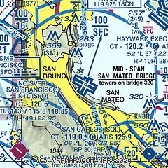
| Sectional chart |
|---|
|
 Download PDF
of official airport diagram from the FAA
| Airport distance calculator |
|---|
|
|
| Sunrise and sunset |
|---|
|
Times for 21-Apr-2026
| | Local
(UTC-7) | | Zulu
(UTC) |
|---|
| Morning civil twilight | | 06:00 | | 13:00 |
| Sunrise | | 06:27 | | 13:27 |
| Sunset | | 19:49 | | 02:49 |
| Evening civil twilight | | 20:17 | | 03:17 |
|
| Current date and time |
|---|
| Zulu (UTC) | 22-Apr-2026 04:16:04 |
|---|
| Local (UTC-7) | 21-Apr-2026 21:16:04 |
|---|
|
| METAR |
|---|
| KSFO | 220356Z 25008KT 10SM FEW009 BKN070 13/09 A3004 RMK AO2 SLP172 T01330089 $
|
KSQL
9nm SE | 220350Z 23005KT 10SM FEW040 13/09 A3005 RMK LAST
|
KHAF
9nm SW | 220355Z AUTO 29008KT 10SM SCT024 SCT031 SCT048 13/10 A3005 RMK AO2
|
KOAK
9nm NE | 220353Z 24012KT 10SM FEW010 FEW030 BKN070 14/08 A3004 RMK AO2 SLP171 T01390078 $
|
KHWD
13nm E | 220354Z 27004KT 10SM BKN025 BKN030 13/09 A3003 RMK AO2 SLP180 T01330089
|
KPAO
15nm SE | 220347Z VRB03KT 10SM SCT030 12/09 A3004 RMK LAST
|
|
| TAF |
|---|
| KSFO | 212100Z 2121/2224 23014KT P6SM VCSH SCT030 BKN050 FM220000 22012KT P6SM SCT060 FM221100 20007KT P6SM BKN050 FM221400 20007KT P6SM -SHRA BKN030 FM221800 23007KT P6SM SCT035
|
KHAF
9nm SW | 211744Z 2118/2218 19010KT P6SM VCSH SCT030 BKN060 FM220100 23008KT P6SM SCT025 BKN050 FM220500 27010KT P6SM SCT050 FM220900 21008KT P6SM -SHRA BKN030 FM221500 19003KT P6SM SCT040
|
KOAK
9nm NE | 211736Z 2118/2224 17008KT P6SM VCSH SCT020 BKN030 FM212100 25011KT P6SM VCSH BKN050 FM220200 25015KT P6SM SCT050 FM221100 22007KT P6SM BKN050 FM221400 17009KT P6SM -SHRA BKN030 FM221800 21007KT P6SM SCT035
|
|
| NOTAMs |
|---|
NOTAMs are issued by the DoD/FAA and will open in a separate window not controlled by AirNav.
|
|


