FAA INFORMATION EFFECTIVE 14 MAY 2026
Location
| FAA Identifier: | RUQ |
| Lat/Long: | 35-38-45.1800N 080-31-13.0500W
35-38.753000N 080-31.217500W
35.6458833,-80.5202917
(estimated) |
| Elevation: | 772.3 ft. / 235.4 m (surveyed) |
| Variation: | 06W (1985) |
| From city: | 3 miles SW of SALISBURY, NC |
| Time zone: | UTC -4 (UTC -5 during Standard Time) |
| Zip code: | 28147 |
Airport Operations
| Airport use: | Open to the public |
| Activation date: | 01/1938 |
| Control tower: | no |
| ARTCC: | ATLANTA CENTER |
| FSS: | RALEIGH FLIGHT SERVICE STATION |
| NOTAMs facility: | RUQ (NOTAM-D service available) |
| Attendance: | 0800-2000
UNATNDD THANKSGIVING AND CHRISTMAS DAY. TO SKED AFT HRS OR HOLIDAY SVC CALL 980-892-2840. |
| Wind indicator: | lighted |
| Segmented circle: | yes |
| Lights: | ACTVT MALSR RWY 20; REIL RWY 02 & 20; PAPI RWY 02 & 20; MIRL RWY 02/20 - CTAF. |
| Beacon: | white-green (lighted land airport)
Operates sunset to sunrise. |
Airport Communications
| CTAF/UNICOM: | 122.725 |
| WX AWOS-3P: | 118.175 (704-637-6197) |
| CHARLOTTE APPROACH: | 128.325 |
| CHARLOTTE DEPARTURE: | 128.325 |
| CLEARANCE DELIVERY: | 127.35 |
| BARMY DP: | 128.325 |
| BEAVY DP: | 128.325 |
| BOBZY DP: | 128.325 |
| ESTRR DP: | 128.325 |
| ICONS DP: | 128.325 |
| JOJJO DP: | 128.325 |
| JOOLS STAR: | 135.6 |
| KABEE STAR: | 126.15 |
| KERMIT DP: | 128.325 |
| KILNS DP: | 128.325 |
| KNIGHTS DP: | 128.325 |
| KRITR DP: | 128.325 |
| KWEEN DP: | 128.325 |
| LILLS DP: | 128.325 |
| NASCR STAR: | 128.325 |
| WEAZL DP: | 128.325 |
| WX AWOS-3 at EXX (13 nm NE): | 119.825 (336-956-2967) |
| WX AWOS-3 at JQF (18 nm SW): | 133.675 (704-785-2145) |
Nearby radio navigation aids
| VOR radial/distance | | VOR name | | Freq | | Var |
|---|
| CLTr043/34.5 | | CHARLOTTE VOR/DME | | 115.00 | | 05W |
| GSOr231/35.7 | | GREENSBORO VORTAC | | 116.20 | | 03W |
| BZMr117/37.5 | | BARRETTS MOUNTAIN VOR/DME | | 113.75 | | 06W |
| NDB name | | Hdg/Dist | | Freq | | Var | | ID |
|---|
| ROVDY | | 202/5.4 | | 275 | | 06W | | RU | .-. ..- |
Airport Services
| Fuel available: | 100LL JET-A1+
A1+:MIL FUEL A+ CTC KILLDEVIL OPS 24 HR PPR, C 984-661-6506/6507/6557.
100LL:24 SELF SERVICE AVBL FOR 100LL WITH CREDIT CARD. |
| Parking: | hangars and tiedowns |
| Airframe service: | MAJOR |
| Powerplant service: | MAJOR |
| Bottled oxygen: | LOW |
| Bulk oxygen: | NONE |
Runway Information
Runway 2/20
| Dimensions: | 5501 x 100 ft. / 1677 x 30 m |
| Surface: | asphalt, in good condition |
| Weight bearing capacity: | | Single wheel: | 45.0 | | Double wheel: | 55.0 |
|
| Runway edge lights: | medium intensity |
| RUNWAY 2 | | RUNWAY 20 |
| Latitude: | 35-38.317147N | | 35-39.188833N |
| Longitude: | 080-31.370385W | | 080-31.064443W |
| Elevation: | 769.1 ft. | | 765.6 ft. |
| Traffic pattern: | left | | left |
| Runway heading: | 022 magnetic, 016 true | | 202 magnetic, 196 true |
| Displaced threshold: | 126 ft. | | no |
| Markings: | nonprecision, in good condition | | precision, in good condition |
| Visual slope indicator: | 2-light PAPI on left (3.00 degrees glide path) | | 2-light PAPI on left (3.00 degrees glide path) |
| Approach lights: | | | MALSR: 1,400 foot medium intensity approach lighting system with runway alignment indicator lights |
| Runway end identifier lights: | yes | | yes |
| Touchdown point: | yes, no lights | | yes, no lights |
| Instrument approach: | | | ILS |
| Obstructions: | 35 ft. trees, 814 ft. from runway, 356 ft. left of centerline, 17:1 slope to clear
APCH RATIO 22:1 AT DSPLCD DUE TO 41 FT TREES 1123 FT FM THR OFFSET 418 LEFT OF CNTRLN. | | 23 ft. trees, 231 ft. from runway, 297 ft. left of centerline, 1:1 slope to clear
15 FT TREES 0-200 FT FM THR OFFSET 325 FT LEFT OF CNTRLN. |
Airport Ownership and Management from official FAA records
| Ownership: | Publicly-owned |
| Owner: | ROWAN COUNTY
130 W. INNES ST
SALISBURY, NC 28144
Phone 704-216-8100 |
| Manager: | VALERIE STEELE
3670 AIRPORT LOOP
SALISBURY, NC 28147-8921
Phone 704-216-7753 |
Additional Remarks
| - | MAIN TRML APRON GRASS AREA ADJ TO FUEL PUMPS CLSD TO HELS. |
| - | BE ALERT FOR MIL ROTOR WING TFC. RNG RAMP LCTD W OF RWY. FRQ NGT OPS. |
| - | CTC KILLDEVIL OPS 10 MIN PRIOR TO LDG. RNG OPS FREQ - 40.700, 126.100, 293.000. |
| - | FOR CD CTC CHARLOTTE APCH AT 704-359-0241. |
| - | ADDNL OBSTNS FOR RWY 02; 20 FT BLDG 1100 FT FM THR 100 FT R OF CNTRLN. |
| - | 24 HR SVC BY REQ. FOR AFT HRS SVC CALL 980-892-2840. |
| - | TRANSIT MIL FUEL. |
| - | RMK: ARNG; LTD PRK RAMP CLSD TO ALL TFC EXC MIL ACFT WITH PPR. OPR 1200-2030Z++ MON-FRI EXC HOL. |
| - | SKY DIVING OPS OVR ARPT; DO NOT OVERFLY ARPT DRG SKY DIVING OPS. |
Instrument Procedures
NOTE: All procedures below are presented as PDF files. If you need a reader for these files, you should download the free Adobe Reader.NOT FOR NAVIGATION. Please procure official charts for flight.
FAA instrument procedures published for use from 14 May 2026 at 0901Z to 11 June 2026 at 0900Z.
STARs - Standard Terminal Arrivals |
|---|
| JOOLS TWO (RNAV) **NEW** | |
download (276KB) |
| KABEE THREE (RNAV) | |
download (152KB) |
| NASCR ONE (RNAV) | |
download (142KB) |
IAPs - Instrument Approach Procedures |
|---|
| ILS OR LOC RWY 20 **CHANGED** | |
download (278KB) |
| RNAV (GPS) RWY 02 **CHANGED** | |
download (250KB) |
| RNAV (GPS) RWY 20 **CHANGED** | |
download (258KB) |
| NDB RWY 20 **CHANGED** | |
download (251KB) |
| NOTE: Special Alternate Minimums apply | |
download (167KB) |
Departure Procedures |
|---|
| BARMY SIX (RNAV) **NEW** | |
download (235KB) |
| BEAVY SEVEN (RNAV) **NEW** | |
download (218KB) |
| BOBZY SIX (RNAV) **NEW** | |
download (237KB) |
| ESTRR SIX (RNAV) **NEW** | |
download (204KB) |
| ICONS SIX (RNAV) **NEW** | |
download (207KB) |
| JOJJO SIX (RNAV) **NEW** | |
download (257KB) |
| KERMIT FIVE **NEW** | |
2 pages:
[1] [2] (373KB) |
| KILNS SIX (RNAV) **NEW** | |
download (211KB) |
| KNIGHTS FOUR **NEW** | |
2 pages:
[1] [2] (373KB) |
| KRITR SEVEN (RNAV) **NEW** | |
download (205KB) |
| KWEEN SIX (RNAV) **NEW** | |
download (208KB) |
| LILLS FOUR (RNAV) **NEW** | |
download (187KB) |
| WEAZL SIX (RNAV) **NEW** | |
download (196KB) |
| NOTE: Special Take-Off Minimums/Departure Procedures apply | |
download (588KB) |
Other nearby airports with instrument procedures:
KEXX - Davidson County Executive Airport (13 nm NE)
8A7 - Twin Lakes Airport (16 nm N)
KJQF - Concord-Padgett Regional Airport (18 nm SW)
14A - Lake Norman Airpark (19 nm W)
KSVH - Statesville Regional Airport (22 nm W)
|
|

Road maps at:
MapQuest
Bing
Google
| Aerial photo |
|---|
WARNING: Photo may not be current or correct
 Photo courtesy of NCSHP and Airport Director Kevin Davis
Photo taken 17-Jan-2019
looking northeast.
Photo courtesy of NCSHP and Airport Director Kevin Davis
Photo taken 17-Jan-2019
looking northeast.
Do you have a better or more recent aerial photo of Mid-Carolina Regional Airport that you would like to share? If so, please send us your photo.
|
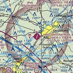
| Sectional chart |
|---|
|
CAUTION: Diagram may not be current

| Airport distance calculator |
|---|
|
|
| Sunrise and sunset |
|---|
|
Times for 27-May-2026
| | Local
(UTC-4) | | Zulu
(UTC) |
|---|
| Morning civil twilight | | 05:41 | | 09:41 |
| Sunrise | | 06:11 | | 10:11 |
| Sunset | | 20:28 | | 00:28 |
| Evening civil twilight | | 20:57 | | 00:57 |
|
| Current date and time |
|---|
| Zulu (UTC) | 27-May-2026 21:55:24 |
|---|
| Local (UTC-4) | 27-May-2026 17:55:24 |
|---|
|
| METAR |
|---|
| KRUQ | 272135Z AUTO 25007KT 210V280 10SM SCT041 BKN048 BKN050 29/21 A2997 RMK AO2 T02870207
|
KEXX
14nm NE | 272135Z AUTO 22010G16KT 180V240 10SM SCT044 30/21 A2996 RMK AO2 T02980206
|
KJQF
18nm SW | 272050Z 22007G17KT 10SM BKN035 30/21 A2999
|
|
| TAF |
|---|
KINT
33nm NE | 271720Z 2718/2818 24011G18KT P6SM BKN020 BKN090 FM271900 24012G19KT P6SM BKN035 BKN090 TEMPO 2719/2723 VRB15G30KT 2SM TSRA BR BKN025CB BKN150 FM272300 27004KT P6SM BKN040 BKN150 FM281300 32007KT P6SM SCT040 BKN090 AMD NOT SKED
|
KCLT
33nm SW | 271939Z 2720/2824 23008G16KT P6SM SCT030 BKN210 FM280000 25006KT P6SM VCSH SCT045 BKN120 PROB30 2800/2803 6SM -TSRA OVC035CB FM280300 21004KT P6SM SCT090 BKN250 FM281800 33005KT P6SM SCT050 PROB30 2818/2822 6SM -TSRA OVC050CB
|
KGSO
39nm NE | 271720Z 2718/2818 24011G18KT P6SM BKN020 BKN090 FM271900 24012G19KT P6SM BKN035 BKN090 TEMPO 2719/2723 VRB15G30KT 2SM TSRA BR BKN025CB BKN150 FM272300 27004KT P6SM BKN040 BKN150 FM281300 32008KT P6SM SCT040 BKN090
|
|
| NOTAMs |
|---|
NOTAMs are issued by the DoD/FAA and will open in a separate window not controlled by AirNav.
|
|


