FAA INFORMATION EFFECTIVE 16 APRIL 2026
Location
| FAA Identifier: | EEN |
| Lat/Long: | 42-53-54.2000N 072-16-14.8000W
42-53.903333N 072-16.246667W
42.8983889,-72.2707778
(estimated) |
| Elevation: | 488 ft. / 148.7 m (surveyed) |
| Variation: | 15W (1995) |
| From city: | 2 miles S of KEENE, NH |
| Time zone: | UTC -4 (UTC -5 during Standard Time) |
| Zip code: | 03431 |
Airport Operations
| Airport use: | Open to the public |
| Activation date: | 02/1947 |
| Control tower: | no |
| ARTCC: | BOSTON CENTER |
| FSS: | BANGOR FLIGHT SERVICE STATION |
| NOTAMs facility: | EEN (NOTAM-D service available) |
| Attendance: | MON-FRI 0700-1900, ALL SAT-SUN 0700-1700 |
| Wind indicator: | lighted |
| Segmented circle: | yes |
| Lights: | ACTVT MALSR RWY 02; HIRL RWY 02/20; MIRL RWY 14/32 - CTAF. |
| Beacon: | white-green (lighted land airport)
Operates sunset to sunrise. |
| Landing fee: | yes, LDG FEE FOR ALL TURBINE PWRD ACFT. |
Airport Communications
| CTAF/UNICOM: | 123.0 |
| WX AWOS-3PT: | 119.025 (603-358-6424) |
| WX ASOS at AFN (13 nm SE): | 135.875 (603-532-6195) |
| WX ASOS at ORE (20 nm S): | 135.675 (978-544-6774) |
- APCH/DEP SVC PRVDD BY BOSTON ARTCC ON FREQS 123.75/338.2 (GARDNER RCAG).
- COMMUNICATIONS PRVDD BY BANGOR RADIO ON FREQ 122.6 (KEENE RCO).
Nearby radio navigation aids
| VOR radial/distance | | VOR name | | Freq | | Var |
|---|
| GDMr350/23.1 | | GARDNER VOR/DME | | 116.95 | | 14W |
| CONr253/36.1 | | CONCORD VOR/DME | | 112.90 | | 15W |
| NDB name | | Hdg/Dist | | Freq | | Var | | ID |
|---|
| CLAREMONT | | 187/28.6 | | 233 | | 16W | | CNH | -.-. -. .... |
Airport Services
| Fuel available: | 100LL JET-A
100LL:100LL AVBL 24 HRS WITH CREDIT CARD. FOR JET FUEL AFT HRS CALL 603-357-7600. |
| Parking: | hangars and tiedowns |
| Airframe service: | MAJOR |
| Powerplant service: | MAJOR |
| Bottled oxygen: | HIGH/LOW |
| Bulk oxygen: | HIGH/LOW |
Runway Information
Runway 2/20
| Dimensions: | 6201 x 100 ft. / 1890 x 30 m |
| Surface: | asphalt, in excellent condition |
| Weight bearing capacity: | | PCN 40 /F/C/X/T | | Double wheel: | 60.0 |
|
| Runway edge lights: | high intensity |
| RUNWAY 2 | | RUNWAY 20 |
| Latitude: | 42-53.239217N | | 42-54.258483N |
| Longitude: | 072-16.252283W | | 072-16.173900W |
| Elevation: | 488.0 ft. | | 482.3 ft. |
| Traffic pattern: | left | | left |
| Runway heading: | 018 magnetic, 003 true | | 198 magnetic, 183 true |
| Markings: | precision, in good condition | | basic, in good condition |
| Visual slope indicator: | 4-light PAPI on left (3.00 degrees glide path) | | 4-light PAPI on left (3.00 degrees glide path)
PAPI OTS INDEFLY. |
| Approach lights: | MALSR: 1,400 foot medium intensity approach lighting system with runway alignment indicator lights | | |
| Runway end identifier lights: | no | | |
| Touchdown point: | yes, no lights | | yes, no lights |
| Instrument approach: | ILS | | |
| Obstructions: | 70 ft. tree, 974 ft. from runway, 540 ft. left of centerline, 11:1 slope to clear | | 112 ft. trees, 1665 ft. from runway, 541 ft. right of centerline, 13:1 slope to clear |
Runway 14/32
| Dimensions: | 4001 x 75 ft. / 1220 x 23 m |
| Surface: | asphalt, in excellent condition |
| Weight bearing capacity: | | PCN 8 /F/C/X/T | | Single wheel: | 25.0 |
|
| Runway edge lights: | medium intensity |
| RUNWAY 14 | | RUNWAY 32 |
| Latitude: | 42-54.342867N | | 42-53.945667N |
| Longitude: | 072-16.656583W | | 072-15.941933W |
| Elevation: | 471.5 ft. | | 481.9 ft. |
| Traffic pattern: | left | | left |
| Runway heading: | 142 magnetic, 127 true | | 322 magnetic, 307 true |
| Displaced threshold: | no | | 1100 ft. |
| Markings: | basic, in good condition | | basic, in good condition |
| Runway end identifier lights: | yes | | yes |
| Touchdown point: | yes, no lights | | yes, no lights |
| Obstructions: | 10 ft. trees, 355 ft. from runway, 37 ft. right of centerline, 15:1 slope to clear | | 48 ft. trees, 522 ft. from runway, 101 ft. right of centerline, 6:1 slope to clear
APCH RATIO 25:1 TO DTHR. |
Airport Ownership and Management from official FAA records
| Ownership: | Publicly-owned |
| Owner: | CITY OF KEENE
3 WASHINGTON ST
KEENE, NH 03431
Phone 603-357-9835 |
| Manager: | RYAN COOLEY
80 AIRPORT RD
KEENE, NH 03431
Phone 603-357-9835 |
Additional Remarks
| - | WILDLIFE ON & INVOF ARPT. |
| - | NOISE ABATEMENT PROC: HEL TFC AVOID RESIDENTIAL AREAS DRCTLY N OF RWY 02-20 & SW OF ARPT. HEL TFC LIMIT MULT CLSD PAT OPS. |
| - | FOR CD IF UNA TO CTC ON FSS FREQ, CTC BOSTON ARTCC AT 603-879-6859. |
| - | COLD TEMPERATURE AIRPORT. ALTITUDE CORRECTION REQUIRED AT OR BELOW -20C. |
| - | NO ENG RUN-UPS ON TRML NW APN. |
| - | GRASS AREAS NOT MNTND FOR TKOFS & LDGS. |
Instrument Procedures
NOTE: All procedures below are presented as PDF files. If you need a reader for these files, you should download the free Adobe Reader.NOT FOR NAVIGATION. Please procure official charts for flight.
FAA instrument procedures published for use from 16 April 2026 at 0901Z to 14 May 2026 at 0900Z.
IAPs - Instrument Approach Procedures |
|---|
| ILS OR LOC RWY 02 | |
download (372KB) |
| RNAV (GPS) RWY 02 | |
download (280KB) |
| NOTE: Special Alternate Minimums apply | |
download (153KB) |
| NOTE: Special Take-Off Minimums/Departure Procedures apply | |
download (493KB) |
Other nearby airports with instrument procedures:
KAFN - Jaffrey Airfield Silver Ranch (13 nm SE)
KORE - Orange Municipal Airport (20 nm S)
0B5 - Turners Falls Airport (22 nm SW)
KGDM - Gardner Municipal Airport (24 nm SE)
KCNH - Claremont Municipal Airport (29 nm N)
|
|

Road maps at:
MapQuest
Bing
Google
| Aerial photo |
|---|
WARNING: Photo may not be current or correct
 Photo courtesy of Bruce Vinal at Aerial Perspectives
Photo taken 02-Sep-2009
Photo courtesy of Bruce Vinal at Aerial Perspectives
Photo taken 02-Sep-2009
Do you have a better or more recent aerial photo of Dillant/Hopkins Airport that you would like to share? If so, please send us your photo.
|
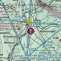
| Sectional chart |
|---|
|
 Download PDF
of official airport diagram from the FAA
| Airport distance calculator |
|---|
|
|
| Sunrise and sunset |
|---|
|
Times for 29-Apr-2026
| | Local
(UTC-4) | | Zulu
(UTC) |
|---|
| Morning civil twilight | | 05:16 | | 09:16 |
| Sunrise | | 05:47 | | 09:47 |
| Sunset | | 19:46 | | 23:46 |
| Evening civil twilight | | 20:17 | | 00:17 |
|
| Current date and time |
|---|
| Zulu (UTC) | 29-Apr-2026 20:42:02 |
|---|
| Local (UTC-4) | 29-Apr-2026 16:42:02 |
|---|
|
| METAR |
|---|
| KEEN | 291956Z AUTO 14008G14KT 110V180 10SM 18/06 A2987 RMK AO2 SLP120 T01780056 $
|
KAFN
13nm SE | 291952Z AUTO 16007KT 10SM CLR 15/02 A2992 RMK AO2 SLP139 T01500022
|
KORE
20nm S | 291952Z AUTO 11011G16KT 10SM FEW090 18/05 A2989 RMK AO2 SLP122 T01780050
|
|
| TAF |
|---|
KMHT
37nm E | 291720Z 2918/3018 09005KT P6SM SCT022 FM292200 10008KT P6SM BKN015 FM300000 09006KT 4SM BR BKN008 FM300900 VRB03KT 2SM -RA BR OVC003
|
KCON
38nm NE | 291720Z 2918/3018 13008KT P6SM FEW028 FM292200 10007KT P6SM BKN015 FM300000 09006KT 6SM BR OVC009 FM300800 VRB03KT 2SM -RA BR OVC003
|
KORH
42nm SE | 291720Z 2918/3018 09006KT P6SM SCT025 FM300200 11005KT 4SM BR BKN004 OVC015 FM300600 14005KT 2SM -SHRA BR OVC003 FM301600 22005KT 5SM BR OVC006
|
KCEF
43nm S | 291700Z 2917/3023 20012KT 9999 FEW050 SCT100 OVC250 QNH2978INS BECMG 3004/3005 16009KT 4800 -RA BR FEW005 BKN012 OVC030 QNH2967INS TEMPO 3010/3017 1600 -RA BR BKN005 OVC012 BECMG 3019/3020 32009KT 9999 NSW SCT012 BKN035 OVC080 QNH2965INS TX21/2919Z TN08/3007Z
|
KLEB
44nm N | 291720Z 2918/3018 VRB04G18KT P6SM SKC FM300200 16005KT P6SM OVC015 FM300900 VRB03KT 4SM -RA BR OVC007
|
|
| NOTAMs |
|---|
NOTAMs are issued by the DoD/FAA and will open in a separate window not controlled by AirNav.
|
|


